
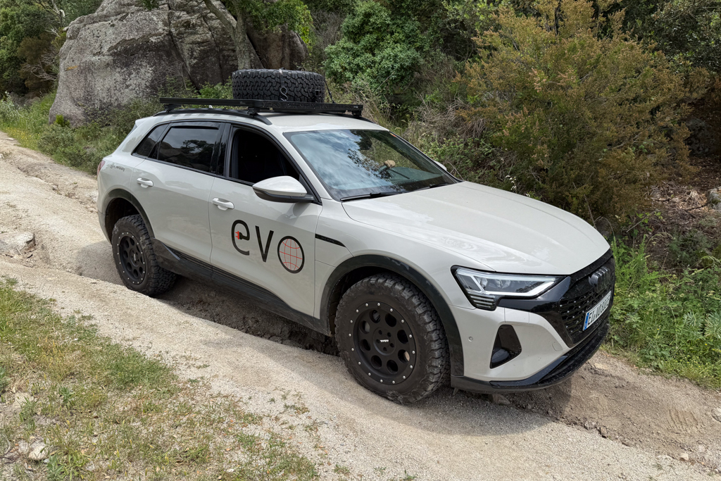
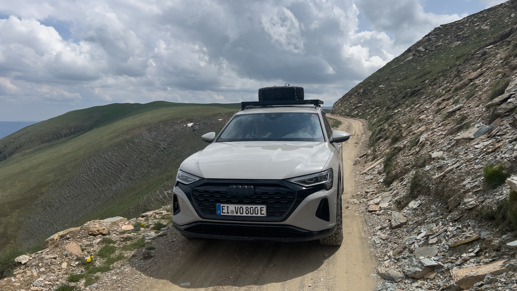
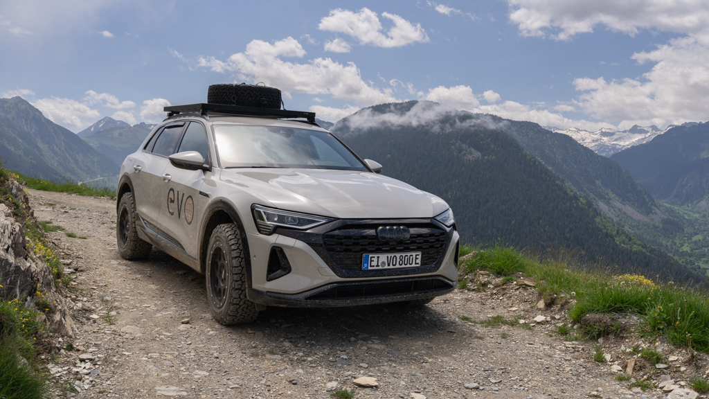
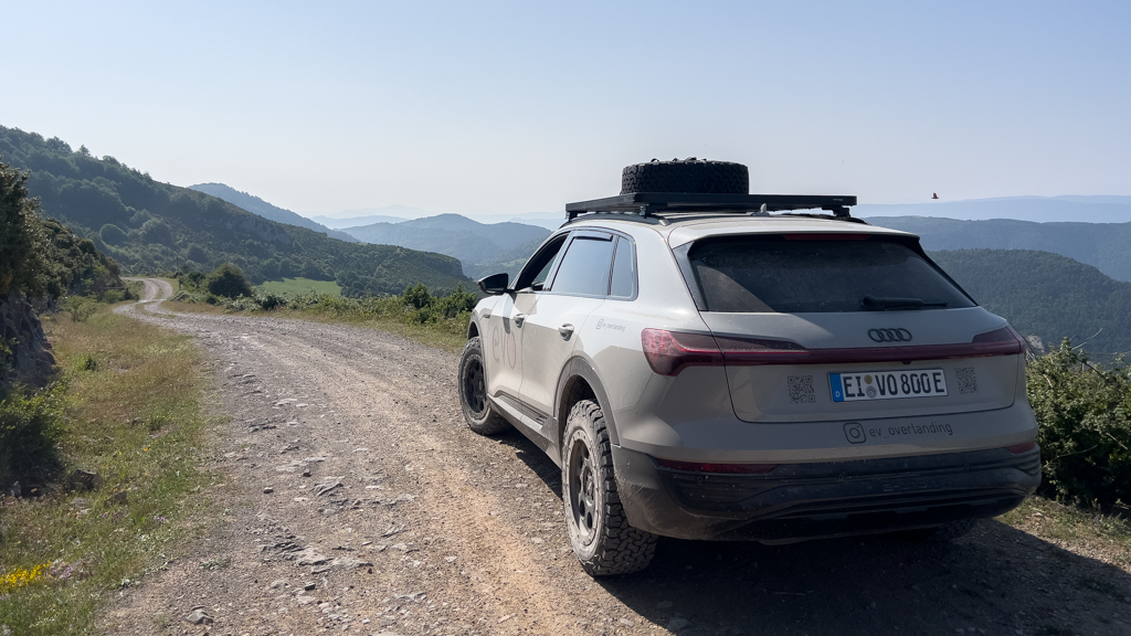
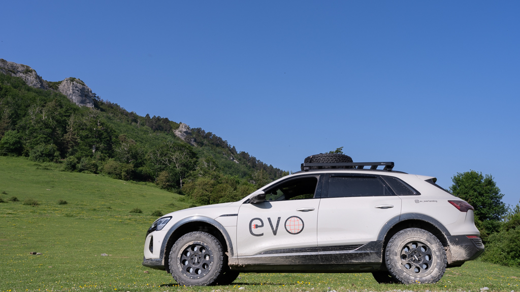
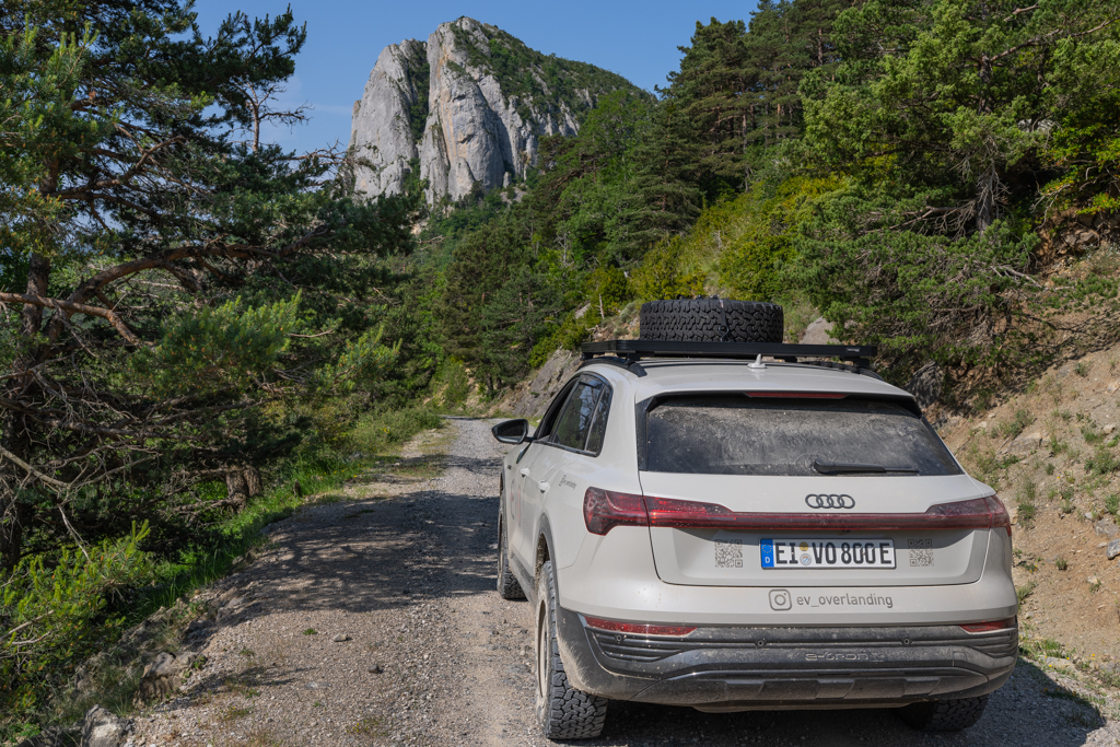
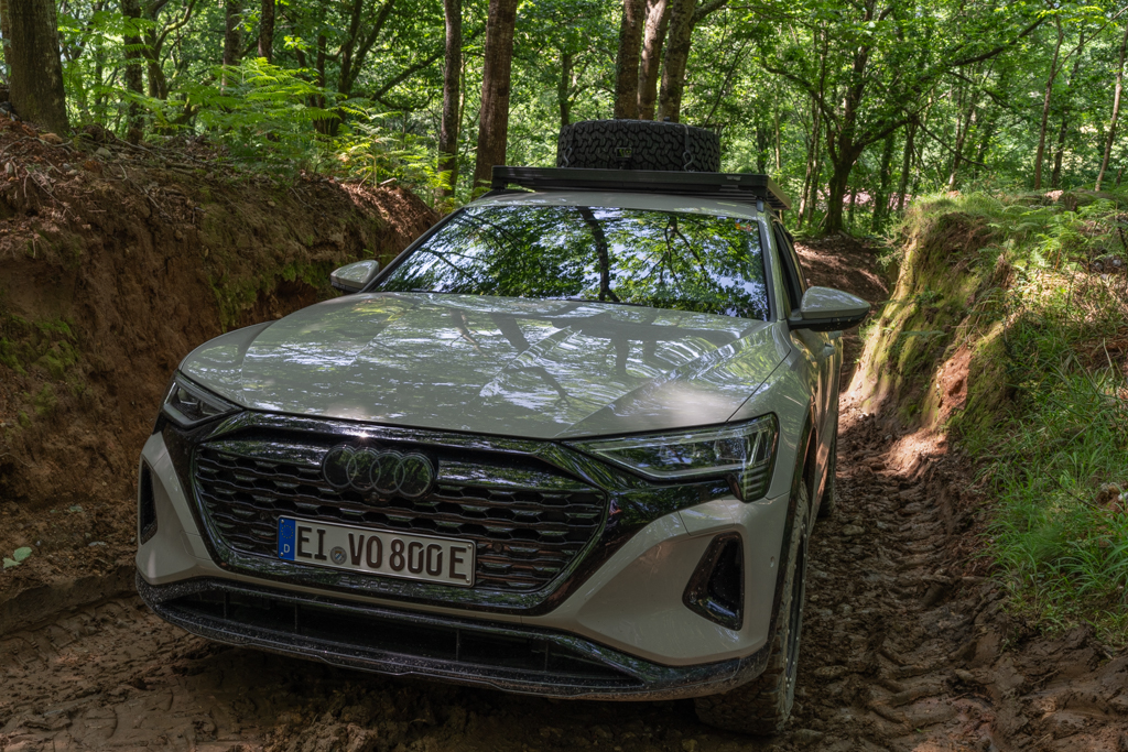
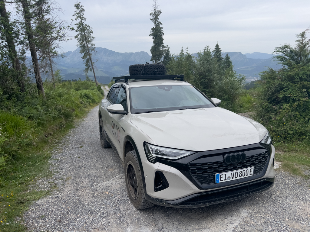
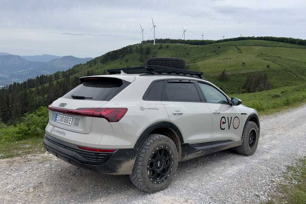
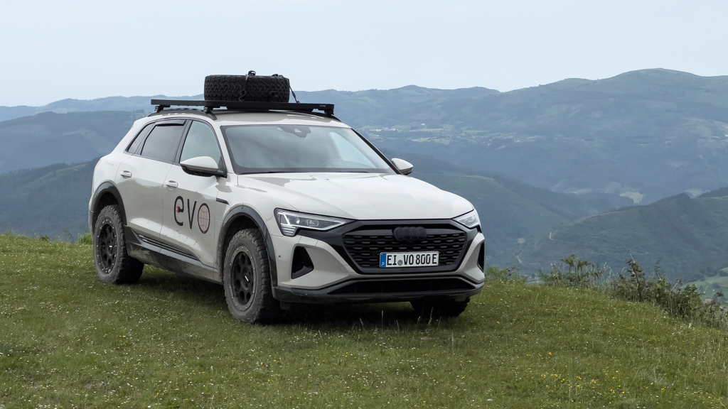
The Transpirenaica is a classic overlanding and offroading trip in Europe. The main idea is to cross the Pyrenees from the Mediterranean Sea to the Atlantic coast on as many 4×4 tracks as possible. This was done countless times in the past with motorcycles, mountainbikes, and 4×4 ICE vehicles. But I haven’t found a single report about a Transpirenaica with an EV. That was another motivation for me to try it with my Audi Q8 e-tron.
There is no exact route that defines the Transpirenaica. Everyone has to find their own combination of offroad and onroad tracks that fits the available time and the capability of the vehicle.
The rough idea was to start at the border between France and Spain at the Mediterranean Sea and then continue along the border through the Pyrenees on the Spanish side (since offroad driving is now mostly forbidden in France) until reaching Bilbao on the Atlantic coast.
For the trip planning (especially for finding suitable and legal offroad tracks), I used the roadbooks from Pistenkuh, which I highly recommend. More about them later.
This EV adventure took place in June 2025.
Journey to Spain
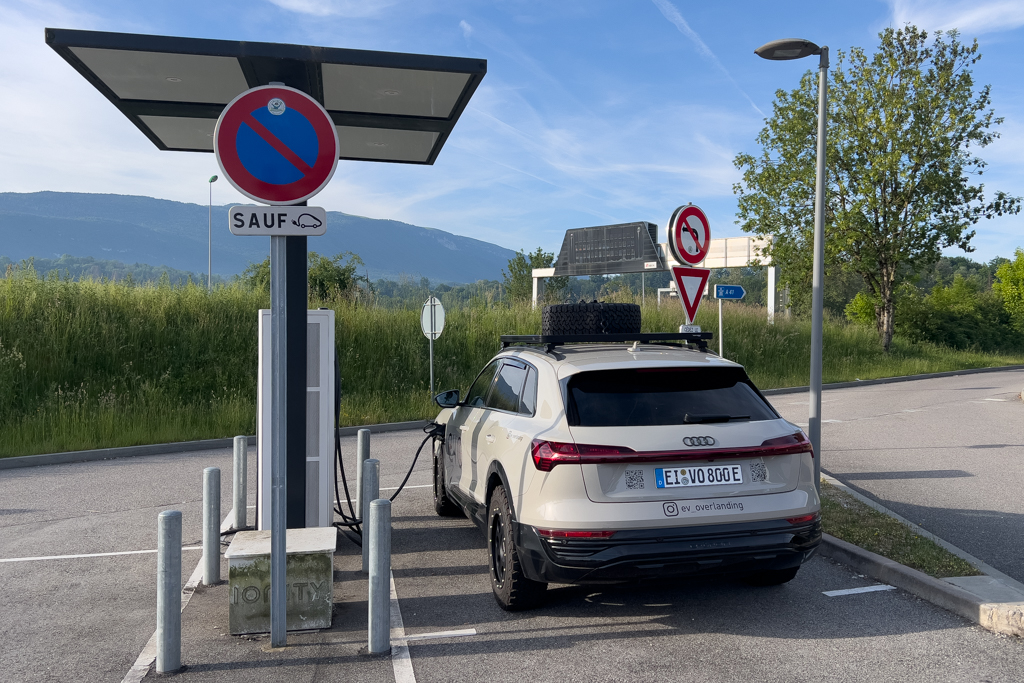
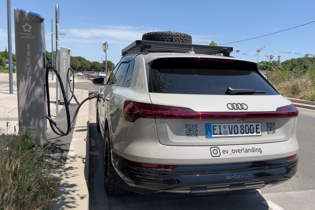
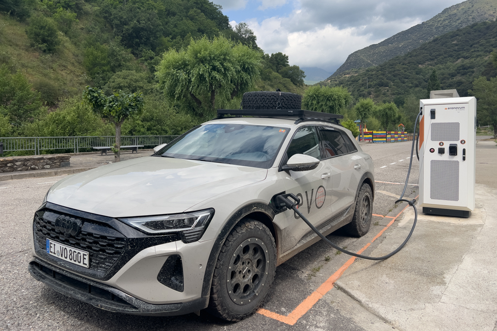
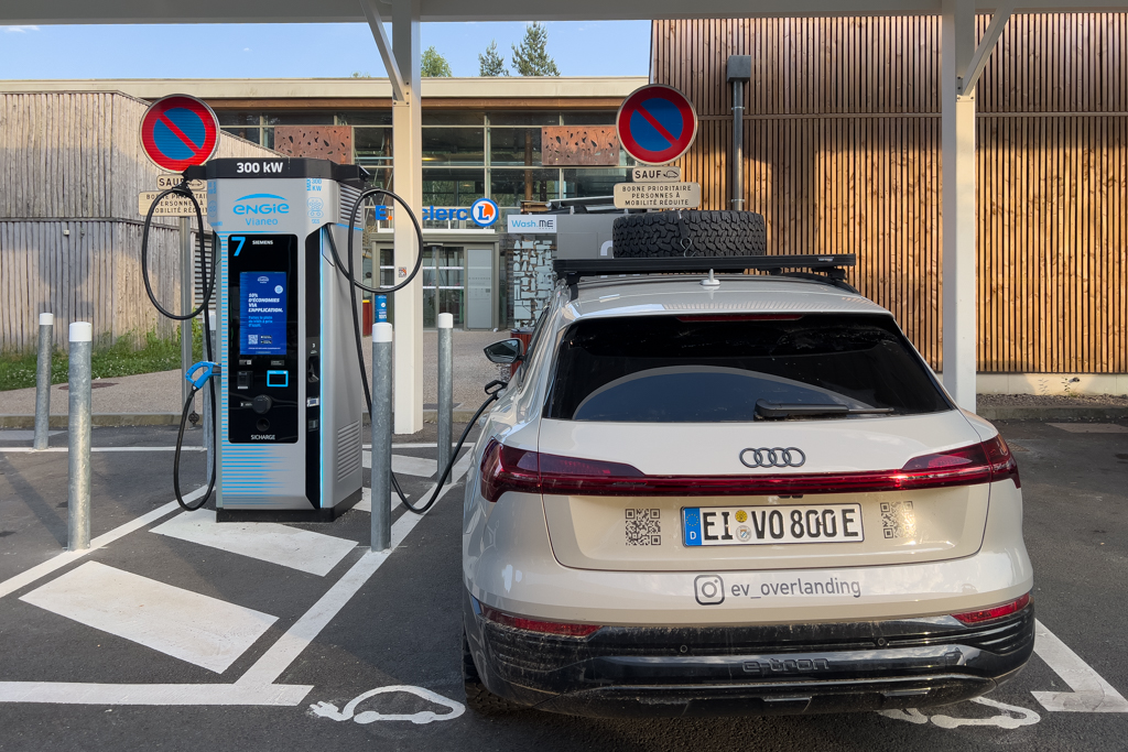
The journey from Germany to Spain was easy and uneventful. I mostly used highways (which are quite expensive in France). Finding fast chargers along the highways was never a problem.

Five hours after my start, I made a quick stop near Zurich to visit Hans. We met last year at the Rive Maroc Rallye and had a great time together in the deserts of Morocco.
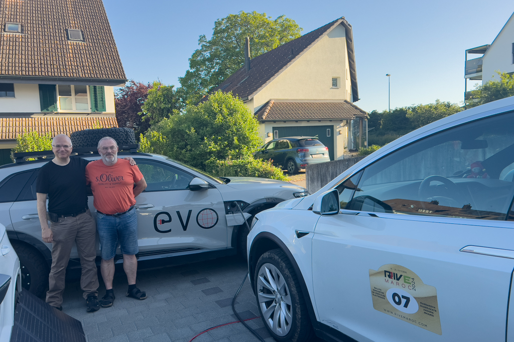
After a couple of hours of chatting and eating a pizza, I continued to the Swiss-French border. Directly after the border crossing, I stopped at a rest area and spent the night in my car.

A couple of DC charges later, I finally reached Spain.

Figueres
Before going on my offroad trip, I wanted to visit the Dali Museum in Figueres, which was located close to my starting point.

Figueres is a nice, medium-sized Spanish village.

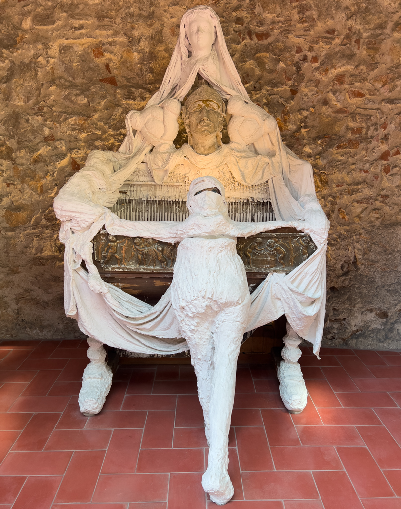
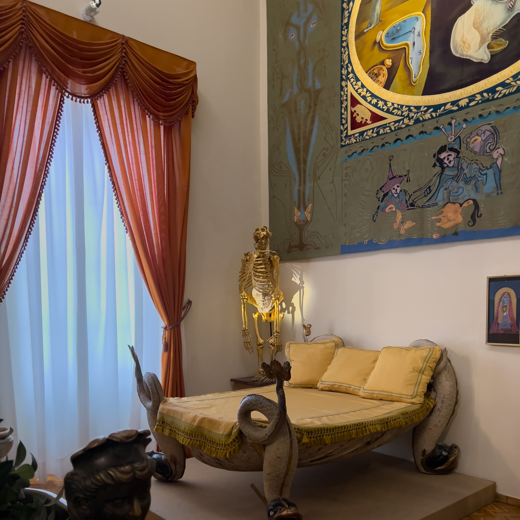
The main attraction of Figueres is the spectacular Dali Museum.

The museum was built on the ruins of the former Figueres Municipal Theatre and was designed by Dali himself.

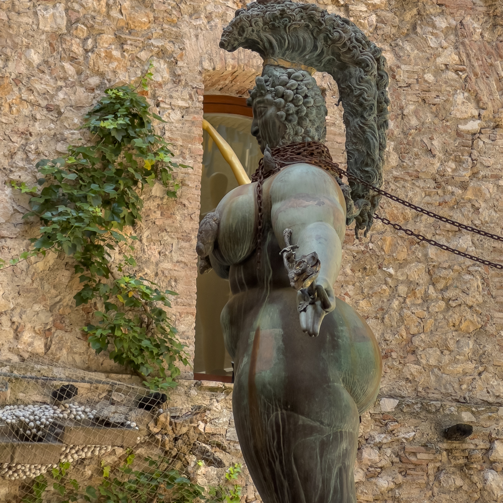
Both the displayed artwork and the architecture of the building were awesome.

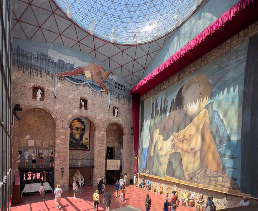


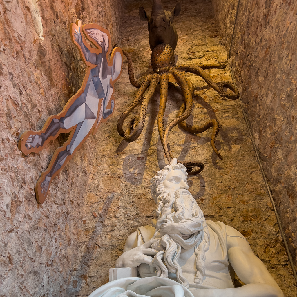
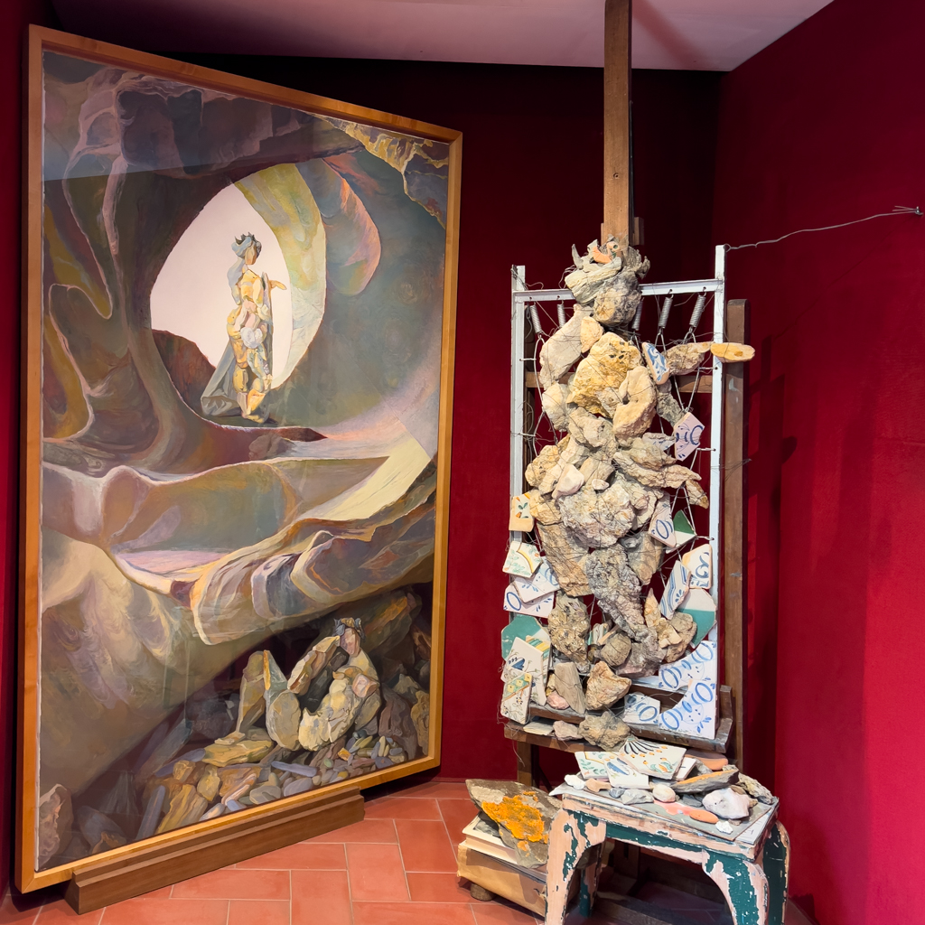


I spent a couple of hours in the museum, and it was definitely worth the visit.
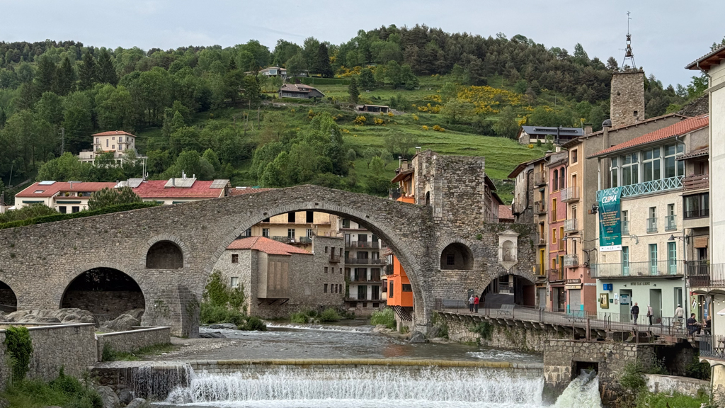
Llançà
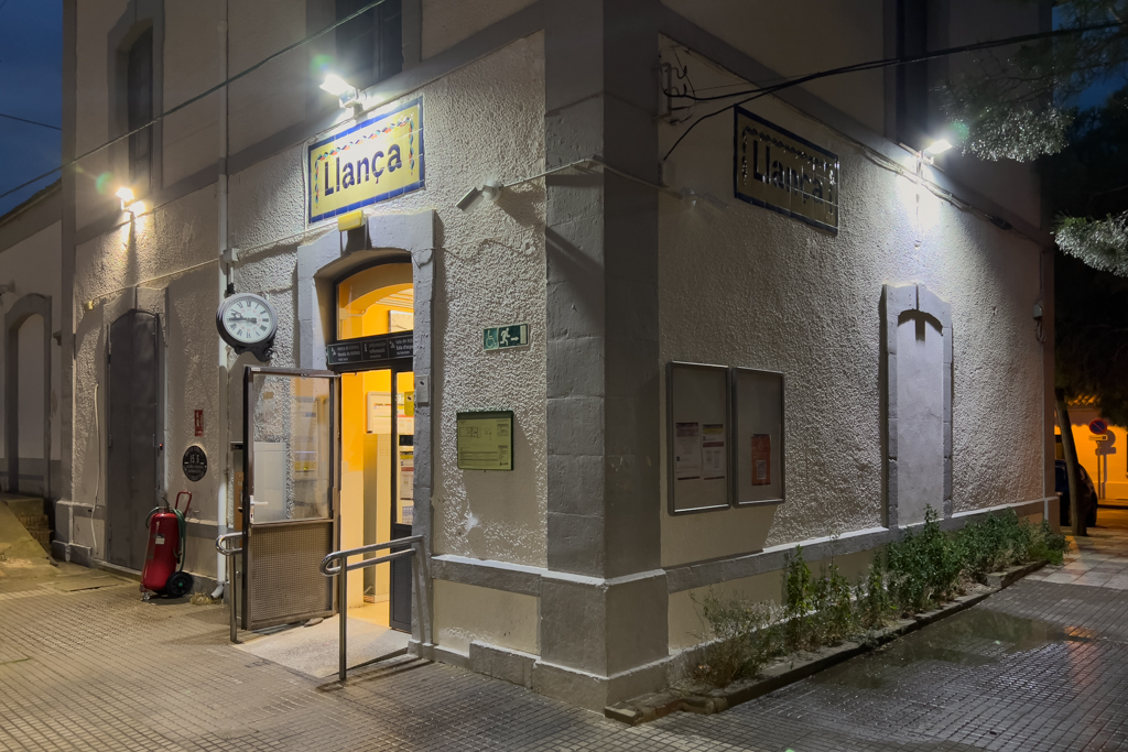
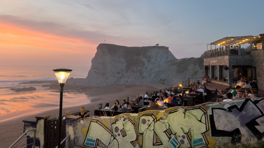
The starting point for my Transpirenaica was Llançà, a small village located 15km south of the border between France and Spain.


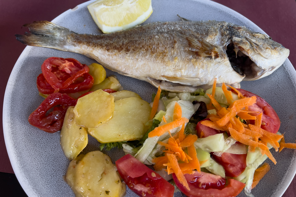
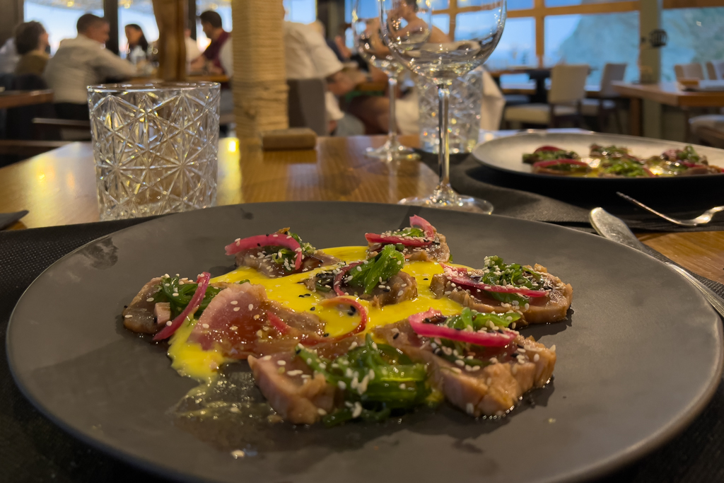
Llançà has a couple of nice restaurants, including one with two Michelin stars (Miramar). I chose some home-cooking style fish and patatas bravas in one of the more basic (and much cheaper) restaurants.

I also had a quick meeting in Llançà with Silvia, the organizer of the Rive Maroc Rallye, which I attended last year. She was on her way from Morocco to Germany, and our paths crossed in Llançà. While charging our cars at one of the AC chargers in the city, we explored the surroundings together and talked about our upcoming EV adventures.


My Transpirenaica wasn’t a solo trip. A good friend of mine, Mark, decided to join me on this adventure. We attended the same elementary school and have always stayed in touch over the last few decades.
He took a plane from Germany to Barcelona and then a train to LLlançà, where I picked him up in the late evening at the train station.
On our first night, we stayed at the campground in Llançà.

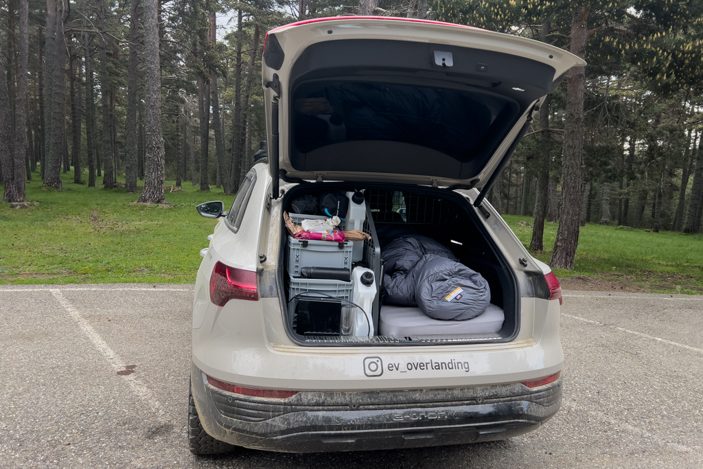
I had planned to sleep in my car the whole time.

Mark brought a small tent and used it during our trip.

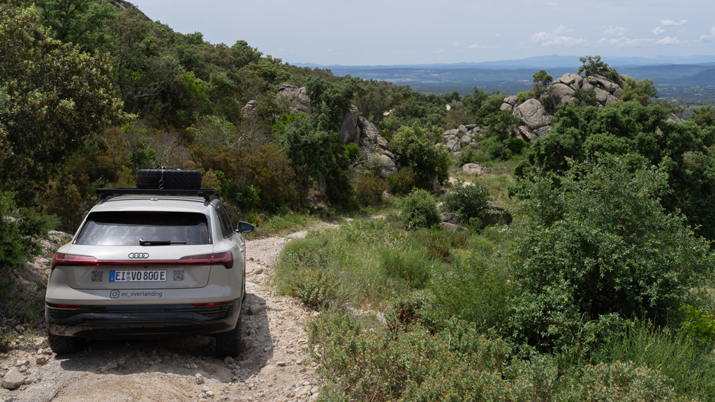
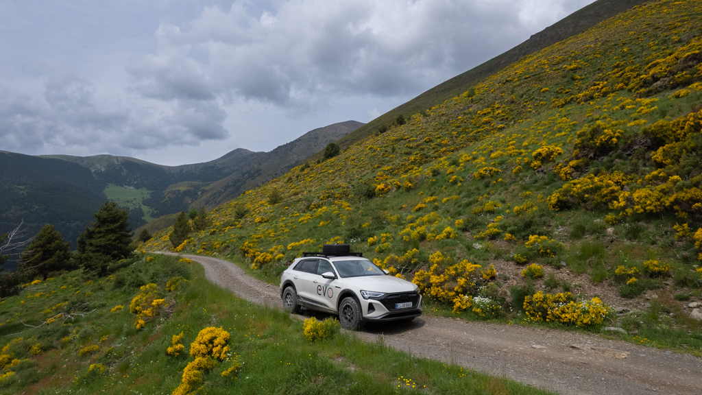
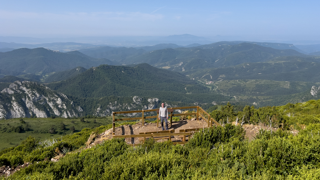
The next morning, we started our Transpirenaica adventure. Since we wanted to drive from coast to coast, we first travelled the short distance to a parking lot at El Castellar next to the Mediterranean Sea and started our Pyrenees crossing from there.

Llançà – La Jonquera (1LL)
Distance: 47.8km total with 33km offroad/gravel.
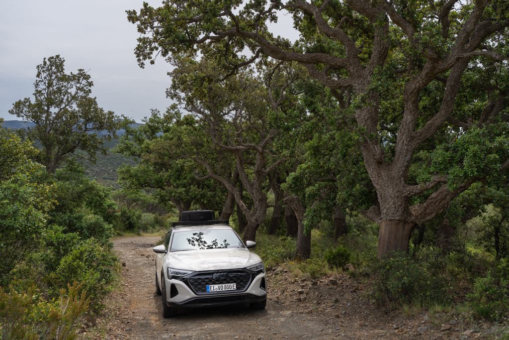
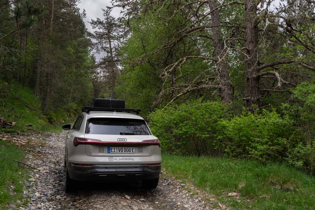
Our first offroad track on the Transpirenaica was the route from Llançà to La Jonquera.

As mentioned above, we used the Pistenkuh trackbooks for our route planning. For the first section of the Transpirenaica, the Pyrenäen book is the right choice. It can be found either on Amazon or ordered directly on the Pistenkuh website.

If you buy this book, you can also download the GPS logs for every track for free. They help tremendously with navigation and can be easily used with smartphone apps like Organic Maps or MapOut.
In the Pistenkuh books, every track has a specific label. For the Llançà to La Jonquera track, this is 1LL. I will put these labels in brackets after the headings for each track.
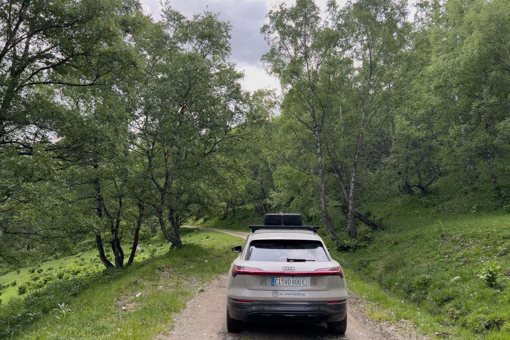
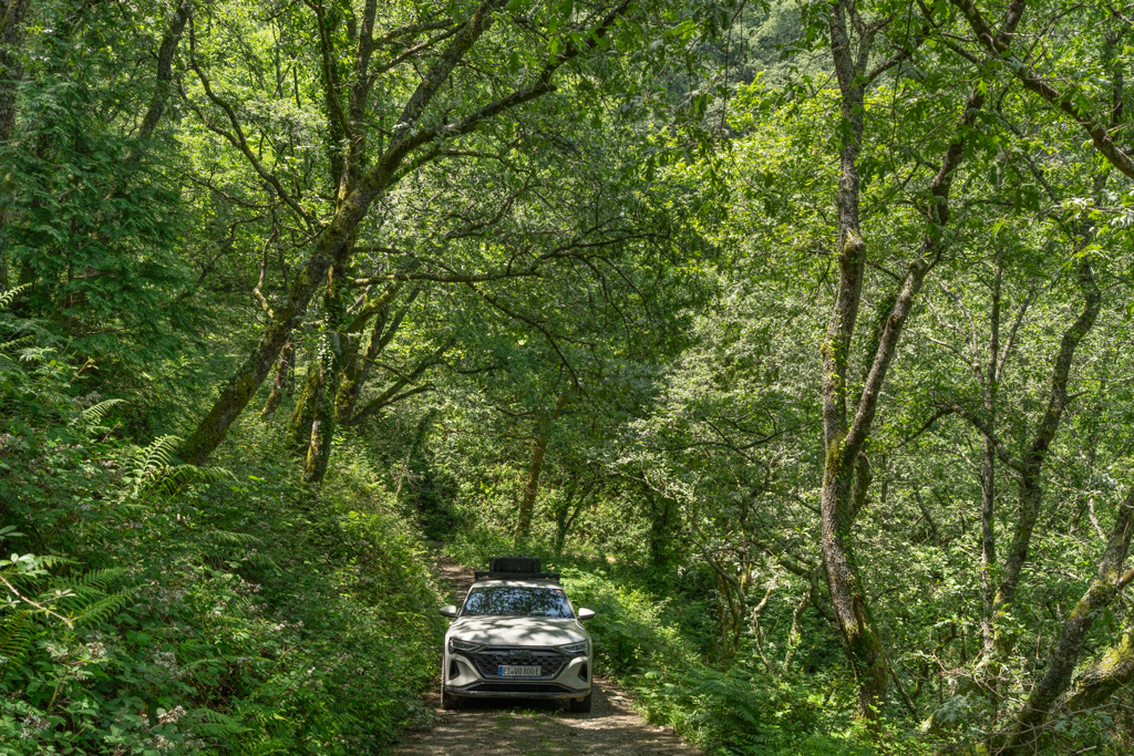
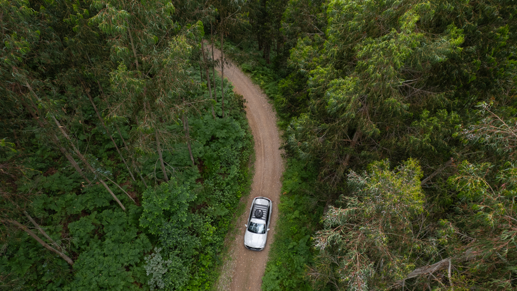
The first gravel section started directly after leaving Llançà.
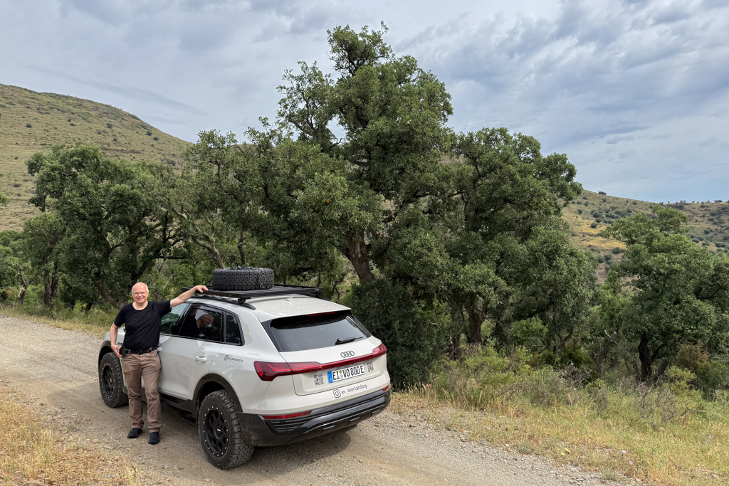

The first part of the track was easy and could be driven with any car.

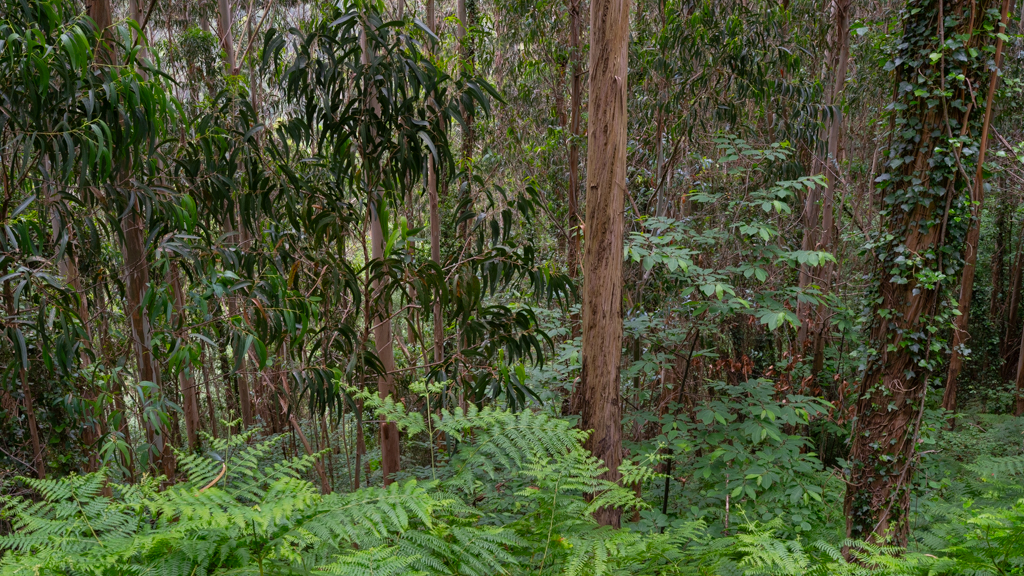
It led through a stunningly beautiful cork oak forest.


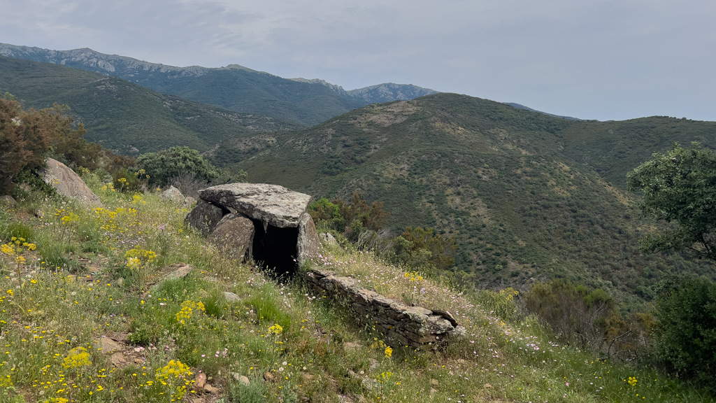
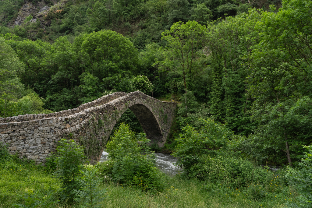
About halfway through the track, we stopped at the Dolmen de Les Morelles, a prehistoric burial chamber.
Soon after, we reached the most challenging section of this track.
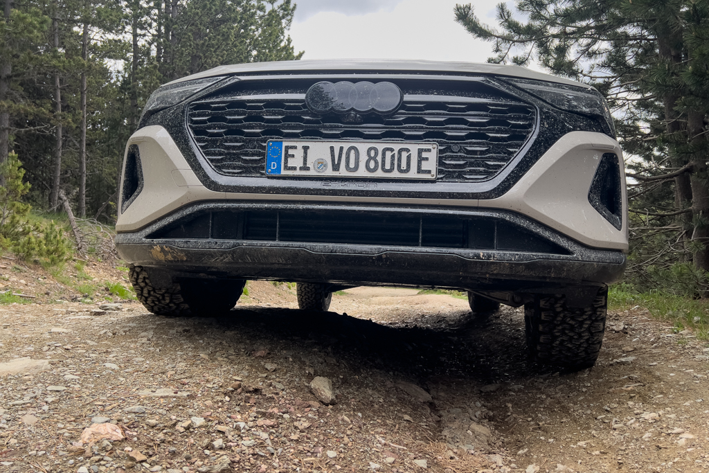
The road was significantly washed out for a couple of meters. To avoid damaging your car, you either need a car with high ground clearance or should use a spotter for very precise maneuvering. In my case, Mark took over the spotter job, since the ground clearance of my Audi is limited.


Luckily, we managed to get through this passage without any ground contact.

Close to the end of the track, we reached the Castell de Requesens. It’s a spectacular sight, but the inside can only be visited on weekends. Allegedly, the movie Perfume by Tom Tykwer was filmed there.

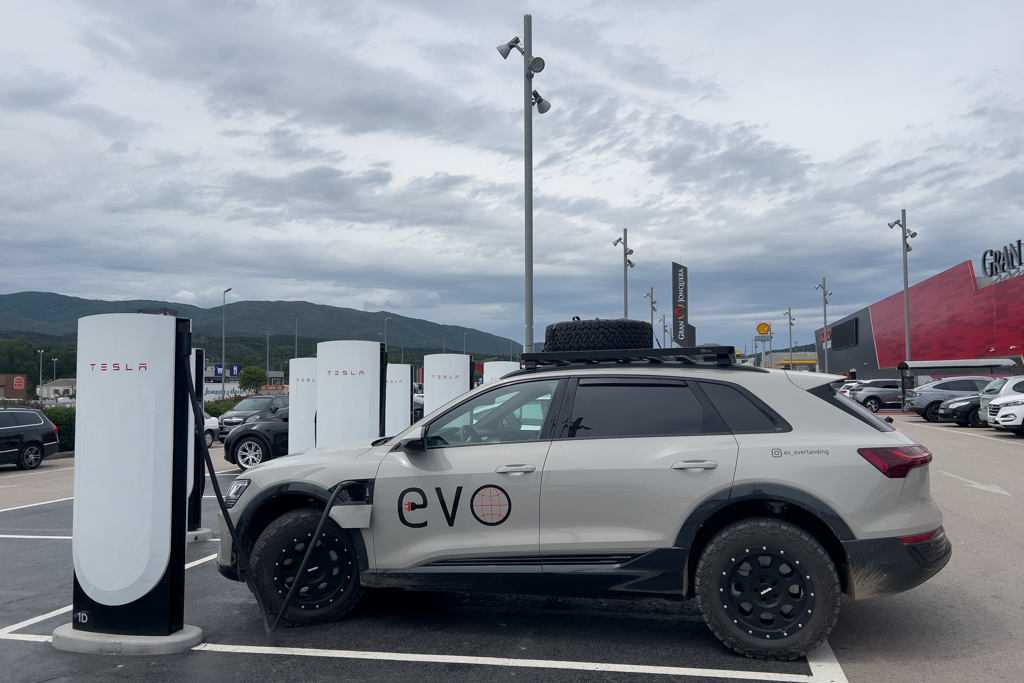
At the end of the track, in La Jonquera, we charged the Audi at the Tesla charger near a large shopping mall. And also used the break to have some lunch in the mall.
We then continued to Camprodon, a beautiful village located close to the starting point of the next track.


South of Camprodon is the large campsite Camping Vall de Camprodon, where we had planned to spend the night.
Directly at the campsite is also a DC fast charger. We charged the Audi to 80% for a quick start the next morning.

The campsite was clean and quiet but lacking a bit of atmosphere.


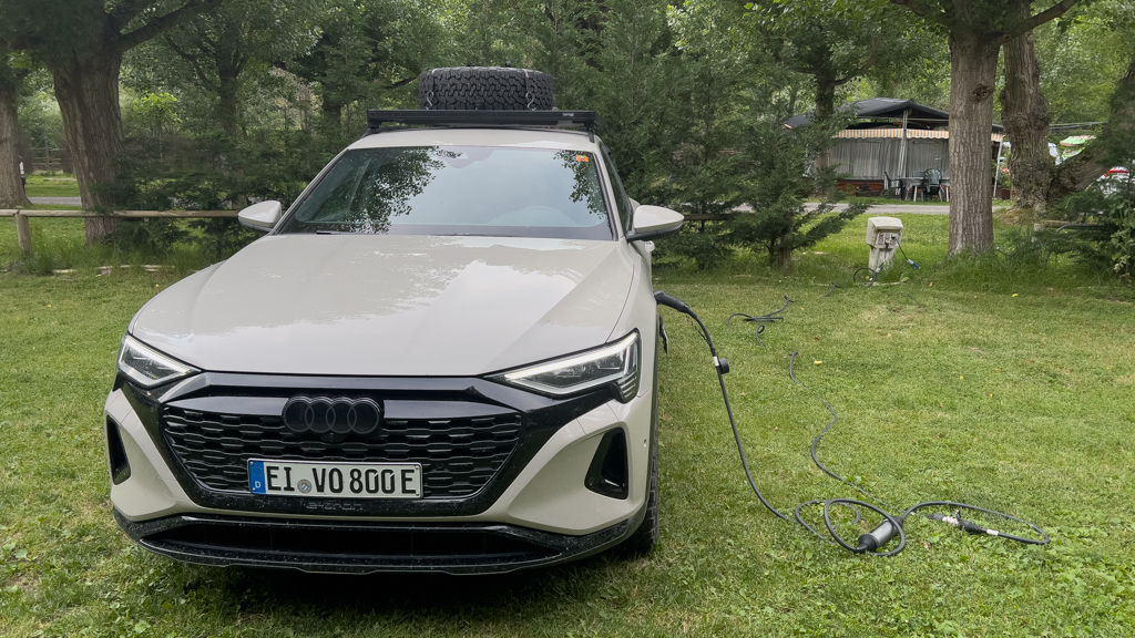
As always, I slept very comfortably in my Audi Q8 e-tron (as long as it is not too hot outside).
Mollo – Ribes de Freser (1MR)
Distance: 65.2km total with 42.4km offroad/gravel.
Our second offroad track on the Transpirenaica led from Mollo to Ribes de Freser.

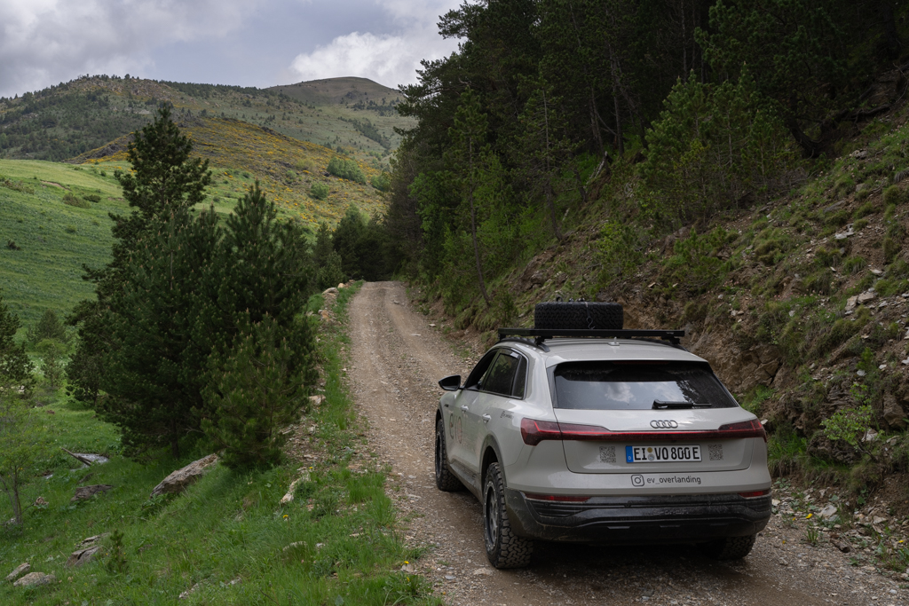
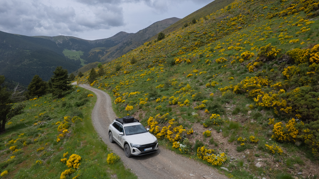
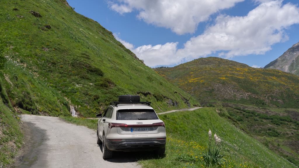
The track was easy to drive and in very good condition. It led through a beautiful mountain area with stunning views. The speed limit on this track is 30km/h.

Along the track, we saw dozens of huge eagles flying directly above our car. A perfect spot for bird photography. Sadly, my longest focal length on this trip was 35mm. So, there was no chance for good wildlife images on this trip.
At the end of the track in Ribes de Freser, we charged the Audi to 80% at a fast charger in the village.
The following night, we spent in a nice campground close to Ribes de Freser.

There were only a few other guests in the huge camp area. It had a completely different vibe compared to the crowded campground in Llançà.


Ribes de Freser – Puigcerdà (1RP)
Distance: 54.2km total with 13km offroad/gravel.
Our third offroad track started directly in Ribes de Freser and led to Puigcerdà.
This track was also easy to drive and led through a lovely coniferous forest with flowering broom bushes.

From the end of the track in Puigcerdà to the starting point of the next track, it was a slightly longer distance. We made a charging stop in La Seu d’Urgell at the Tesla charger.

In the meantime, we explored the historic buildings in La Seu d’Urgell.
From there, we continued to Andorra, where our next track started.
Andorra is one of the smallest countries in Europe. The border crossing was easy, although Andorra is not part of the European Union. But this led to a couple of other problems. The mobile data of our smartphones could not be used anymore (or only with huge roaming fees). This means we were suddenly stuck with offline navigation. Even worse was that all our charging cards didn’t work anymore. And an activation via app was also not possible since we had no mobile data. Luckily, Andorra is small. So quickly driving back to Spain and charging there was the solution.
The capital of Andorra is Andorra la Vella. This was also the starting point for our next offroad track.
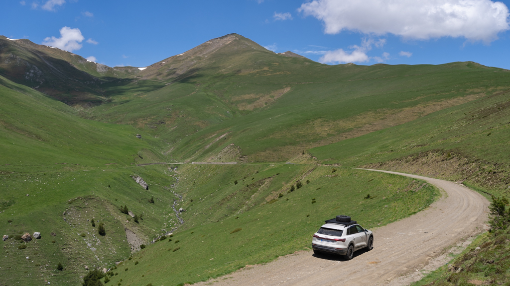
Andorra la Vella – Alins, Val Ferreta (2AA)
Distance: 43.2km total with 10.4km offroad/gravel.
Our next offroad track was used in the past as a smugglers’ trail. It goes from Andorra la Vella to Alins in Spain.

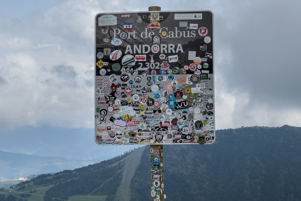
In Andorra, the road is completely paved. Directly at the border between Andorra and Spain, the real offroad track started.

It’s a green border without any border control, located at an altitude of 2,302m.


The first section of the track is rather easy, but a little bit higher ground clearance is recommended due to some larger rocks on the ground.
The landscape along this track had a very remote and wild vibe. For many hours, we didn’t see any other cars or people.

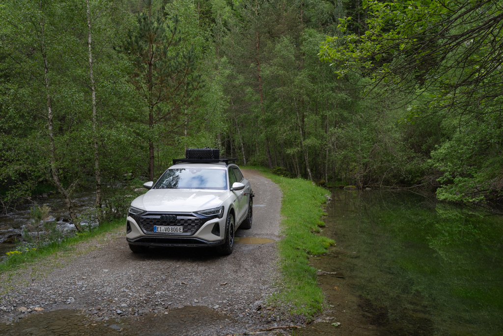
Soon, we reached our first ford. The water depth was no problem for the Audi Q8 e-tron.

For the first time on this trip, I used my drone to get some alternative perspectives of this impressive landscape.


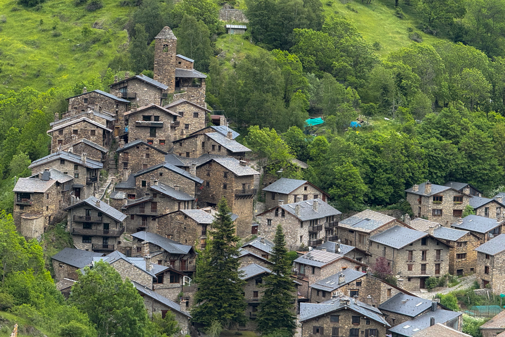
Close to the end of the track, we reached a small mountain village with interesting historic houses and a small church.


The track ended in Alins, from where we continued to the village of Llavorsí.

In Llavorsí, I spent the night in my car at the campground while Mark decided to take a hotel room for one night due to the rainy weather.
There is a type 2 charger in Llavorsí, but sadly, it wasn’t working when we arrived there.
Instead, I used the electricity at the campground to charge my car overnight with my Juice Booster. It was a single-phase 10A connection. Therefore, we are talking about just topping up about 20% overnight. Fully charging my car there would take two full days. But luckily, this wasn’t necessary.
Tirvia – Bixessarri (2TB)
Distance: 44.8km total with 32.8km offroad/gravel.
This track led von Tirvia in Spain back to Bixessarri in Andorra. It is another historic smugglers’ trail.

The start of the trail was about 7km from Llavorsí. Signs showed specific restrictions for this track that are important to understand. The track is closed between November and May. And groups of more than 4 cars or more than 7 motorcycles are not allowed on this track.


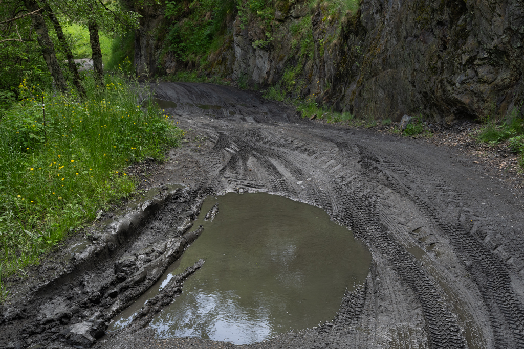
Depending on the weather, this track can be far more difficult than the previous tracks. We had some rain on the previous day, and the track was very muddy.

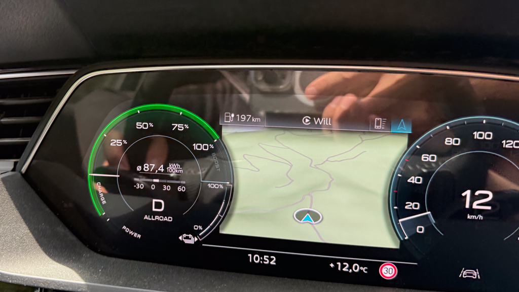
The combination of driving through the mud and some ascents led to an average energy consumption of 87.4kWh/100km on the first section of this track. Even for my Audi, that’s a high value I rarely see.
We met only one other car on the track, but it was an interesting one.

A French Range Rover with overlanding modifications was suddenly in front of us. Later, we learned that it belongs to YouTuber Ben’s Garage.
Our encounter is documented in his Calalunya video (starting at 11’18”):
It was fun meeting another fellow overlander on this trail.
Compared to the first trails close to the Mediterranean coast, the landscape was now much greener with a mix of coniferous and deciduous trees.
And the track was again very muddy. Without 4×4 and good AT tires, you would probably have no chance of getting through.

On some sections, I wasn’t 100% sure if we would get through the mud holes without getting stuck.

Luckily, our only problem was a very dirty car.


At the final part of the track, the landscape changed again and led through a more open Alpine-type landscape.
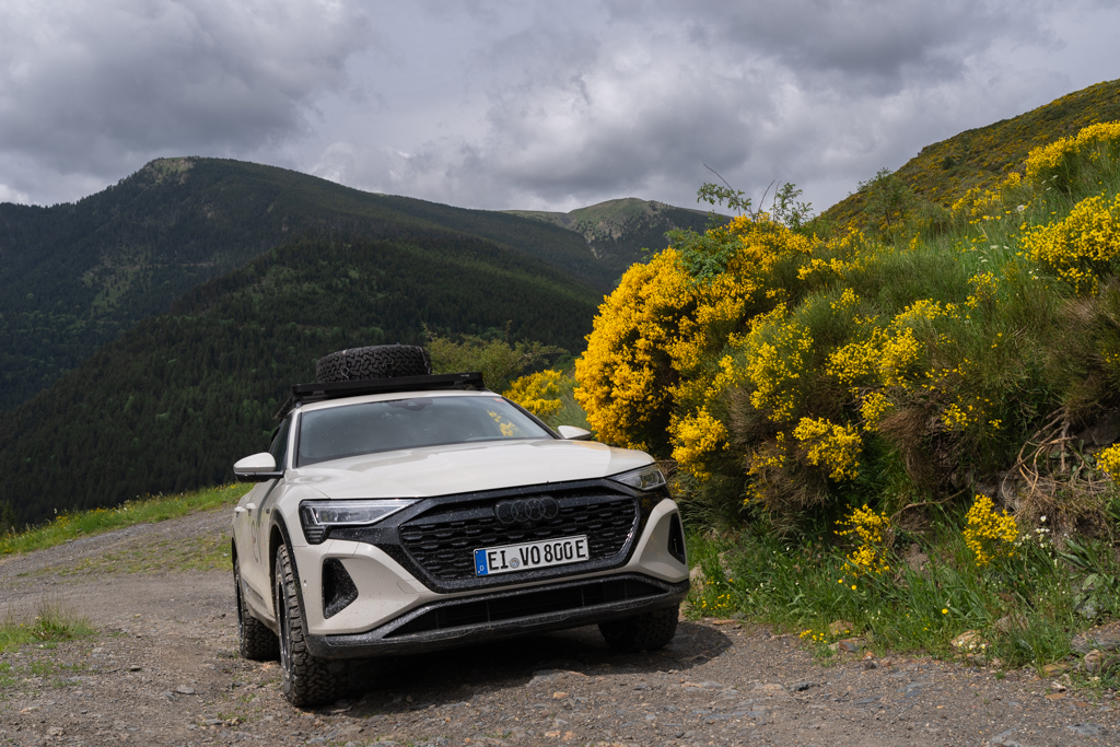

The flowering broom bushes were a spectacular sight.

Finally, we reached Andorra again, and the gravel road ended.

This time, we really needed a charger in Andorra because my car was close to empty. As mentioned above, that’s not easy in Andorra. Although there are many chargers available, none of the common charging cards work in Andorra. And the smartphone isn’t working either.
In addition, most of the chargers in Andorra are not registered in Plugshare, my main app for finding chargers in exotic or remote locations.
Luckily, we found a free charger at the River Centro Commercial shopping mall, south of Sant Julia de Loria. It worked immediately without any activation. Of course, I also added the charger in Plugshare to make life a bit easier for future EV adventurers.
Since it was a type 2 charger with 22kW, it took a couple of hours to fully recharge the Audi. We used the time for a lunch break and restocking some food at the shopping mall.
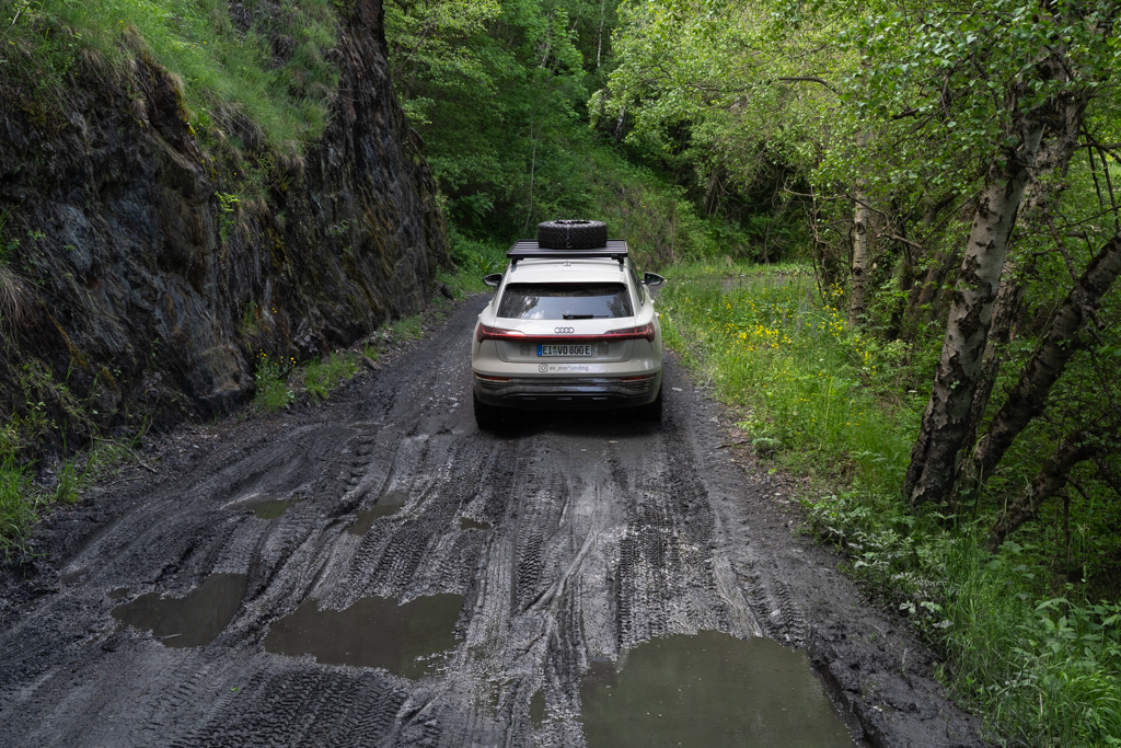
Bixessarri – Rubio (2BR)
Distance: 49.2km total, with 40.7km offroad/gravel.
This track from Bixessarri to Rubio leads back from Andorra to Spain.
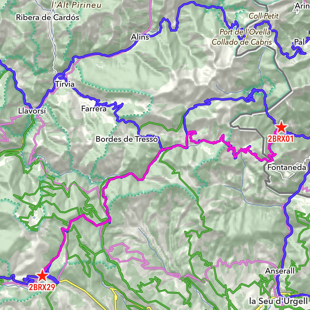
For this track, the same restrictions (season and group size) apply as for the previous track. In addition, the speed limit is 30km/h.
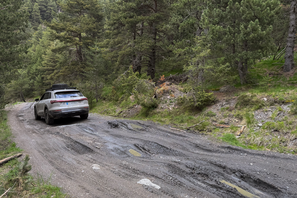
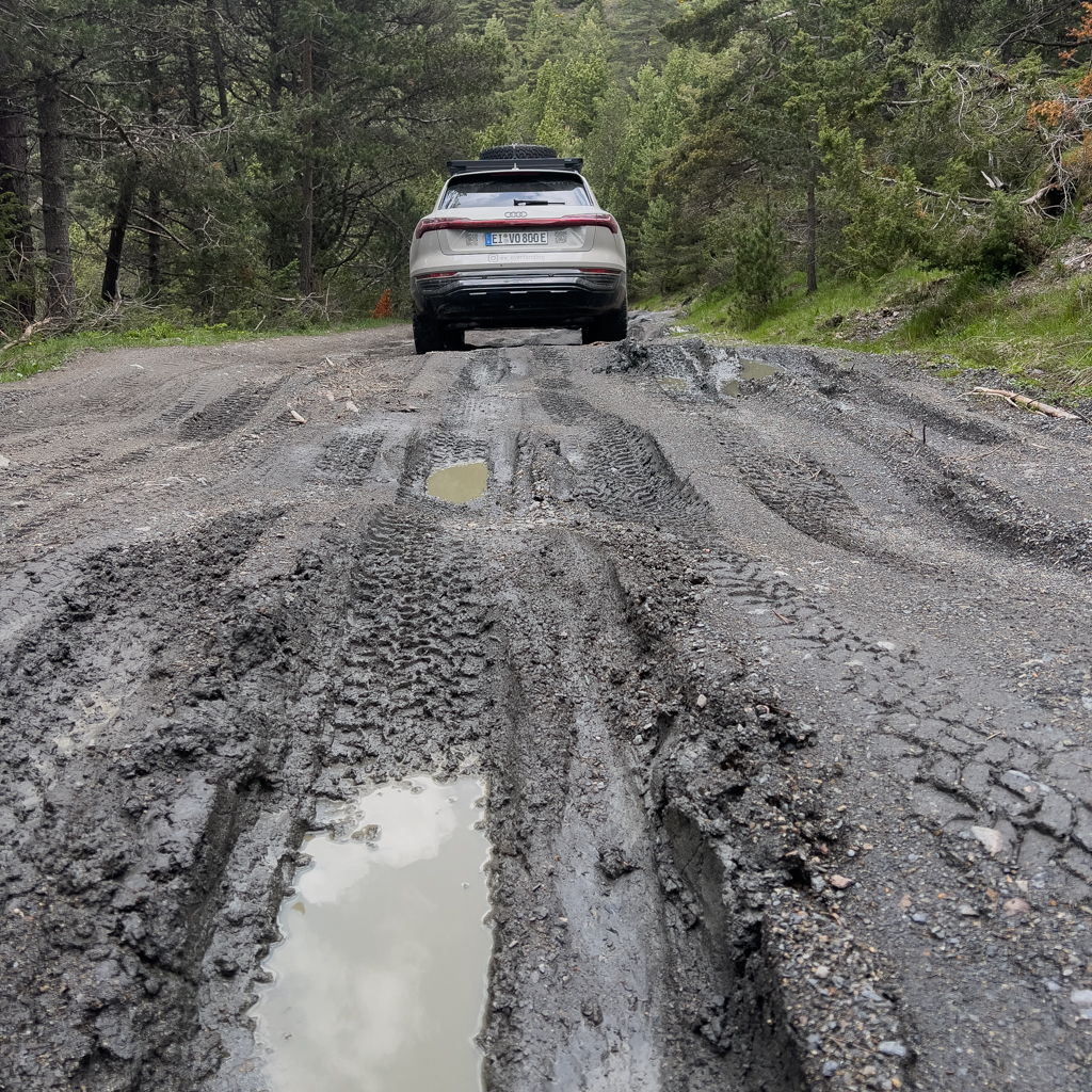

There were again many muddy sections on this track. In wet weather, I would recommend this track only with 4×4 and AT tires.


In the Pyrenees, you sometimes encounter cows on the trails. Often, they were very stubborn and didn’t move at all.

Or maybe they had just watched The Lord of the Rings (“You shall not pass“).
Some of the muddy sections were really on the edge of getting stuck.


Meanwhile, the fords were never deep on this trail and were always easy to get through.

The forest with its small streams along the trail was stunningly beautiful.
Since it was getting late, we decided to spend the night at the Refugio Estacio d’esqui Sant Joan de L’erm near the Coll de la Basseta.

I slept in my car, and Mark took a room in the Refugio. Since the Coll de la Basseta has an altitude of 1,732m, I expected a cold night, and for the first time on this trip, I used my thicker sleeping bag. For the previous nights, a thin blanket was completely sufficient.
The next morning, after a nice breakfast at the Refugio, we continued on the track.

The final part of the track was easy to drive. Only a few larger corrugations needed a bit more attention, especially if you use a vehicle with lower ground clearance.

From the end of the track in Rubio, we continued 25km to Rialp, where we charged the Audi on a DC fast charger.
In Rialp, we also found a car wash to get rid of all the mud. The cleaning of the wheel arches took forever. Although a muddy car looks cool, I think it’s best to remove the mud as soon as possible. Especially on moving parts, the abrasive effect of mud should not be underestimated.

Since it was still early in the day, we immediately started on another 4×4 track.
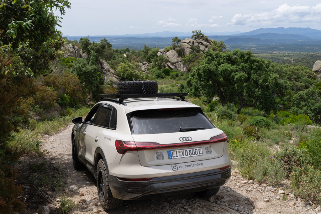
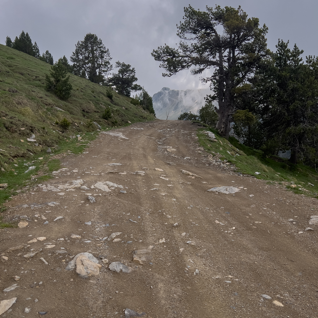
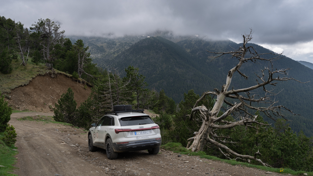
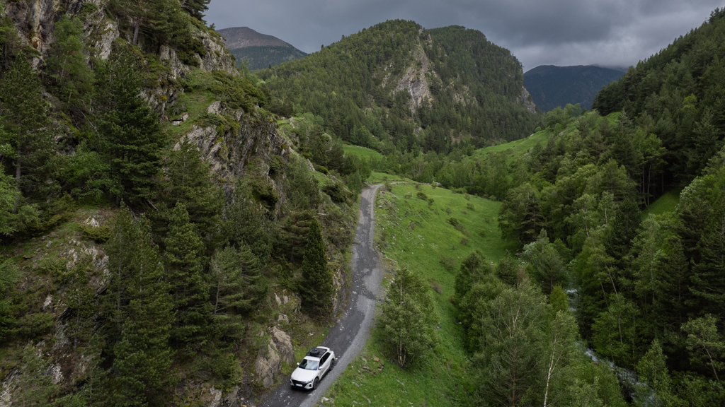
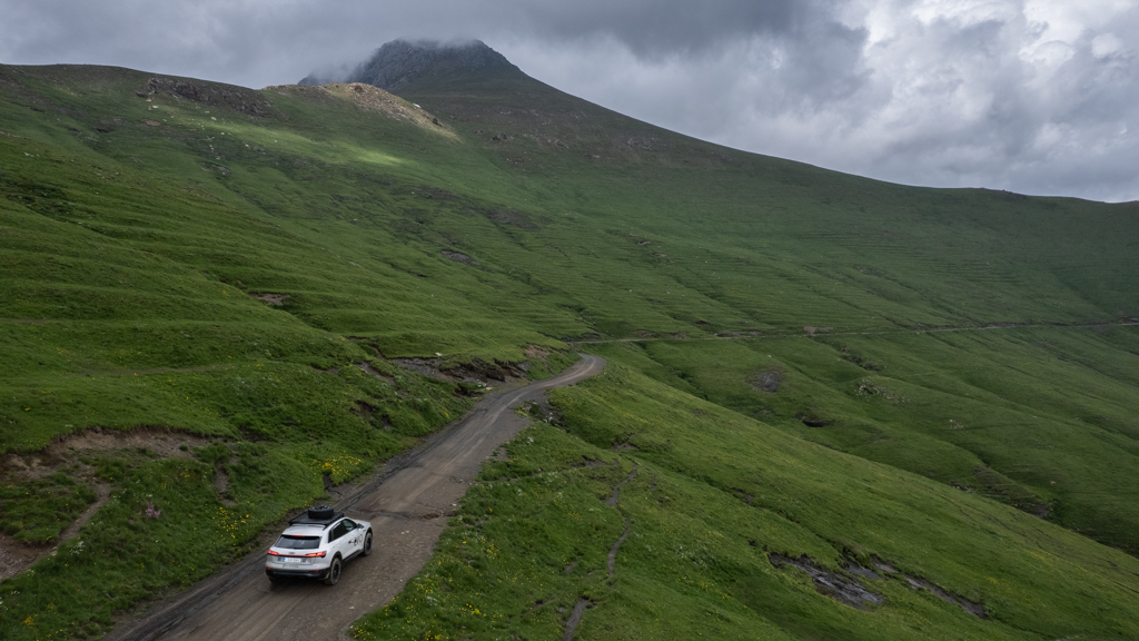
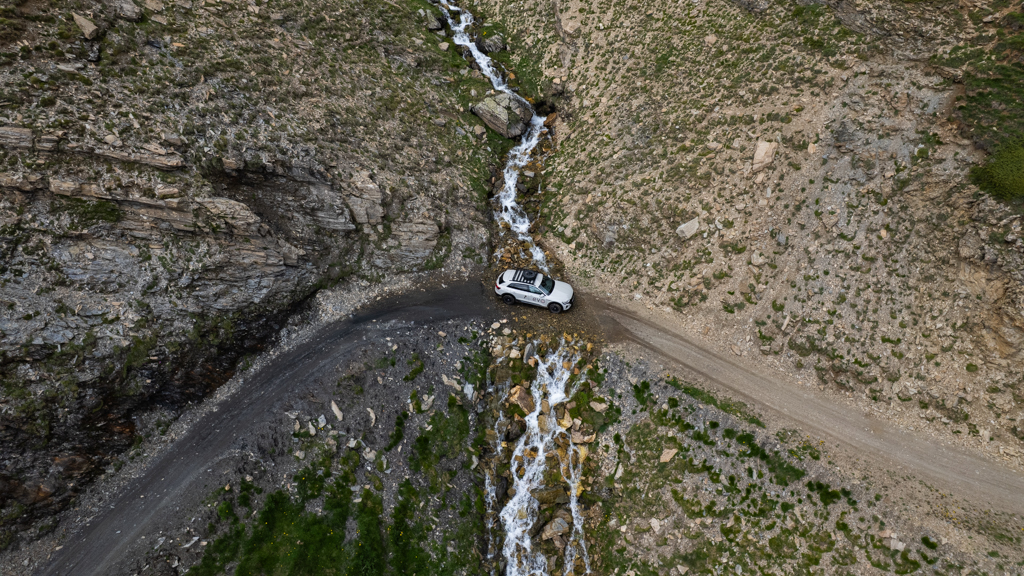
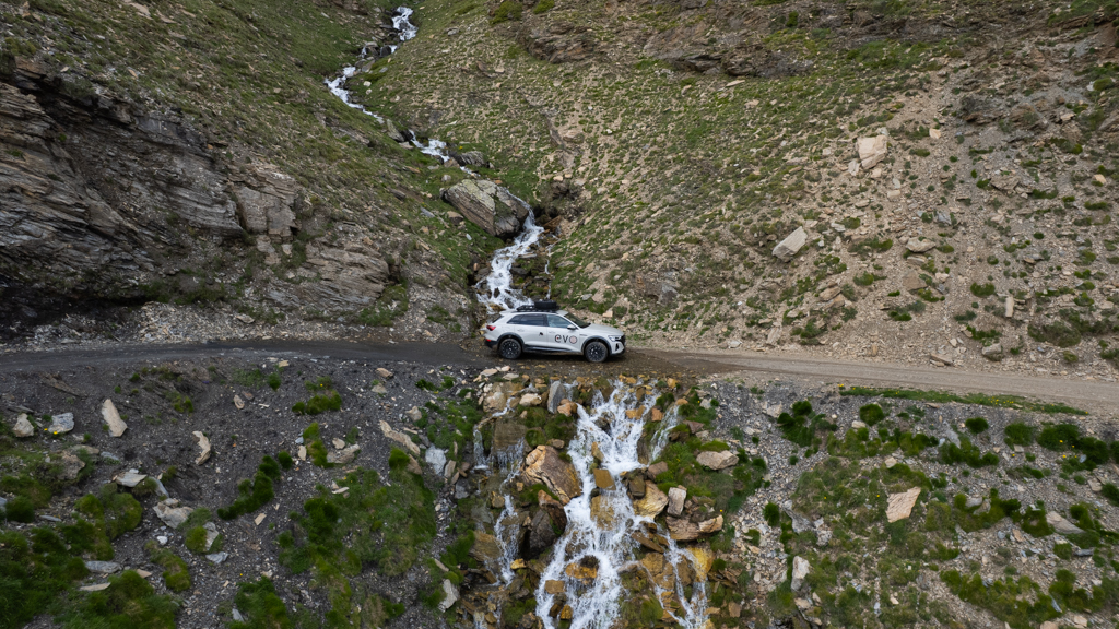
Espui – Escaló (2EE)
Distance: 45.3km total with 41.5km offroad/gravel.
The following offroad track goes from Espui to Escaló.

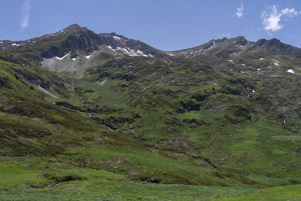
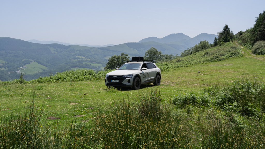
The route leads continuously above the treeline through a stunning mountain landscape.


Some of the places reminded me of Iceland or the Faroe Islands.


In one section, two waterfalls crossed the track. A good opportunity for some cool drone shots.
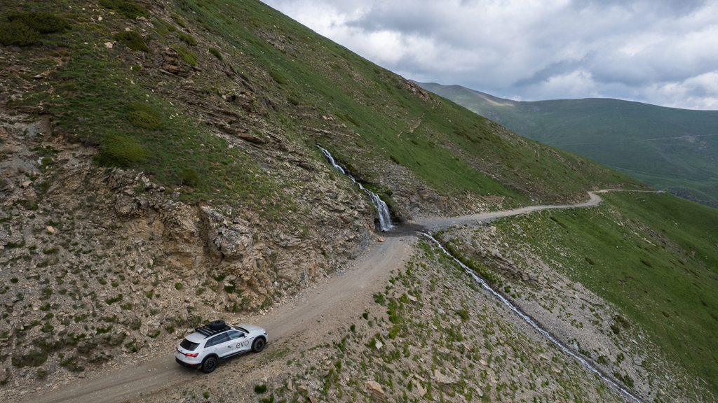


Contrary to the tracks in the Western Alps, we were again pretty much alone there.


Early in the season, snowfields can still block the road. Luckily, we were able to pass.


After the end of the track, we drove back to Llavorsí. This time, the type 2 charger was working.
We finished the day with dinner in a restaurant in Llavorsí and spent the night at the well-known campground.

The next morning, we drove to the starting point of the next offroad track, which was 18km north of Llavorsí.
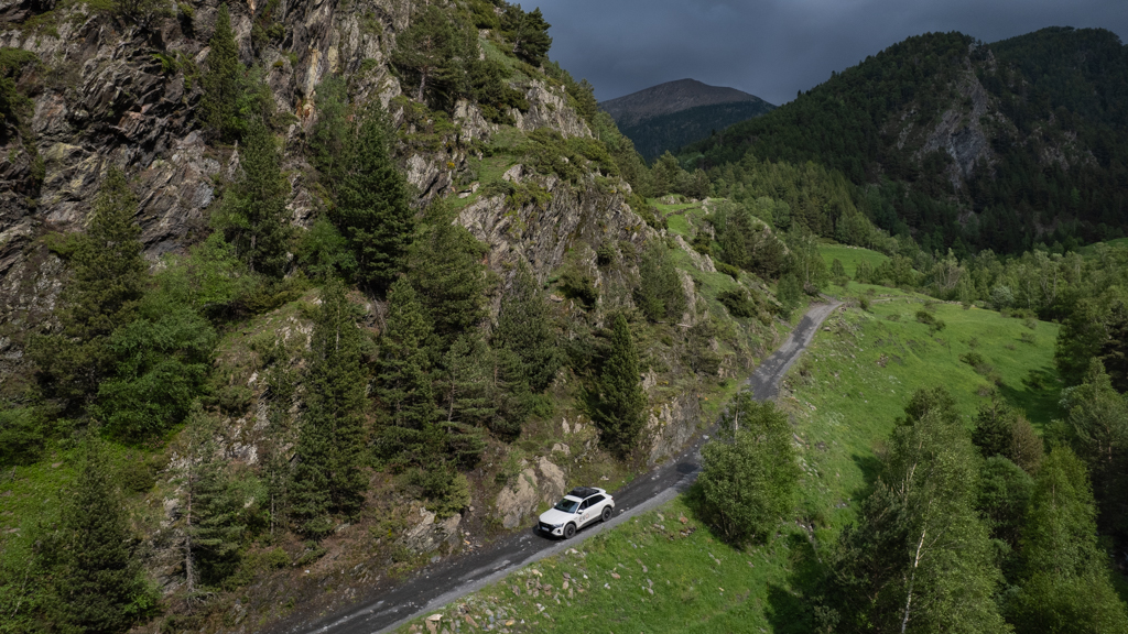
Esterri d’Aneu – Salardú (2ES)
Distance: 47.7km total, with 20.1km offroad/gravel.
This offroad track leads from Esterri d’Aneu to Salardú.


From December until May, the track is completely closed.
During high season (from 23rd of June until 11th of September), the number of vehicles is limited to 130 per day, and you normally have to buy a ticket in advance at https://www.valldebonabe.com/home.html. Luckily, electric vehicles are exempt from this regulation. The area is, according to the Spanish law, a Special Acoustic Quality Protection Zone to guarantee the tranquility of the natural environment. Since EVs produce far less noise, the exemption makes sense. A nice side effect of driving an EV.
The track has a speed limit of 20km/h.


The track leads through another beautiful mountain region with wide open views. It was easy to drive without any significant challenges. Just in case of oncoming traffic, you have to be able to drive in reverse for 100m or more on a narrow mountain road until you reach a spot that is wide enough for two vehicles. Luckily, when we were there, we were pretty much alone.


At the end of the track, we charged the Audi Q8 e-tron at a type 2 charger in Bagergue.

In the meantime, we explored the beautiful small village of Bagergue. It has a population of only 100 people and is situated at an elevation of 1,490m. There were a couple of interesting handicraft shops, historic buildings, and nice restaurants. It’s definitely worth a stop.

Charged to 80% we continued to the offroad track, which started only 2km south of Bagergue.
Salardú – Vielha (2SV)
Distance: 36.4km total with 16.4km offroad/gravel.
This track leads from Salardú to Vielha.

At the beginning of the track, there was a sign recommending a 4×4 vehicle.

This track is closed from December until April, and the maximum speed limit is 20km/h.

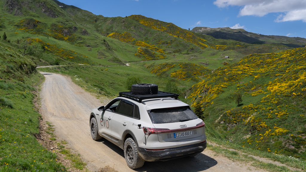
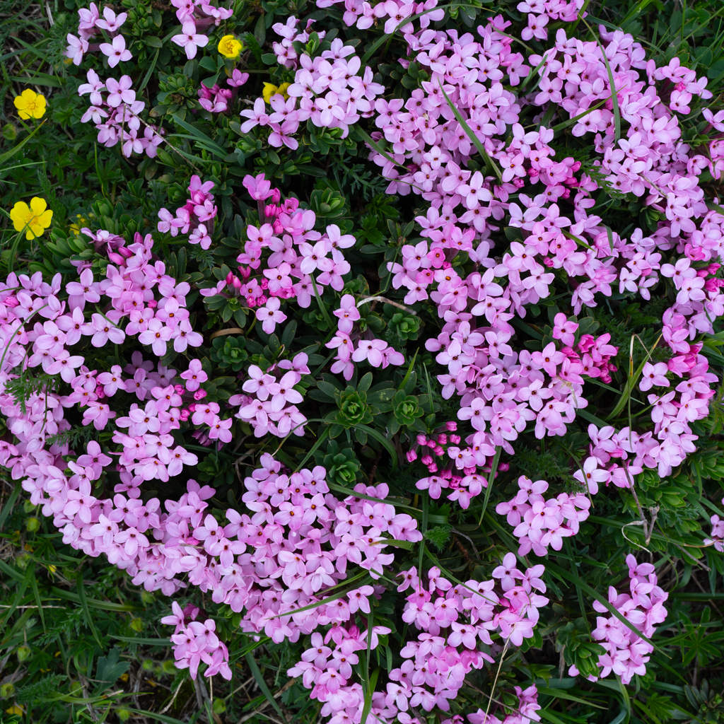
It leads through another spectacular mountain area with abundant wild flowers in June.


It’s a rather easy track, often wide enough for two vehicles. A 4×4 is, in my opinion, not needed.


We charged the Audi at a fast charger in Mijaran, just 2km from the end of the track in Vielha.
Afterwards, we drove another 50km to the campground in Laspaúles, where we charged the Audi again overnight on the 10A single-phase wall plug (using the Juice Booster).

The next morning, we had to drive only 20km to reach the starting point of the next offroad track.
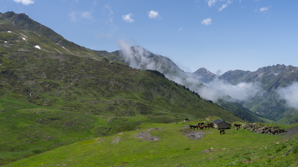
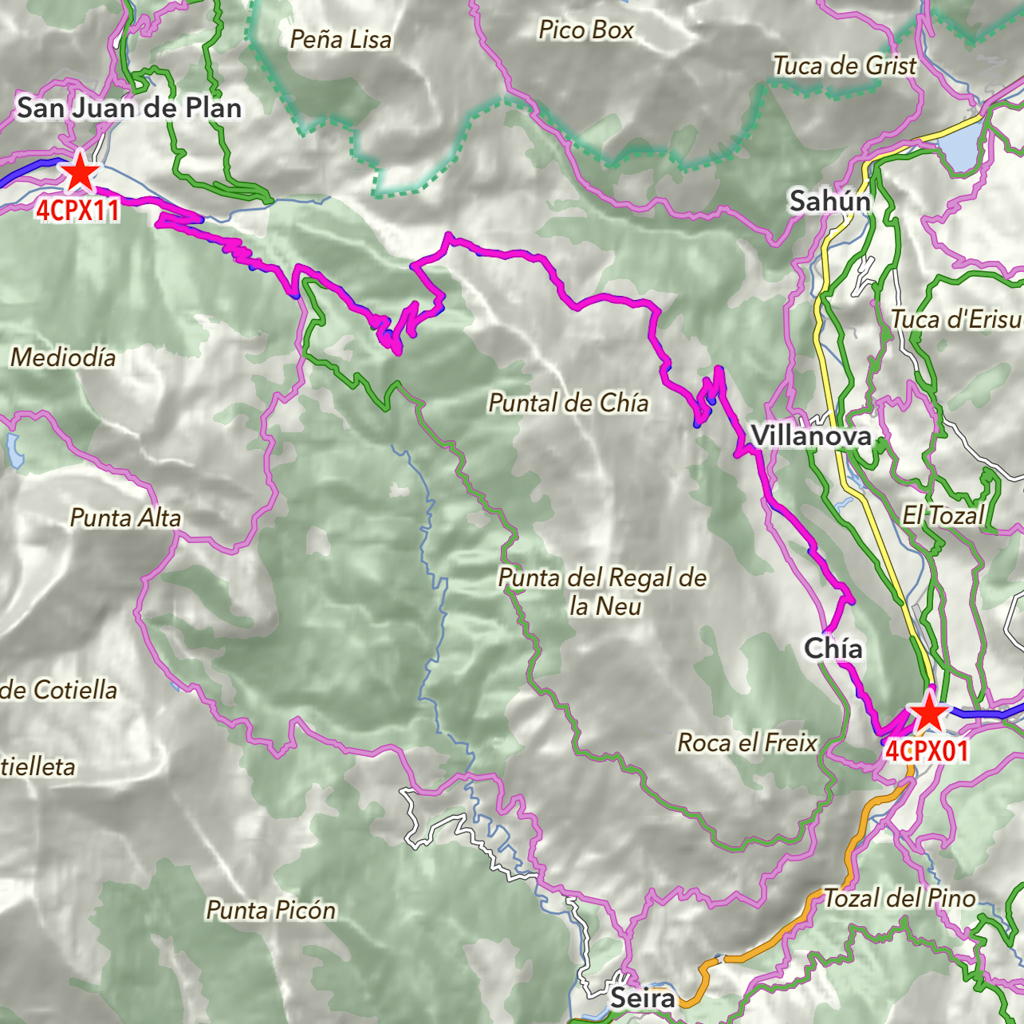
Chia – Plan (4CP)
Distance: 29.4km total with 24.2km offroad/gravel.
This track leads from Chia to Plan.
The weather in June was just perfect with lots of sun and neither too hot nor too cold.

Most of the track was very easy to drive. There were only a few places that had some larger corrugations. A 4×4 is not needed, but a little bit higher ground clearance can help on this track.

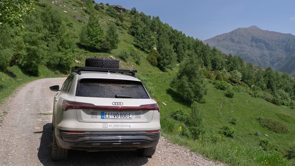


The landscape was stunning again, with interesting rock fields and beautiful wild flowers along the way.
After finishing the track, we wanted to visit a nearby canyon.
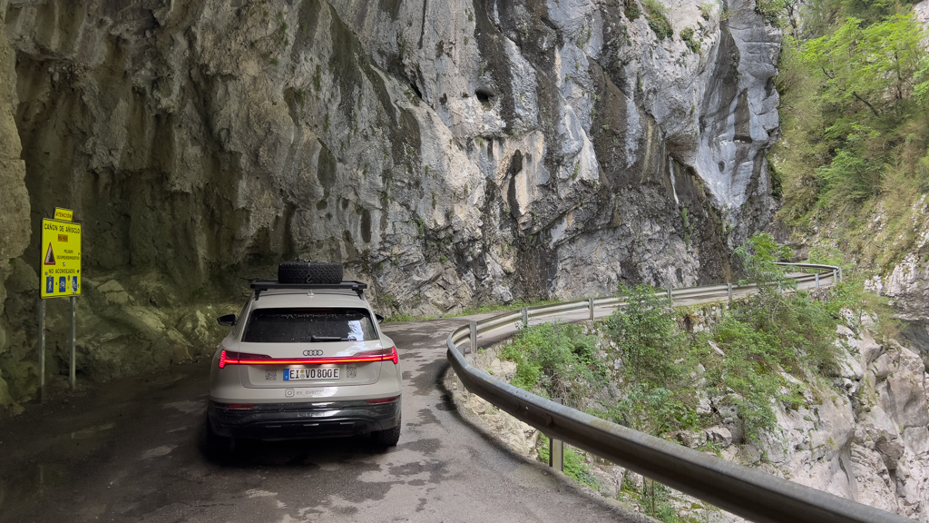
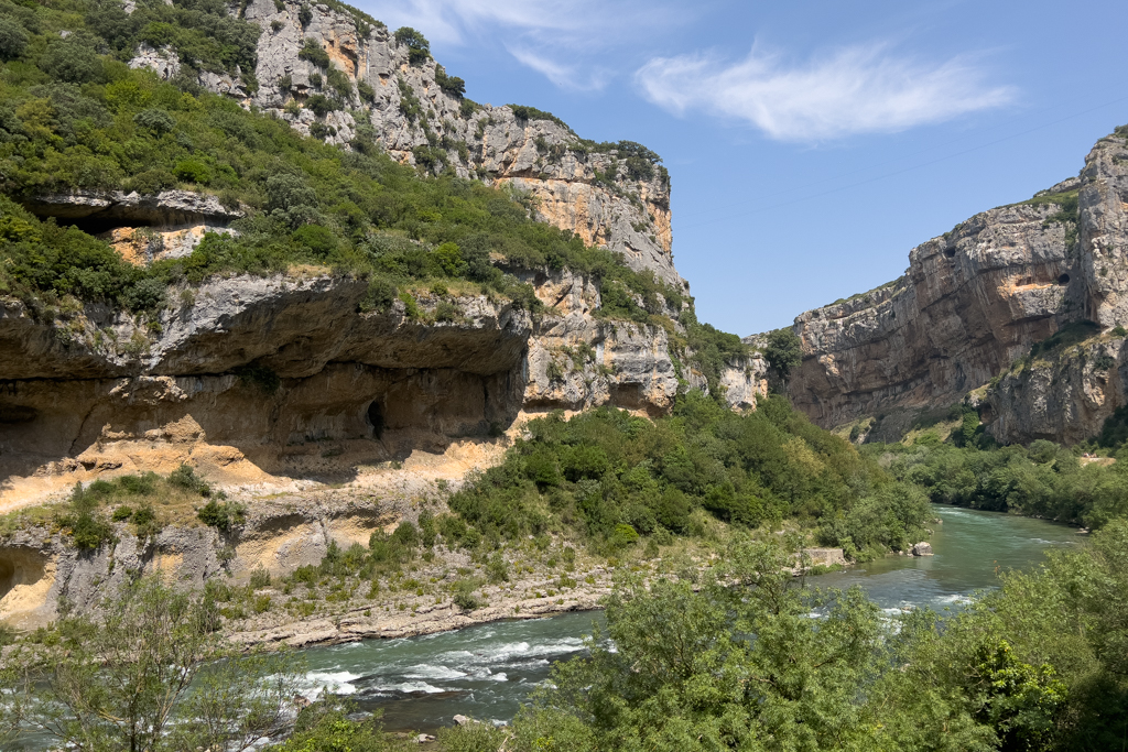
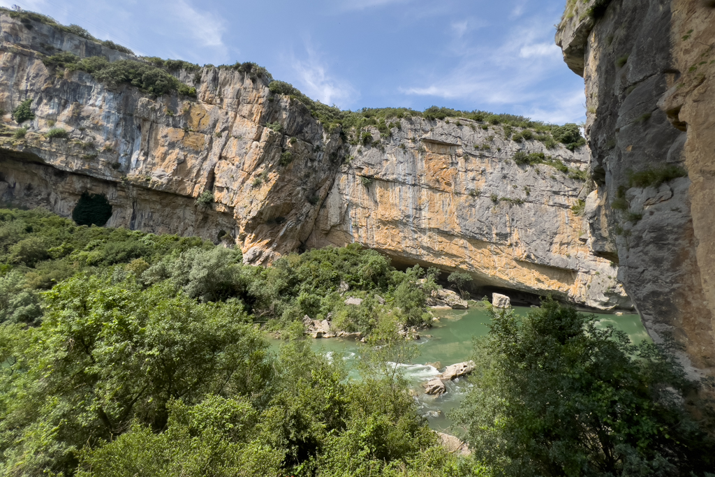
Caňon de Aňisclo
The well-known Caňon de Aňisclo is located in the National Park Ordesa y Monte Perdido.
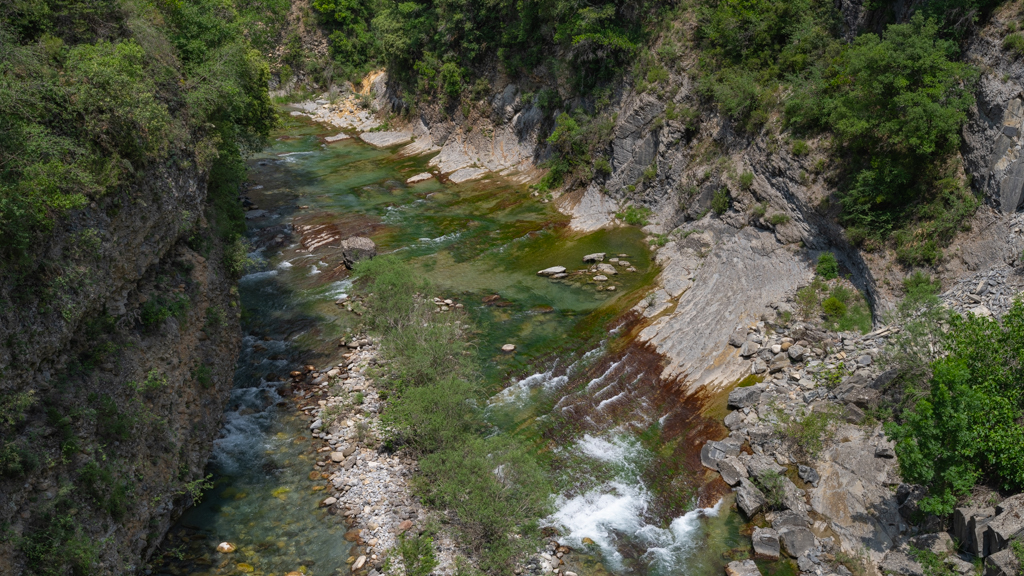
There is a very narrow road leading through the canyon. It is completely paved and can only be driven from South to North. This makes it easy to drive, because there won’t be any oncoming traffic (which would otherwise be a real challenge on this road).


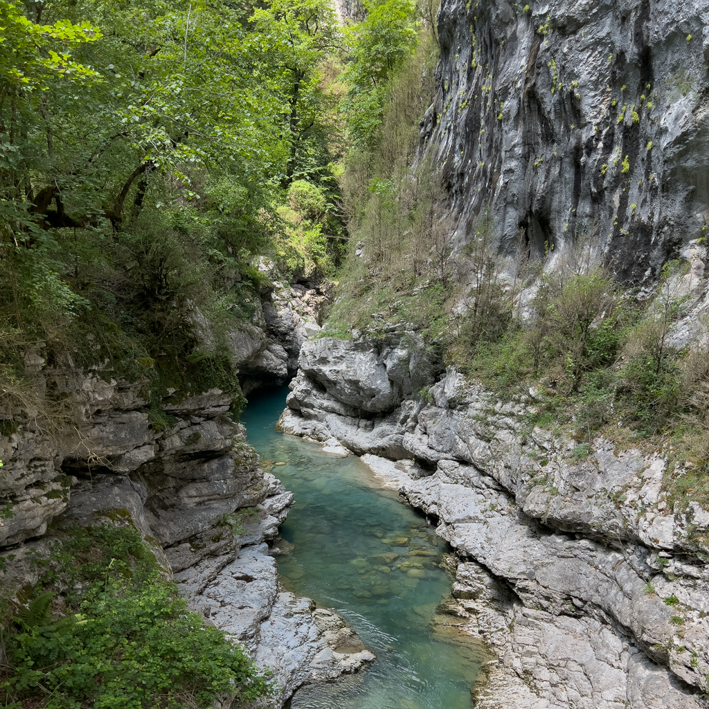

We even found a snake in the canyon.

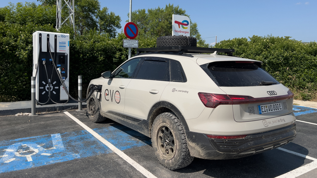
After visiting the Caňon de Aňisclo, we charged the Audi a little bit in Sabiñánigo. However, since the charger was not particularly fast (only 50kW) and there was nothing to do at this location, we decided to continue to the next charger after a few minutes.

The next fast charger was in Berdún. This time, there was at least a restaurant next to the charger where we had a lunch break.
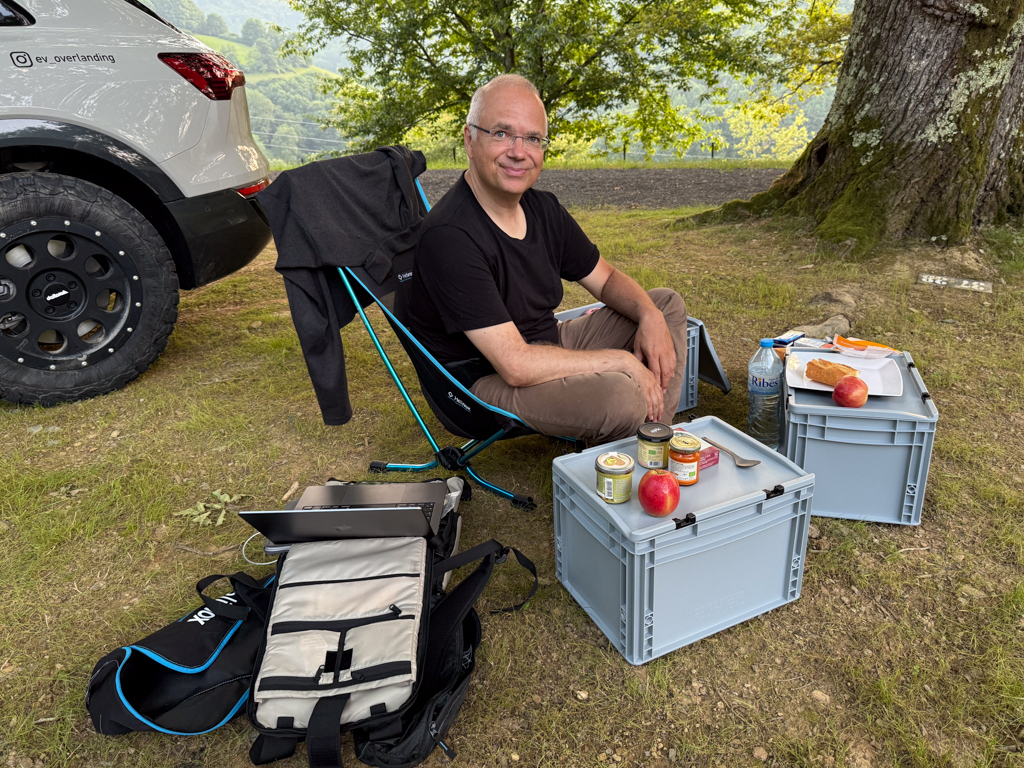
Afterwards, we continued another 60km to a campground in Eparza.

Overnight, I topped up the Audi with the 10A wall plug at the campground.
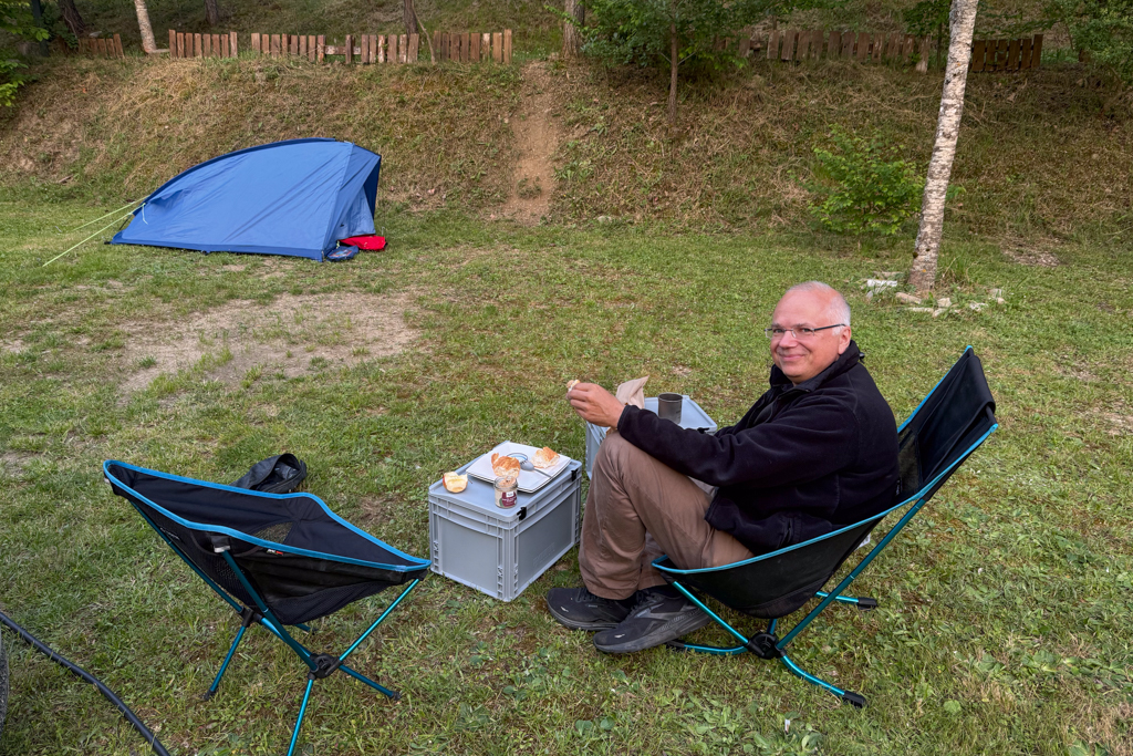
We had dinner at the campground using our camping chairs and one of the Euro boxes as a table.
Next morning, I set up my Nespresso machine for a good start of the day with a strong espresso (or two). The machine can be connected to the EcoFlow powerbank in my car. But since the campsite had electricity, I used this power source instead.

From the campground, it was a 17km drive to the starting point of the next track.
Abaurregaina – Elkoatz (4AE)
Distance: 19.8km total with 17.6km offroad/gravel.
This offroad track leads from Abaurregaina to Elkoatz.

The track started in a coniferous forest.
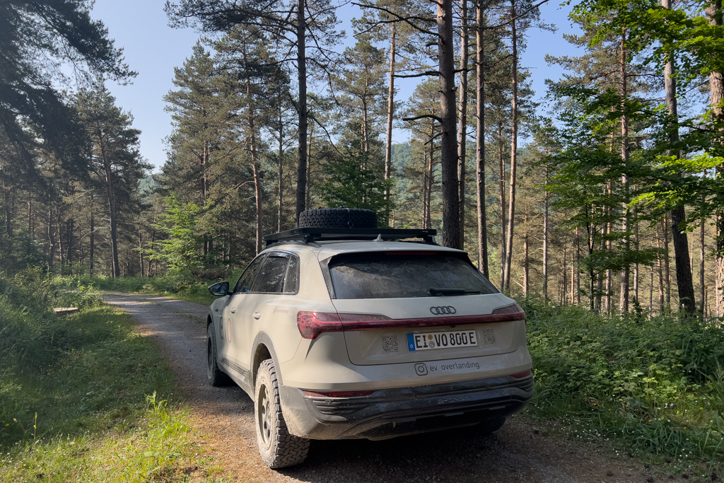

And then led through a more open area with great views of the surrounding landscape.
It’s an easy gravel track without any serious challenges. A 4×4 vehicle is not needed.

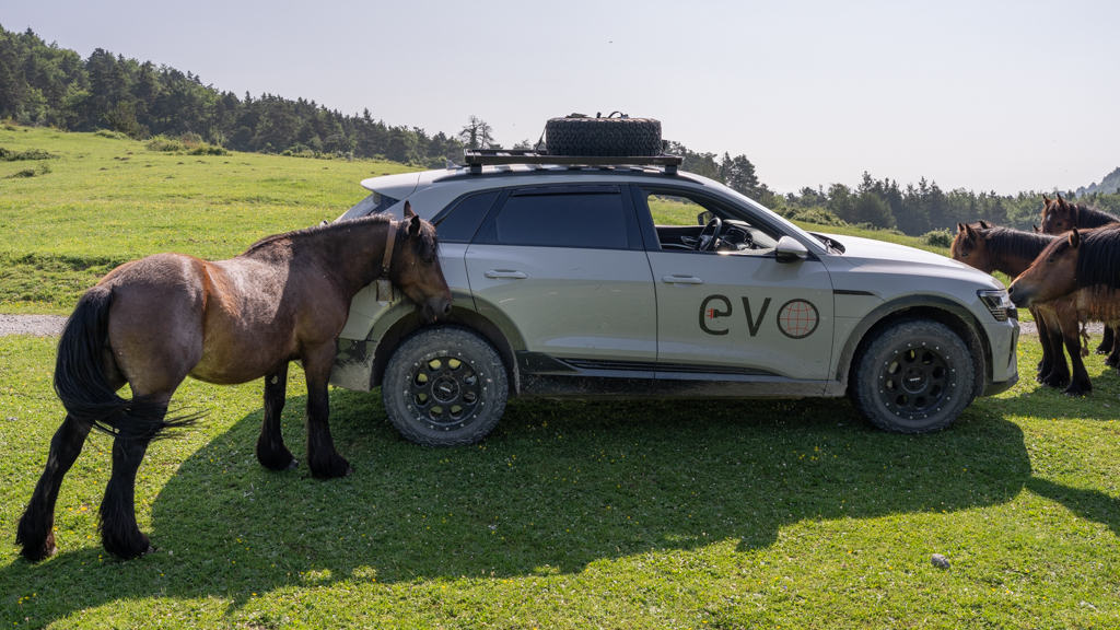
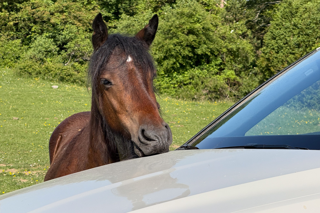
At one point, we met a very curious herd of horses.

Some of them seemed to really love my car for whatever reason.
In the last part of the track, the landscape was really stunning with steep rock formations and a beautiful forest that reminded me of national parks in North America.

After finishing this track, we wanted to explore two nearby canyons: the Foz de Lumbier and Foz de Arbayún.
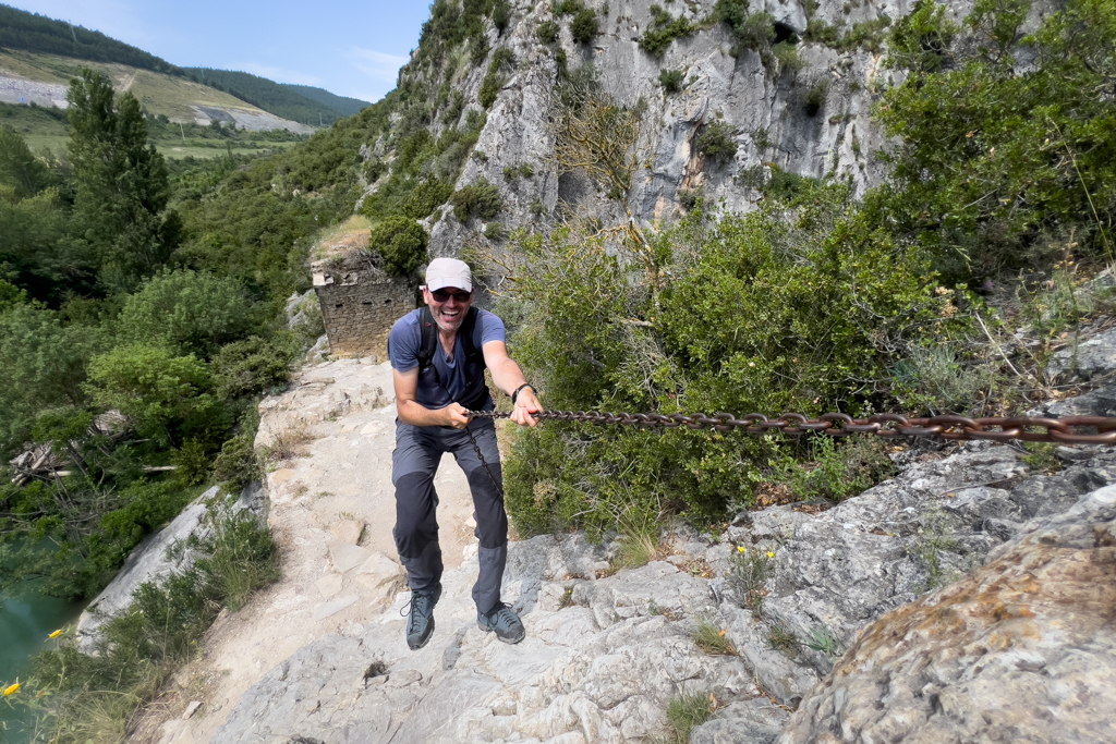
Foz de Lumbier and Foz de Arbayún
The Foz de Lumbier can be explored on a 6km hiking trail. The round trip takes about two hours.
It’s one of the best spots for watching vultures in Europe. The sky was full of them, and many were sitting at the edges of the canyon.
The fun part of this trail is that it leads through a couple of dark tunnels. A small flashlight is therefore recommended for the hike.


To reach the viewpoint at Puente del Diablo, a little bit of climbing is necessary. But with good shoes and the help of a chain, it was easy.

The second canyon, the Foz de Arbayún, has no hiking trails. It can only be explored from the viewpoint. But it’s 6km long, 400m deep, and stunningly beautiful.

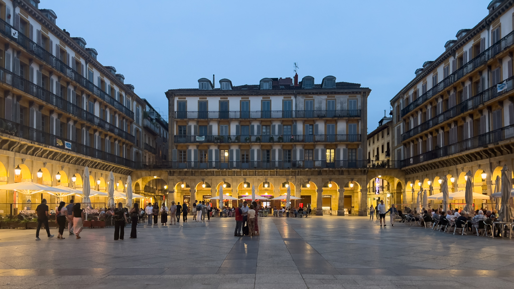
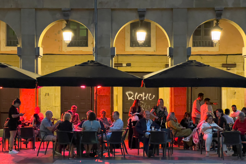
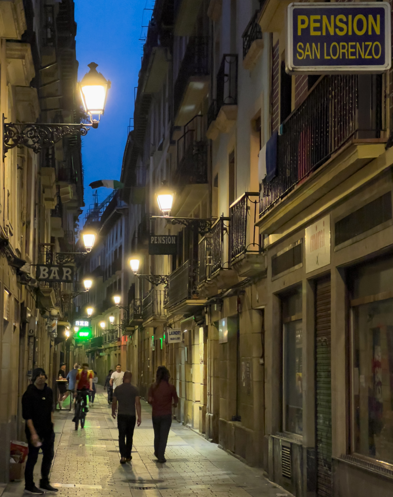
Pamplona
Since Pamplona was close, we decided to do a quick detour to explore the city.

Pamplona is the capital of the region of Navarra.
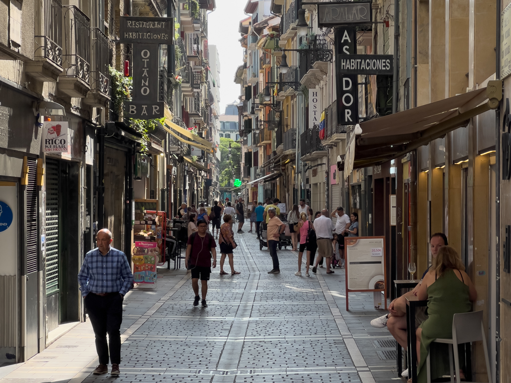

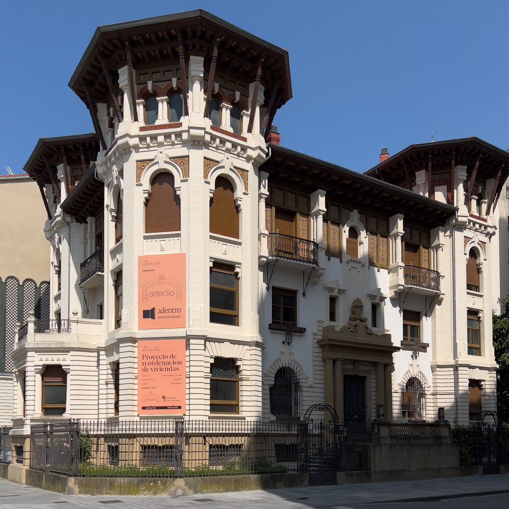

Many beautiful historic buildings can be found throughout the city.


Pamplona was definitely worth a quick stop.
Afterwards, we drove another 50km to a campground near Sunbille, close to the starting point of the next track.


We had dinner at the campsite. In the meantime, I was saving my images and videos from this trip on my notebook.
The campsite (Camping Ariztigain Navarra) also had a type 2 charger, which we used the next morning to charge the e-tron back to 80%.

The start of the next track was only 4km away from the camp.
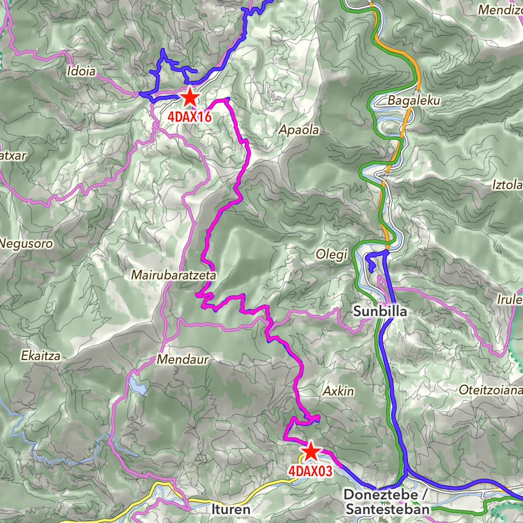
Donetztebe – Arantza (4DA)
Distance: 16.5km total with 9.6 km offroad/gravel.
This offroad track leads from Donetztebe to Arantza.
The track is a bit rougher than the last one, and 4×4 is recommended. But vehicles like the Tesla Model Y or an ID.4 are perfectly fine for this track.

The vegetation changed again. It was much greener now with lots of ferns along the track.
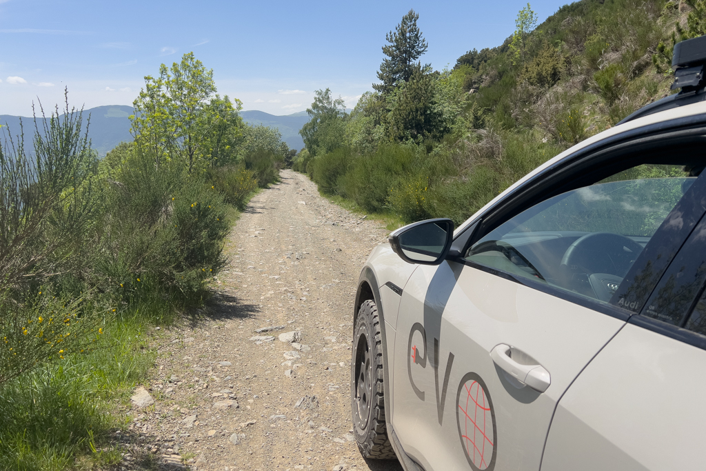
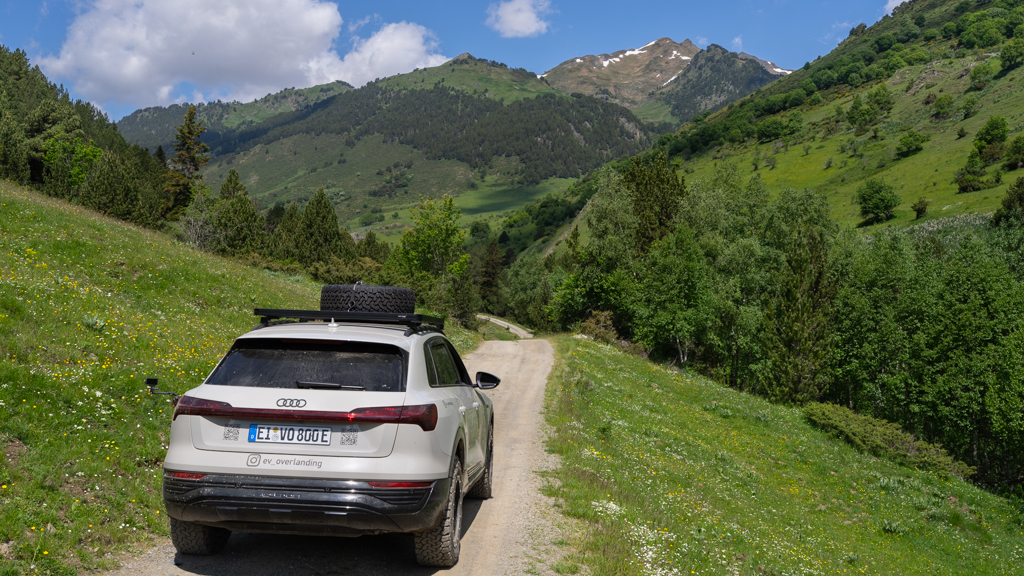
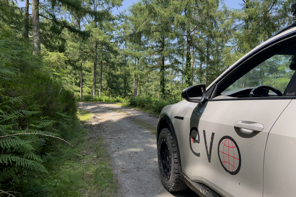
That’s one of the fascinating aspects of a Transpirenaica: the landscape along the way is very diverse, and you can observe the change in vegetation from the Mediterranean Sea to the Atlantic Ocean over time and distance. From the cork oak forests at the beginning to the wild flowers in the high altitude regions, to a kind of tropical vegetation with ferns in the end.

Since this track wasn’t long, we did another one on the same day.
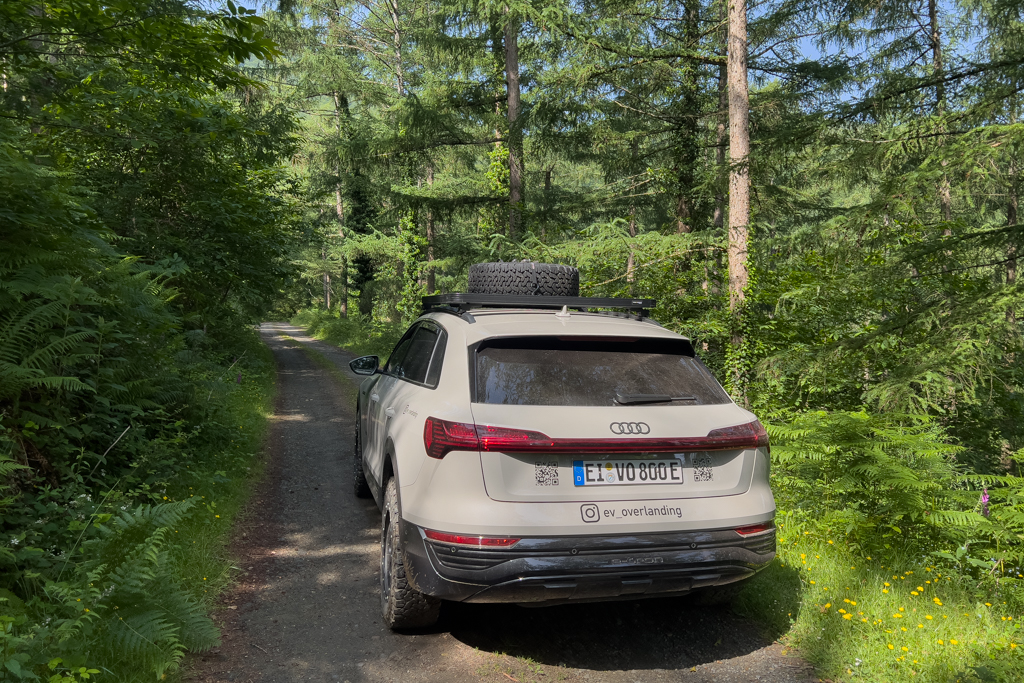
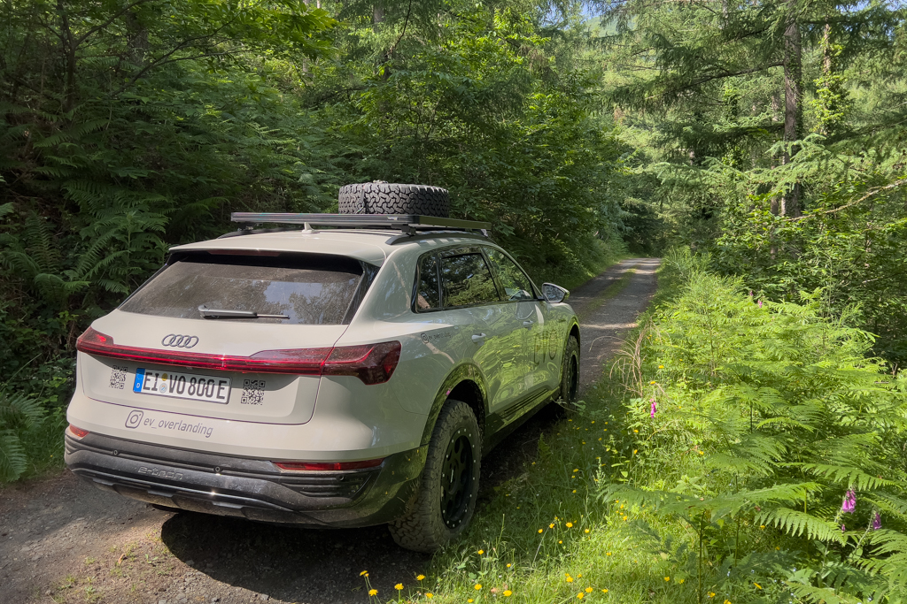
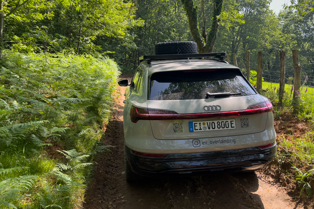
Arantza – Irun (4AI)
Distance: 26.1km total with 24.2 km offroad/gravel.
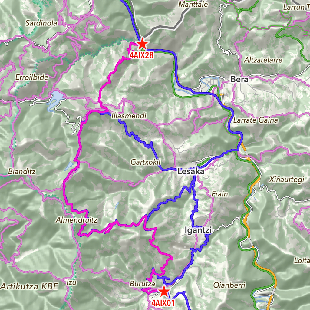
This offroad track leads from Arantza to Irun. In theory, it’s 26km long, and there is a more or less a direct connection between these two points. But depending on the weather, some sections can be extremely challenging. We therefore had to skip one section and take a detour to get back on the track. More about this later.
The beginning was easy. The track led again through a lush green vegetation with lots of ferns.
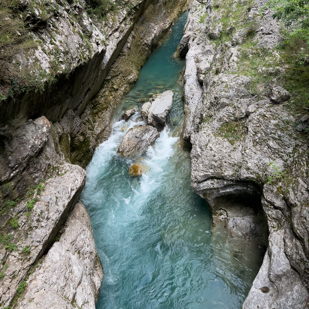
Then we reached the first key point of this track: a deep gully/ravine. But that was not the main problem. It was wide enough for the Q8. But it was also very steep (not really visible in the images), and it had an extremely slippery underground. The surface consisted of wet clay. Even walking there was very difficult. It felt like walking on ice.


Without AT tires and 4×4, there would be absolutely zero chance of getting up there. But even with AT tires and 4×4, there would be a very high risk of losing traction halfway and sliding into one of the sidewalls. The risk of damaging the car was significant.
Therefore, we decided to slowly reverse and turn around. We then drove a detour via Igantzi and Lesaka to get back on the track as shown on the map below.
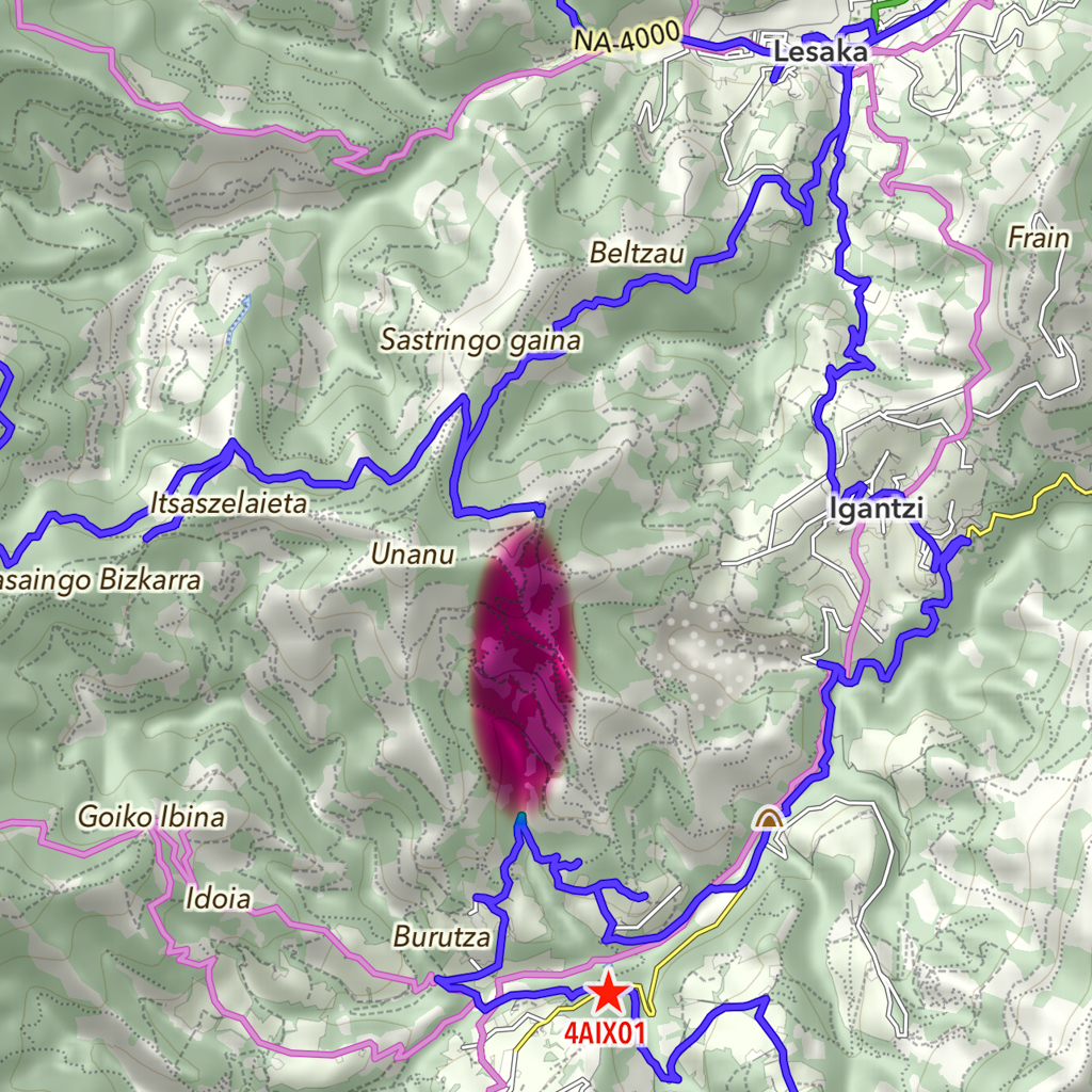
In the end, we drove the whole track except for the marked area.
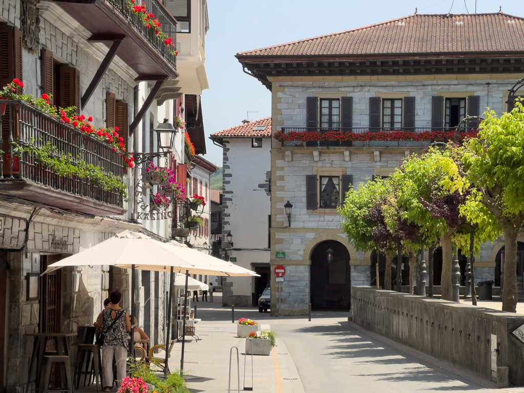
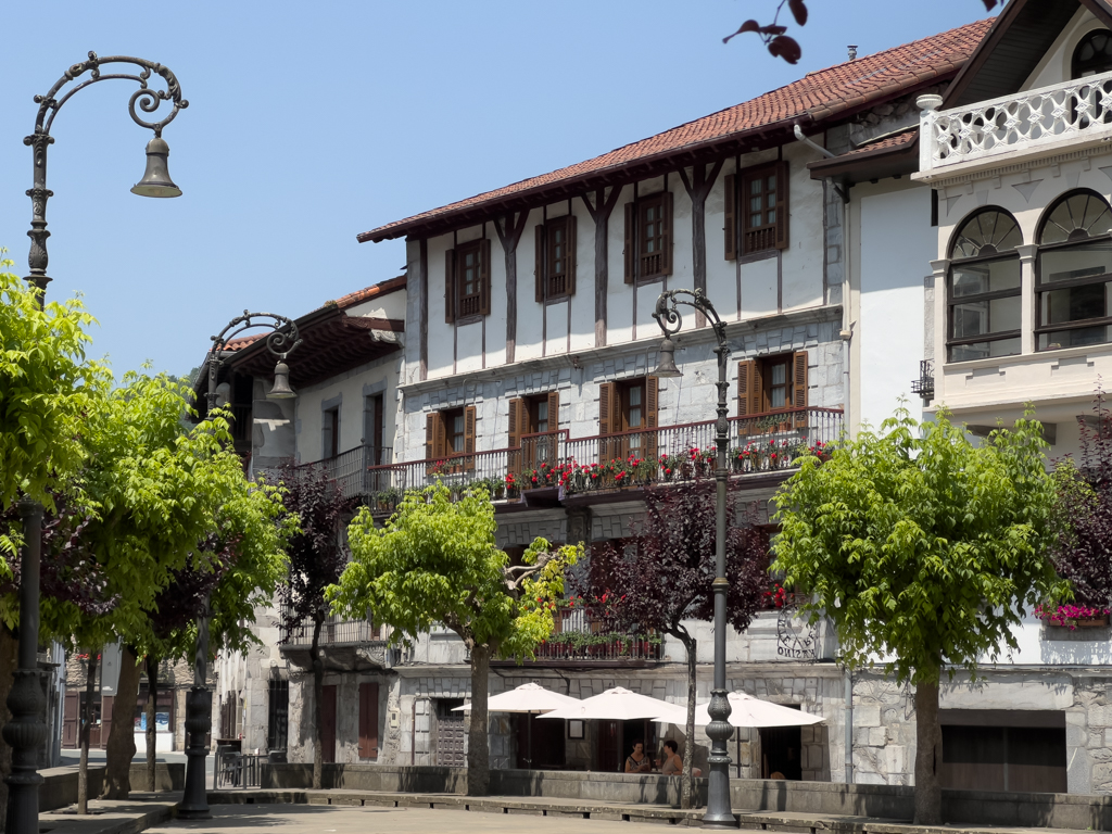
On our detour, we also visited the beautiful village of Leska and had a quick coffee break there.

Back on the track, we continued to Irun. The track now led through a very dense and green forest.


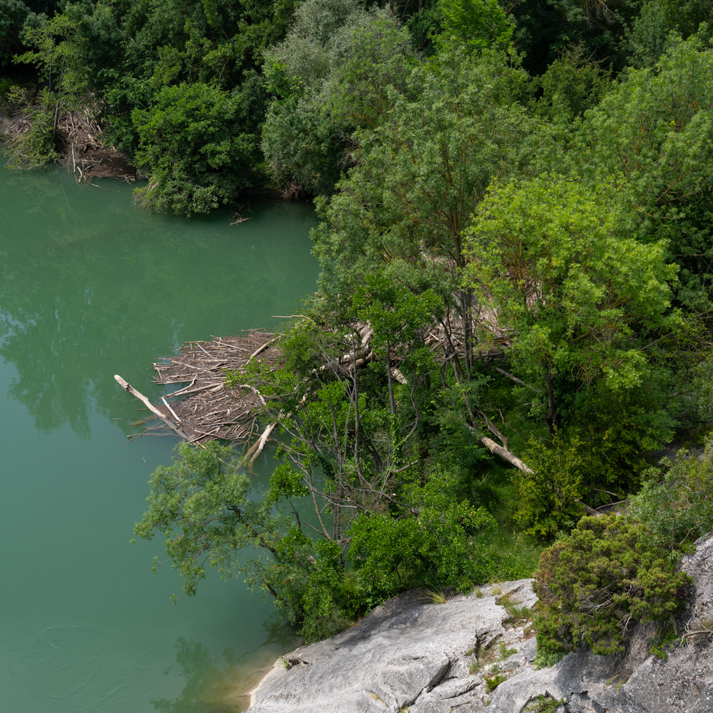
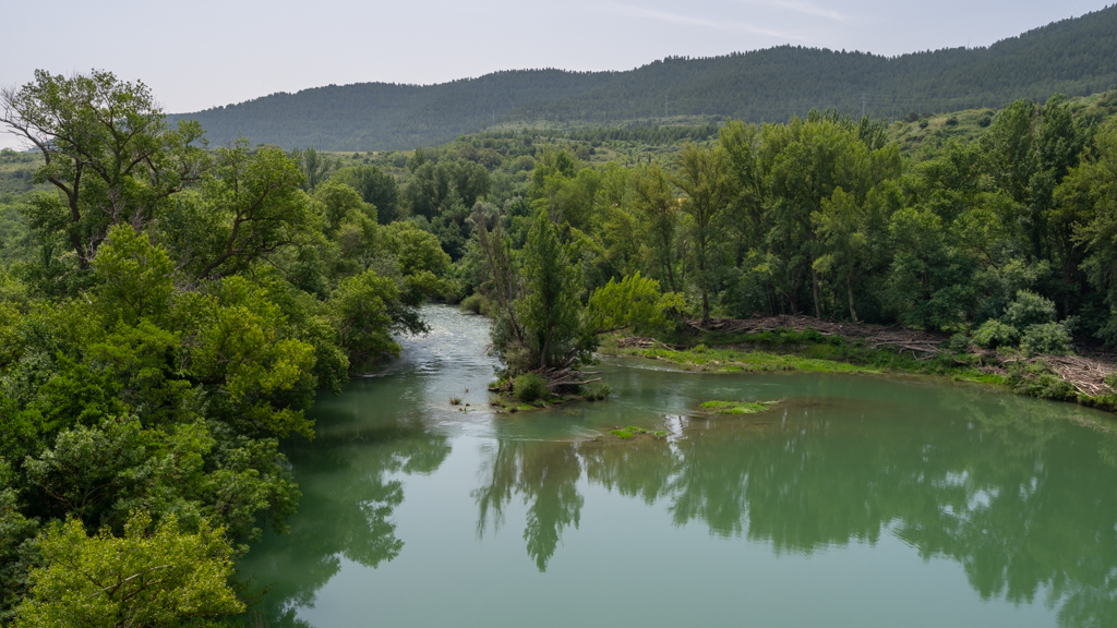
After the end of the track, we drove another 10km to the Faro de Higuer at the Atlantic Ocean.


Our plan was to spend the night at the campground next to the Faro de Higuer.
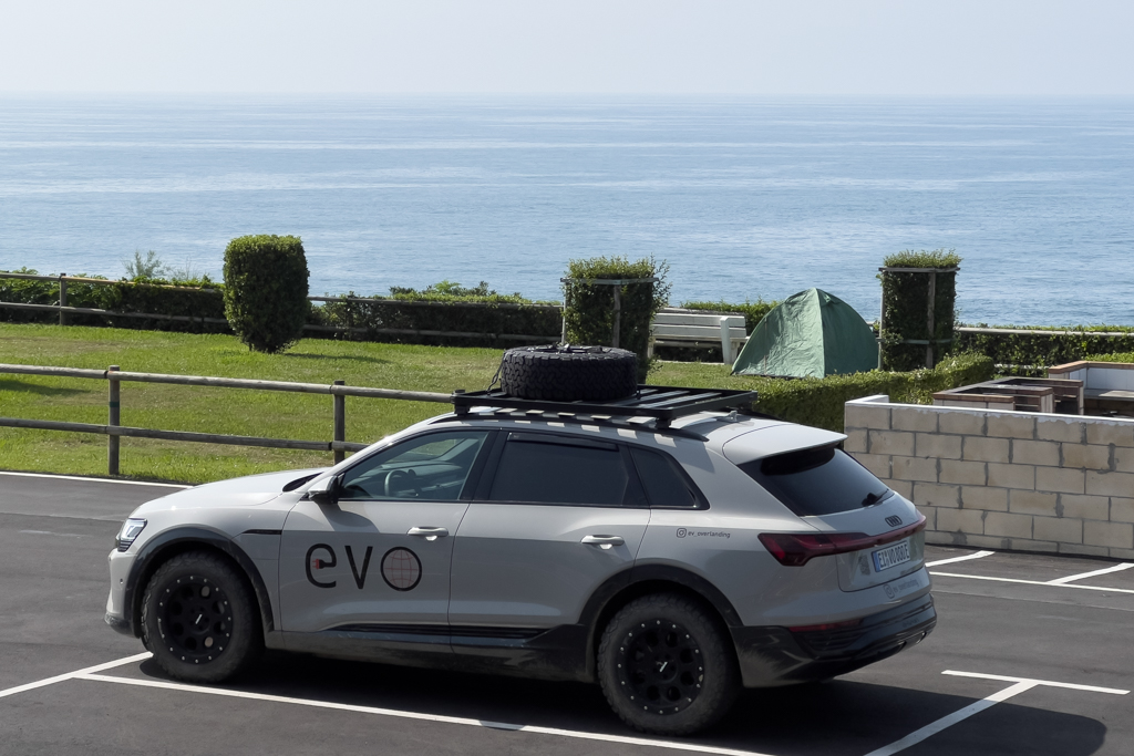
We managed to cross the Pyrenees and reach the Atlantic Ocean. A first big milestone of our EV adventure trip was reached. But it wasn’t the end of our trip. As mentioned in the beginning, our final destination was Bilbao.
Donostia-San Sebastián
In the late afternoon, we drove the short distance to San Sebastián to explore the city.
San Sebastian is a Low-Emission Zone, and all private vehicles need a registration to enter the city. Older combustion engine cars are now forbidden (cars registered before 2006). Of course, electric vehicles are allowed in San Sebastian. But even they need a registration using the following link: https://www.donostia.eus/ataria/en/web/ige/foreing-vehicles.
The fine for not following this rule is 200€.
Parking in Spanish cities is always a challenge. If you park on the public road, there is a high risk that your car will be broken into. Many years ago, I did a long road trip through Spain, and on this trip, 5 times someone either smashed one of the side windows of my car or broke the lock. It was really frustrating at that time. Therefore, I always try to find a safe parking spot in larger cities now.
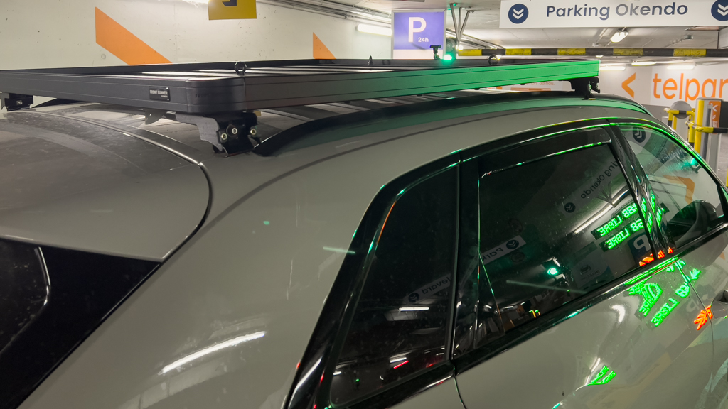
Since my car has a roof rack with a spare tire, not every parking garage can be used. For San Sebastian, I checked all the parking garages on Google Maps about their high restrictions and found one with a limitation of 2.2m, sufficient for my vehicle. At the entrance of the garage, there was a sign confirming the 2.2m. But later, in the garage, there was another sign that I sadly overlooked.
It showed that if you use the parking lots on the left side, the maximum height is only 1.85m instead of 2.2m (see sign below).

One thing leads to another, the EV chargers were located in this left area of the garage, and I thought it would be a great idea to charge the car while exploring the city.
In the end, I hit a metal bar of the garage with my roof rack and tore the rack off my car’s roof. The roof of my car was scratched, and the roof rack was bent. And as you can imagine, I was extremely pissed.
(Update from a couple of weeks after the trip: I’ve now repaired both the roof and the roof rack. The repair costs were altogether more than 9000€. The larger part of it was paid by my full comprehensive insurance, but of course, with an impact on my future insurance fees.)
We provisionally repaired the roof rack in the garage with spare parts I had in my trunk, and afterwards started exploring San Sebastian, while still in a slightly bad mood.


It’s a beautiful and vibrant city.
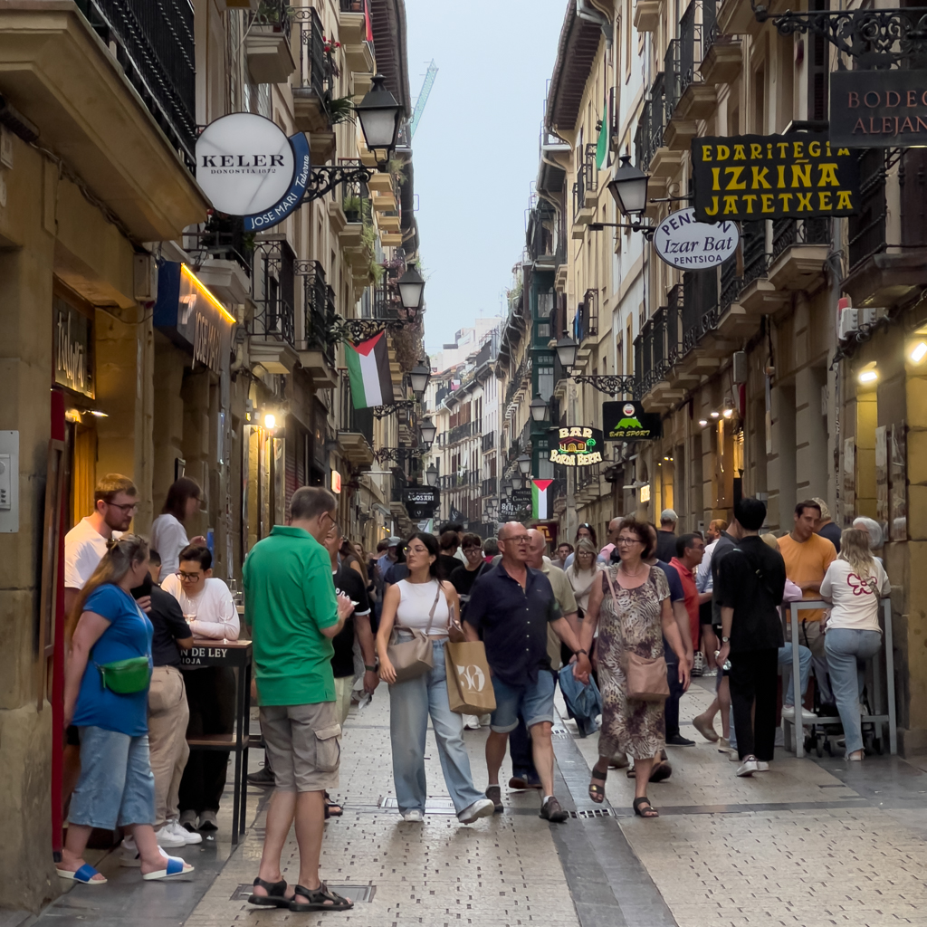

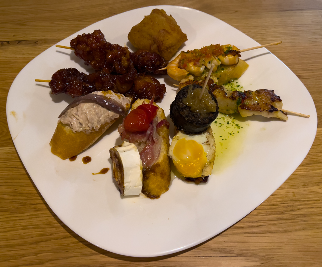
For dinner, we went to one of the countless Pintxos bars in the city center. Pintxos (or Pinchos) are very similar to Tapas.

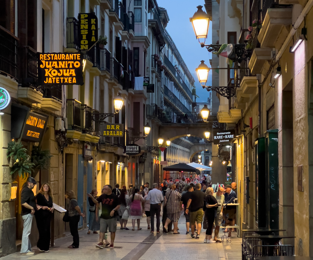
Except for the parking garage, I can highly recommend San Sebastian. It’s a beautiful city. The next morning, we drove 140km to the starting point of the next track.
Along the way, we charged the Audi at a 200kW DC charger.

Osma – Zugaztieta (1OZ)
Distance: 16.0km total, about half of it offroad/gravel.
This track leads from Osma to Zugaztieta.
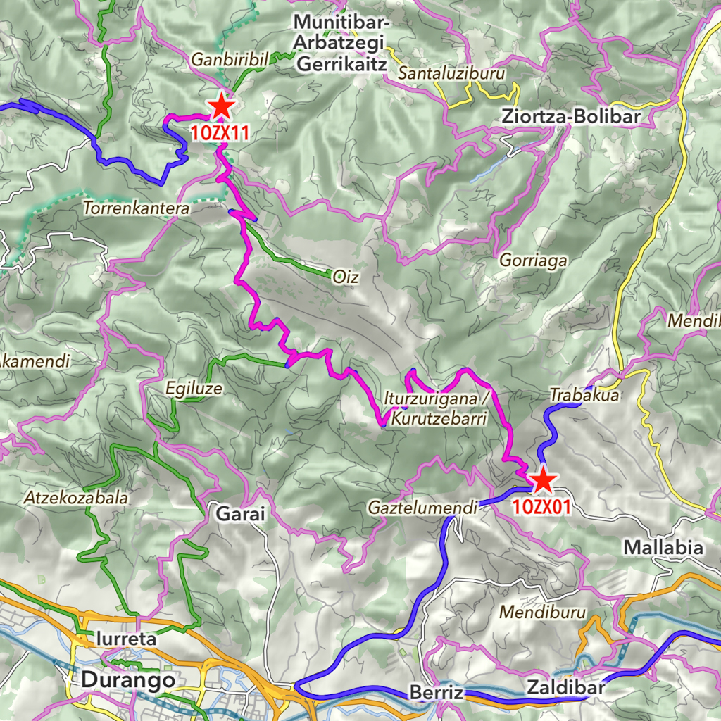
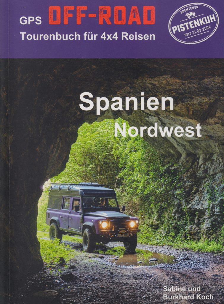
For the area west of San Sebastian, we used a different Pistenkuh roadbook called “Spanien Nordwest“.
Contrary to the description in the Pistenkuh roadbook, about 50% of this track is now paved.
The track is mainly used for the maintenance of a wind turbine park. It is therefore also in very good condition and can be driven in any car.


After finishing this track, we continued to our last planned offroad track near Muskiz. Halfway, we charged our car at a fast charger.

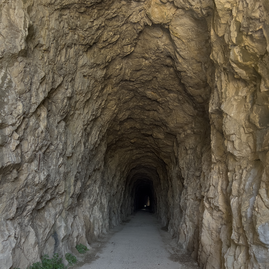
Muskiz – Artzentales (1MA)
Distance: 23.2km total with 19.8km offroad/gravel.
This offroad track leads from Muskiz to Artzentales and has some distinctive highlights.

It starts with a very dense vegetation.

And then quickly leads through a stunningly beautiful Eucalyptus forest that reminded me of Australia. I wasn’t even aware that this kind of forest exists in Europe. A pleasant surprise.


The next spectacular highlight was a small tunnel. It was used in the past for mining activities, and you can drive through the tunnel with your car.
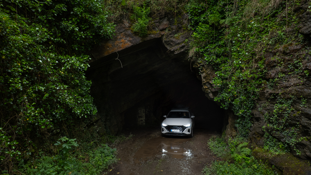
A perfect spot for some spectacular images.
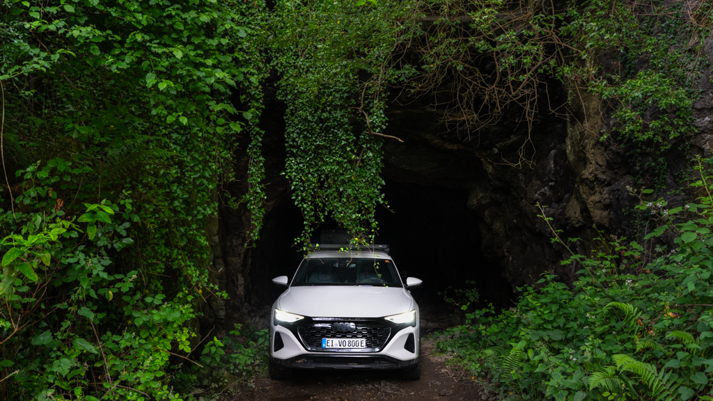
After another section through an Eucalyptus forest, we soon reached the next tunnel.

This one was even more spectacular than the first one, with dense vegetation all around.
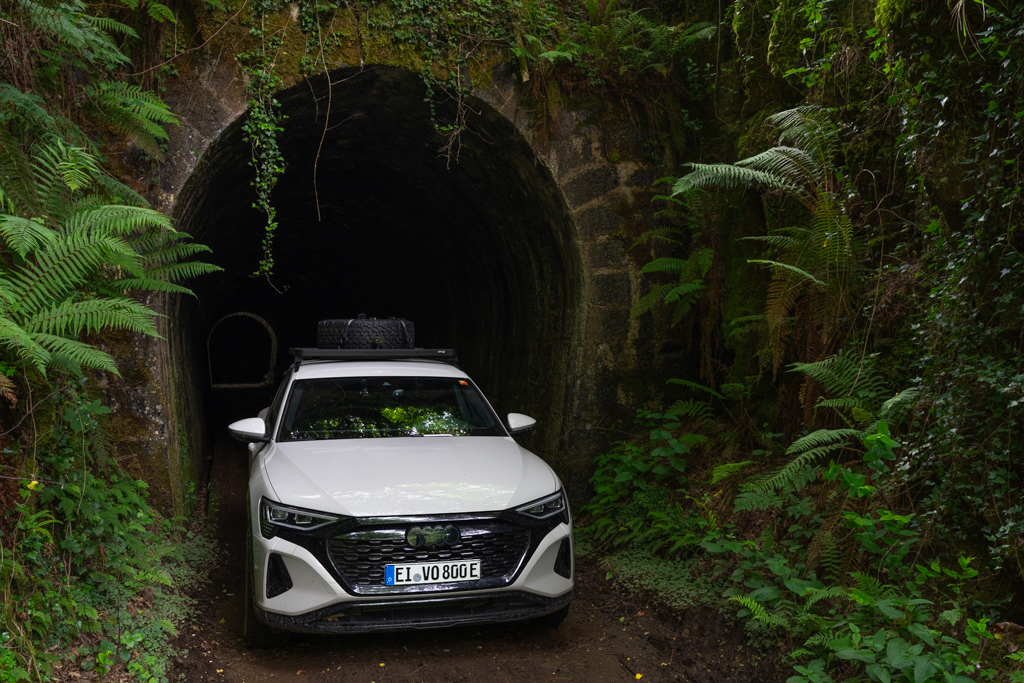
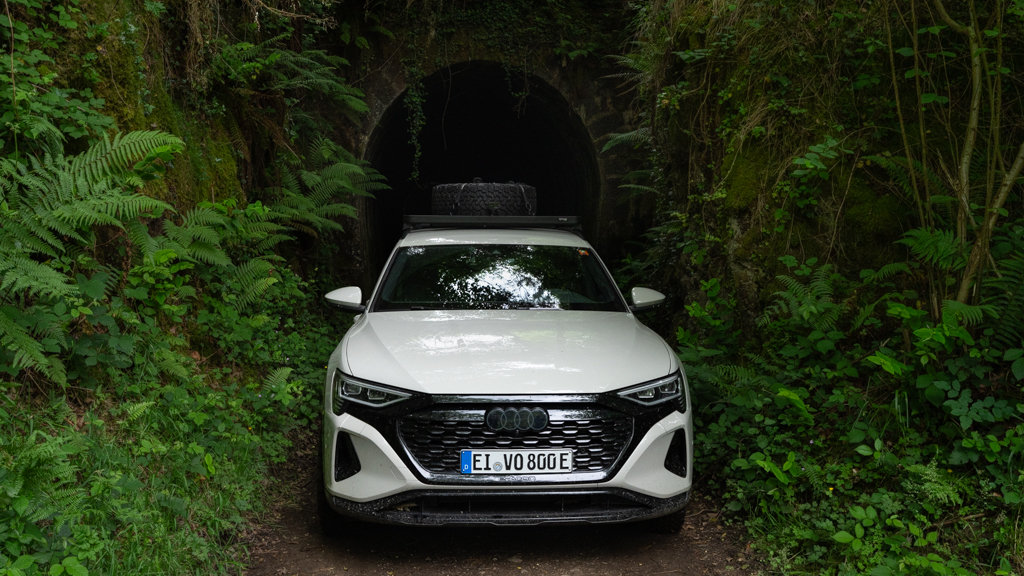
This scene could be right out of a Jurassic Park movie. Another pleasant surprise for me was that such a place can be found in Europe. I hadn’t expected this.

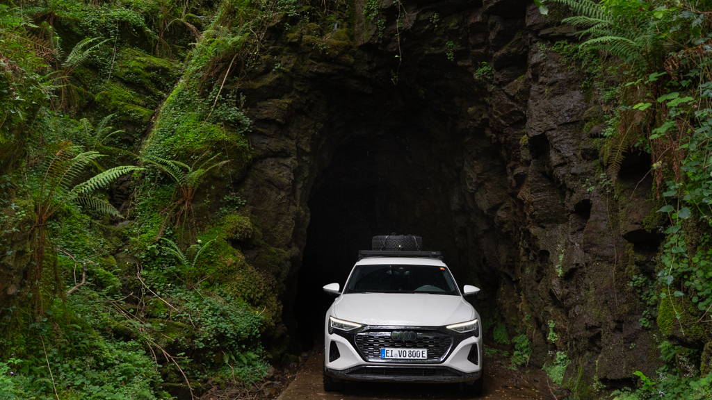


We soon reached the end of the track. This was definitely my favorite track of the whole trip and a worthy conclusion to Transpirenaica.
We then drove to a campground in Sopelena, located directly at the Atlantic Ocean, not far from Bilbao.


We had now completed the Transpirenaica. Maybe for the first time with an EV. Who knows?
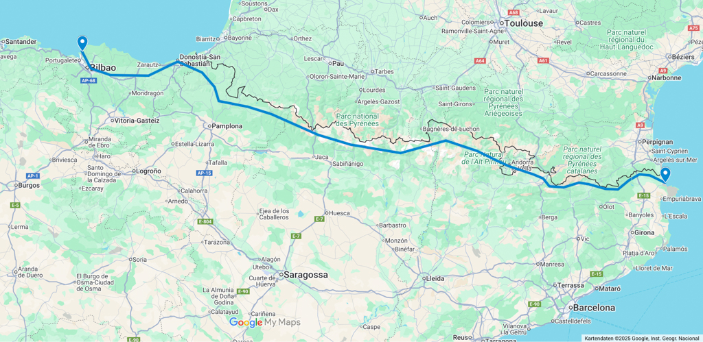
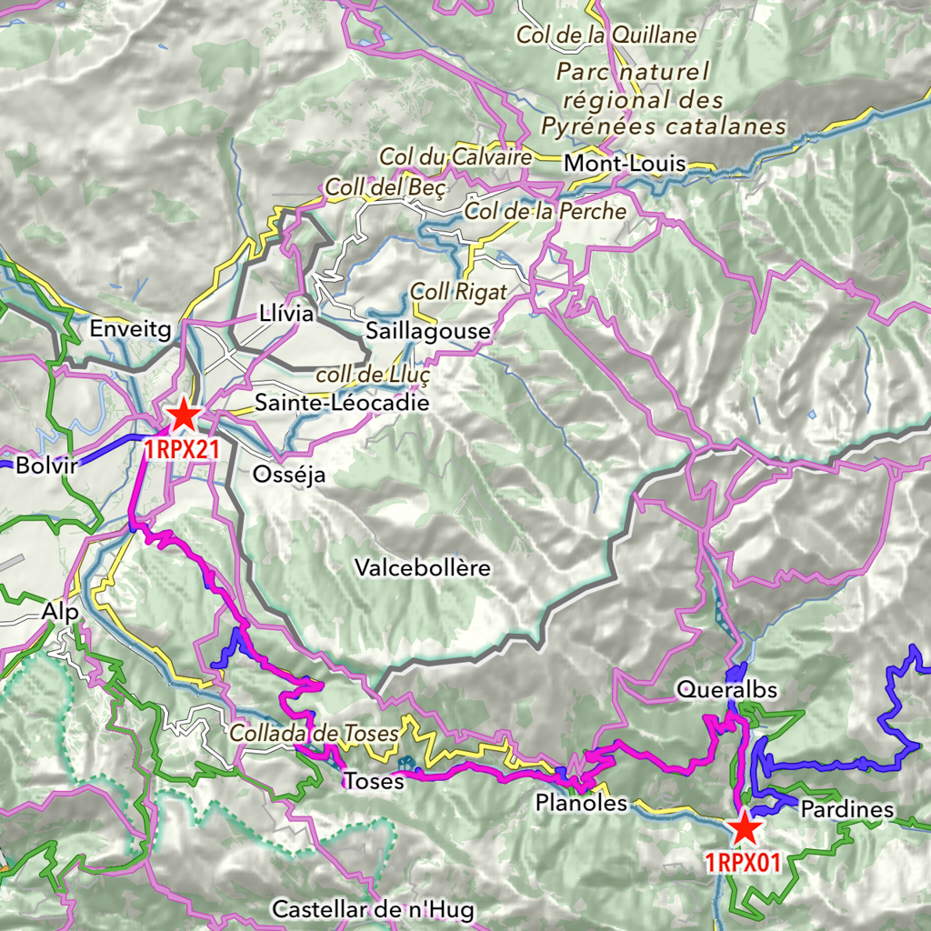
The following map shows the complete track log of our adventure from the Mediterranean Sea to the Atlantic Ocean.

It was time to celebrate the success. We booked a table at the El Peñón de Sopelana restaurant next to the beach and enjoyed the great food.


Bilbao
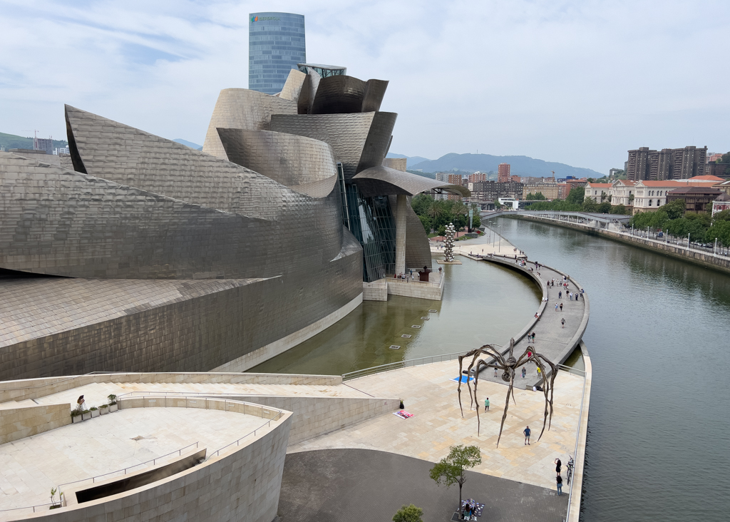
On our last day together, we wanted to visit Bilbao and especially the Guggenheim Museum. It’s been on my bucket list for years.


Bilbao is definitely an interesting city with many beautiful historic buildings.


But the highlight is clearly the Guggenheim Museum.

The architecture of the building is extremely impressive.


And I thoroughly enjoyed the inside exhibition of contemporary art.
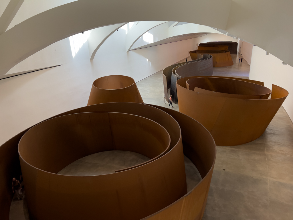


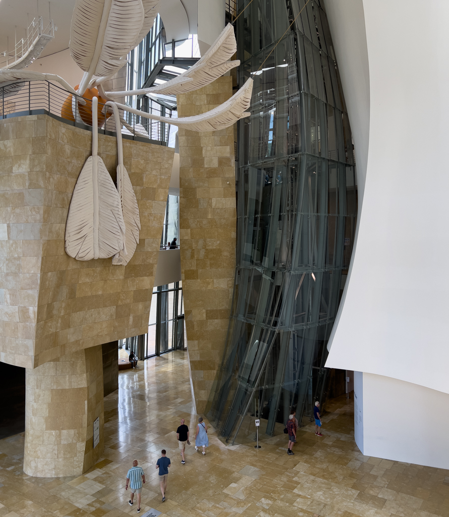


We spent around 3 hours in the Guggenheim Museum, and it was definitely another highlight of this trip.
The next morning, Mark took a plane from Bilbao to Berlin while I drove back to Munich in two days.
Since I stayed mostly on highways, fast charging was never a problem on the way back.


Altogether, our Transpirenaica trip was really great with some pleasant surprises, both regarding nature and culture.
The whole distance of the trip (from Germany back to Germany) was 4,854km. The Transpirenaica part from the Mediterranean Sea to Bilbao was 1,765km.
Charging
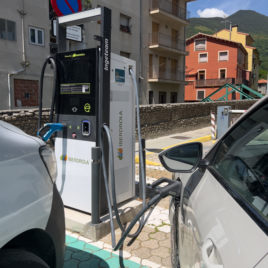
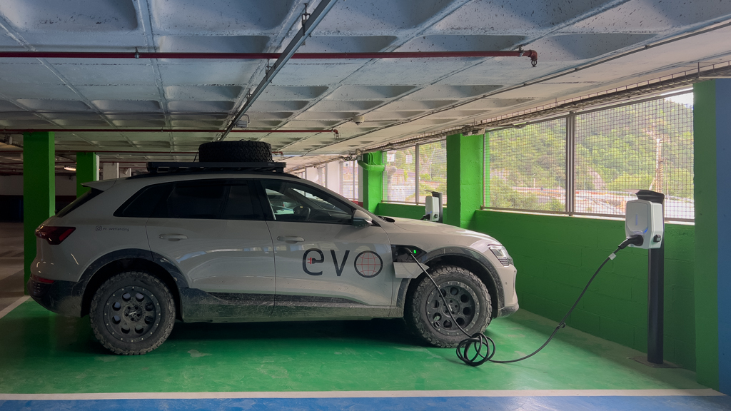
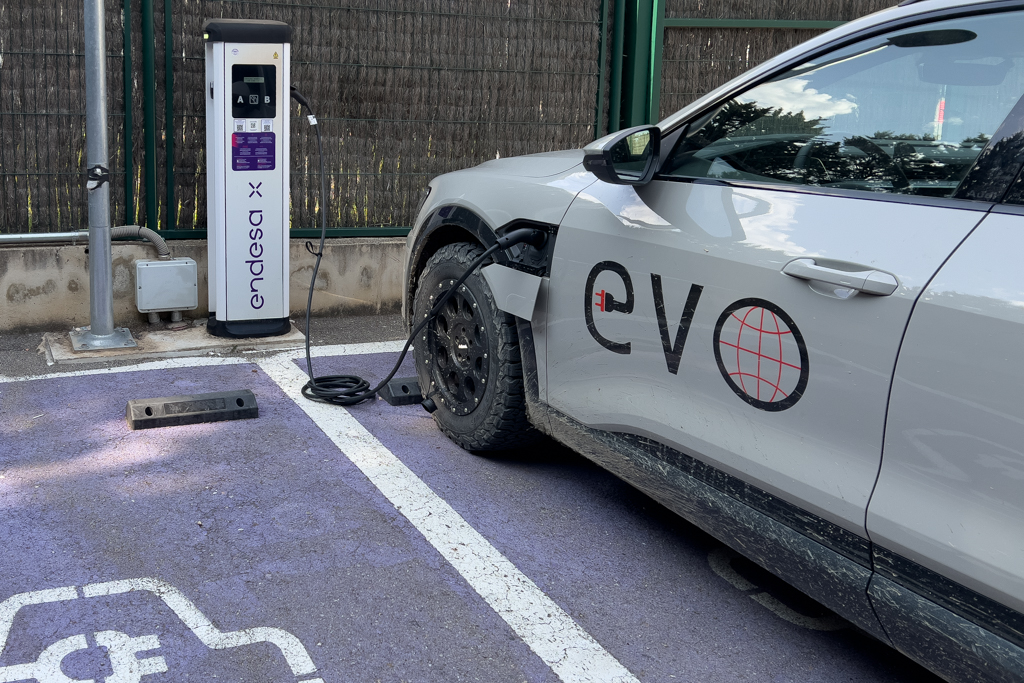
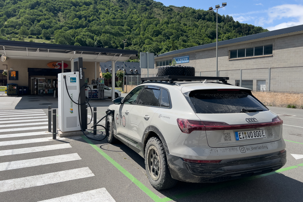
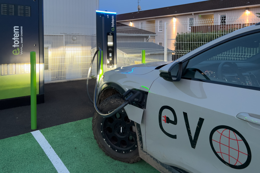
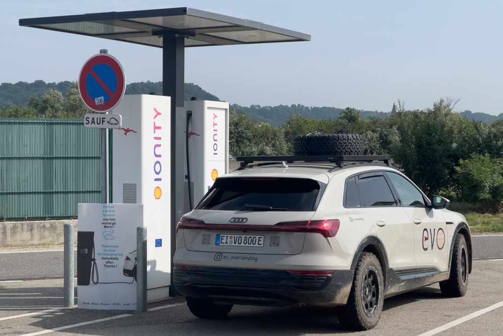
Charging was never a serious problem on this trip. In some of the more remote areas, DC fast charging was not always available. Then you have to rely on type 2 AC charging instead. Luckily, most AC chargers are 22kW in Spain. Since my Audi is able to charge with 22kW, it is fully charged in less than 4 hours, even on AC. In the meantime, you can explore a village or have lunch or dinner. So even if there are no fast chargers in some areas, it’s not a big deal in my opinion.
Another option is to charge at a campground overnight. Most campgrounds in the Pyrenees are limited to 10A, and you have to pay an additional fee of 6-7€ for electricity. I always asked if it’s ok to charge an electric car on their wall plugs. It was never rejected. But at some places, I got the request to limit the maximum power to 8A instead of 10A. With the Juice Booster, it’s very easy to set a maximum power limit.
I would strongly recommend always asking before you charge an EV at a campground and following their requests. Otherwise, there might be restrictions for EVs on campsites sooner or later. And I would really like to avoid this.
Altogether, the charging was not cheap on this trip. I paid 665€ total for all charges. That’s still a bit cheaper than using a combustion engine car of similar size, but not much.
The costs per kWh varied between 49 and 89 ct/kWh.
But the high cost is partially based on my decision to never compare prices and just use the charger that is on the way and activate it with my EnBW charging card. Different chargers, different times of the day, and different activation methods could have saved me some money. But it was a conscious decision. I preferred to use my limited time during the trip for other, more important things and not to save maybe 100€ by spending hours finding the cheapest charging solution.
Nearly all chargers could be activated with the EnBW card. Twice, I had to install a specific local app because the EnBW card was not accepted. And once, I used the Shell charging app on a Shell charger. Two times we were charging at Tesla chargers using the Tesla charging app. Whenever the EnBW card was not accepted by a charger, other charging cards like Shell, Aral, or Plugsurfing didn’t work as well.
The average energy consumption of my Audi Q8 e-tron during the trip was 31.8kWh/100km. But keep in mind that the vehicle had a roof rack, AT tires, and we were often driving on mountain tracks.
Another minor problem was that in reality, there are far more chargers than shown in the common apps. Even PlugShare, which is normally the best source in remote places, didn’t show all chargers. Therefore, in addition to using apps like PlugShare, it makes sense to always keep your eyes open or sometimes ask the local people. The biggest deviation between what apps show and reality was in Andorra.
But if you follow the above tips, doing a Transpirenaica with an EV is no real challenge and can be highly recommended. The landscape is spectacular, the people are very friendly, the offroad tracks are fun, and it’s far less crowded than the Western Alps.
I also recorded many hours of video footage during the trip. The processing of all this material will likely take until the end of the year. Stay tuned for the upcoming Transpirenaica video!

Awesome Trip, thanks for sharing!
Greetings from Eichstätt