
In the Western Alps exists a vast network of spectacular high altitude roads. Most of them are former military roads built to defend the border between France and Italy in World War I and II.
Some of the most famous roads are the Strada dell’Assietta, the roads to the Col de Sommeiller and Monte Jafferau, the Col de Tende pass, and the Alta Via del Sale.
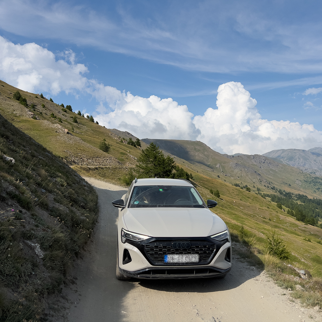
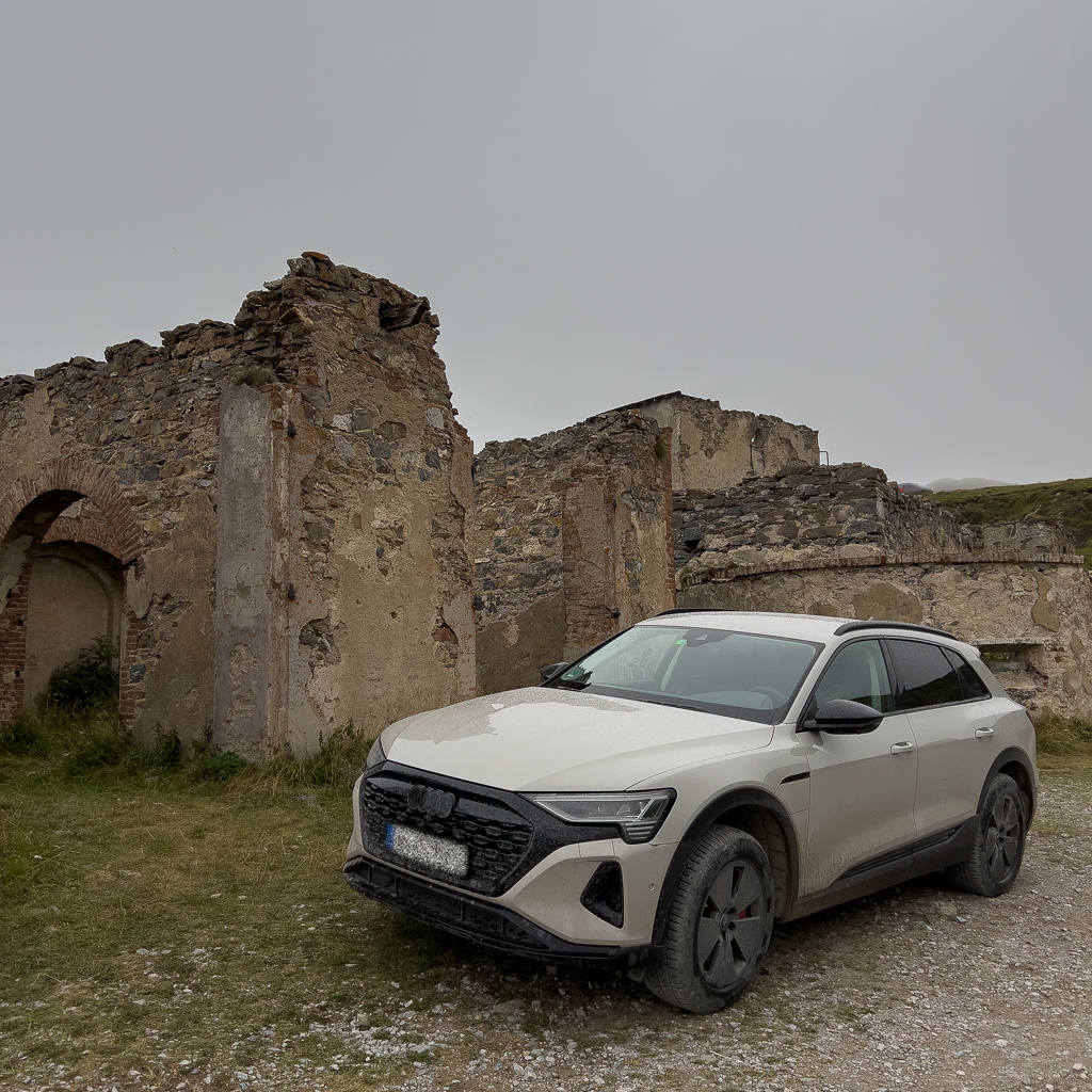
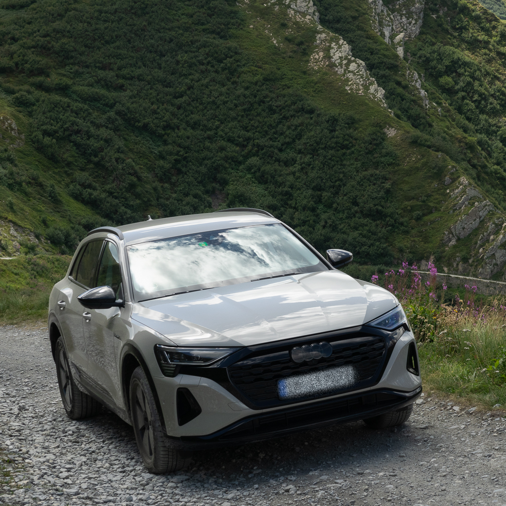
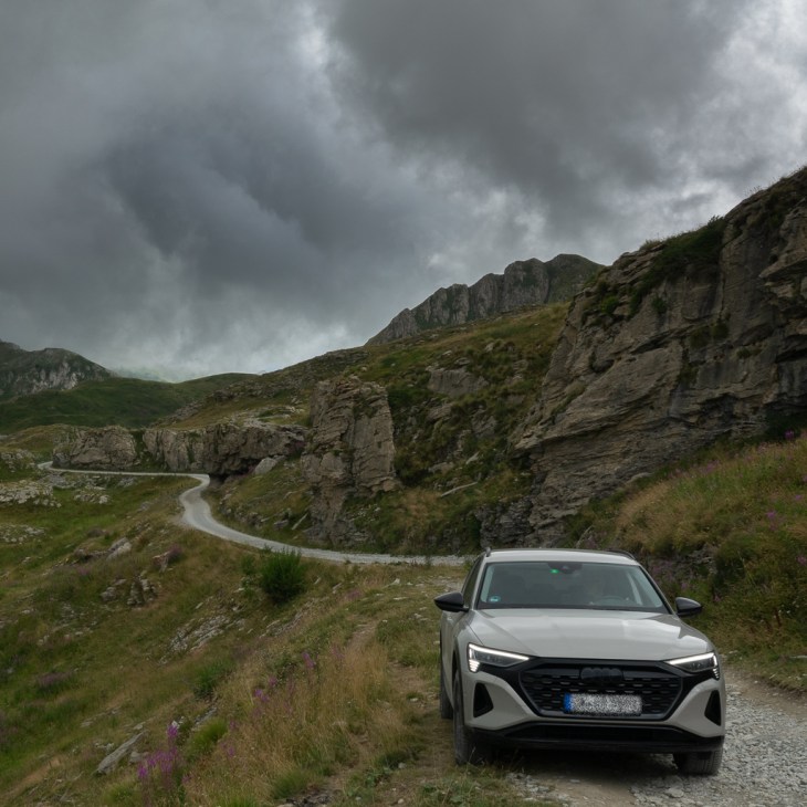
I’ve driven all these roads already a couple of times in the past with a VW Touareg. But this time I wanted to find out if an Audi Q8 e-tron EV is up to the task.
The journey from Germany to Susa, our first base camp in the Western Alps, was uneventful. There were enough fast chargers along the road, both in Switzerland and Italy.
Strada dell’Assietta
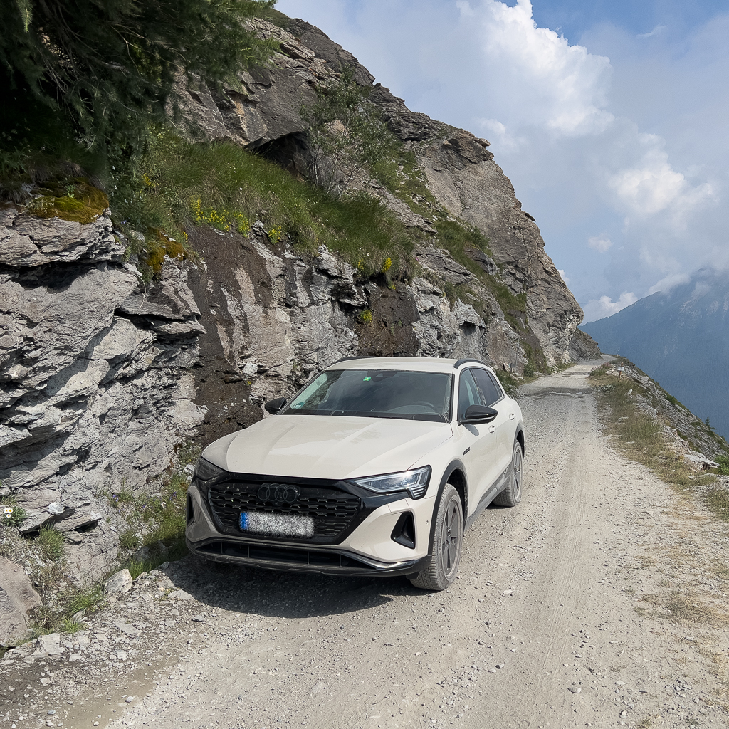
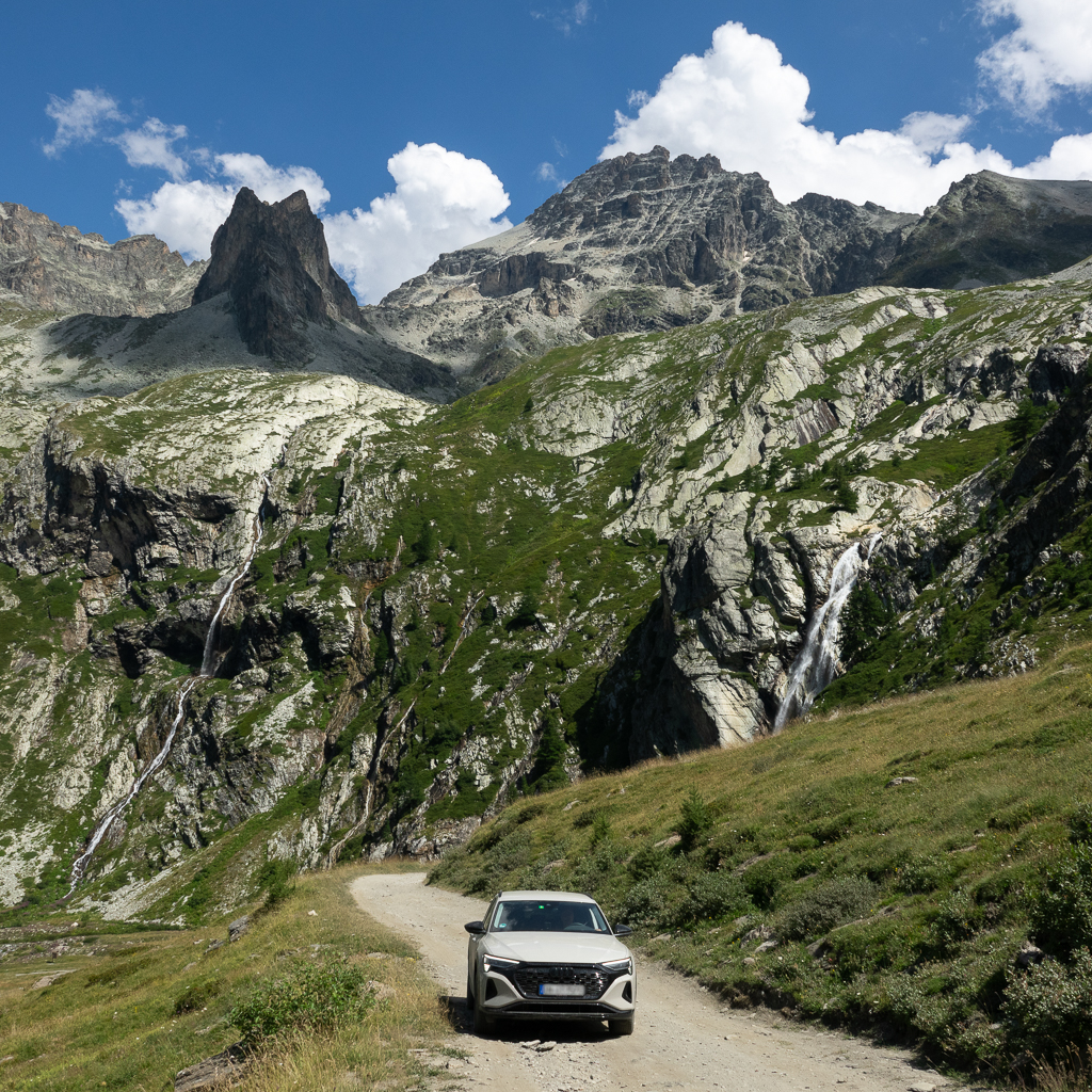
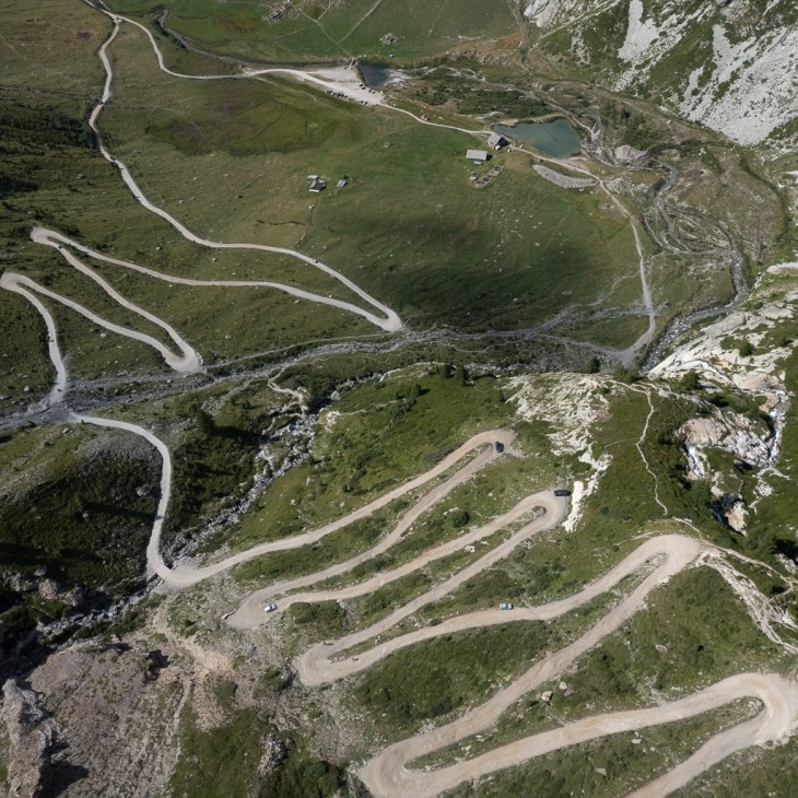
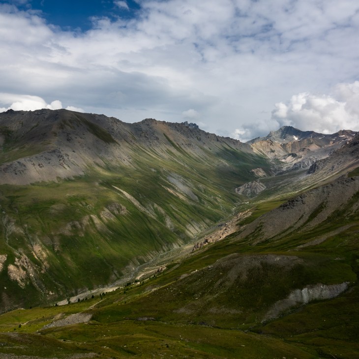
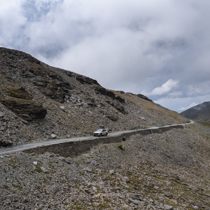
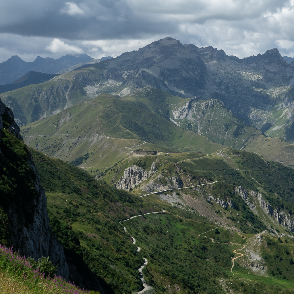
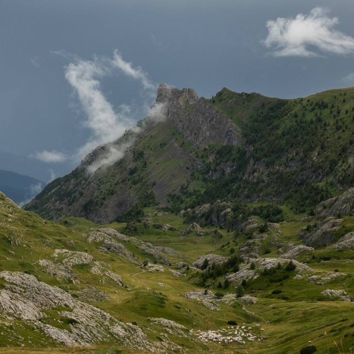
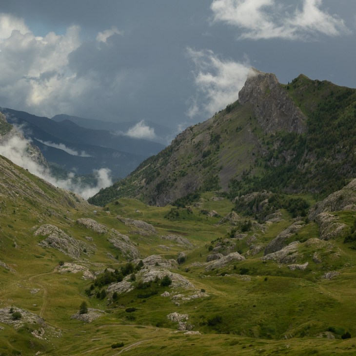
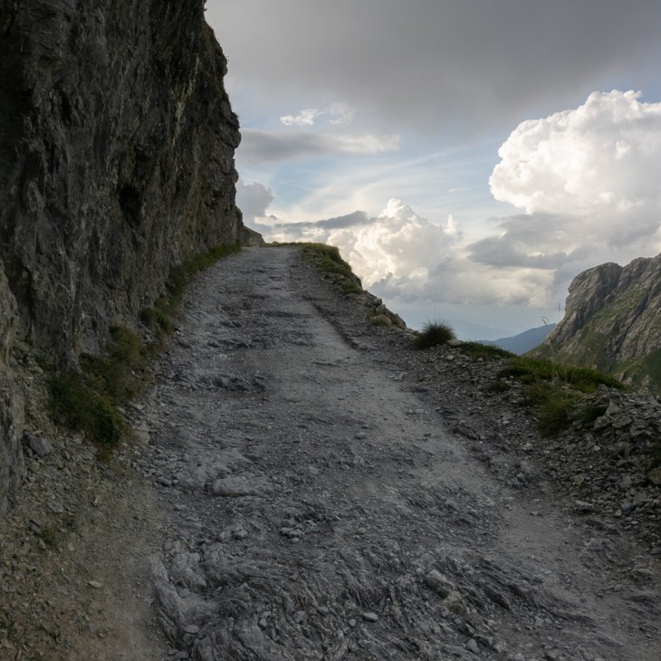
On our first day in the Western Alps, we wanted to explore the Strada dell’Assietta. It’s a beautiful but easy-to-drive road. The length of the Assietta is 48 km. Large parts of it are still gravel, but in good condition with no real challenges for any SUV. The whole trip from Susa, along the Assietta and back to Susa has a length of 103 km and takes about half a day.

The Strada dell’Assietta links the Susa and Chisone valleys and is located at an altitude between 1970m and 2536m.
The first parts of the Assietta road were already built around 1700 and were of high importance during the War of the Austrian Succession in the combat between France, Spain, and Austria. Later, in 1890, the road was extended by the Italian military commands to allow a rapid movement of troops.
If you want to drive the Assietta it is important to know that it is closed for motorized vehicles on Wednesdays and Saturdays.

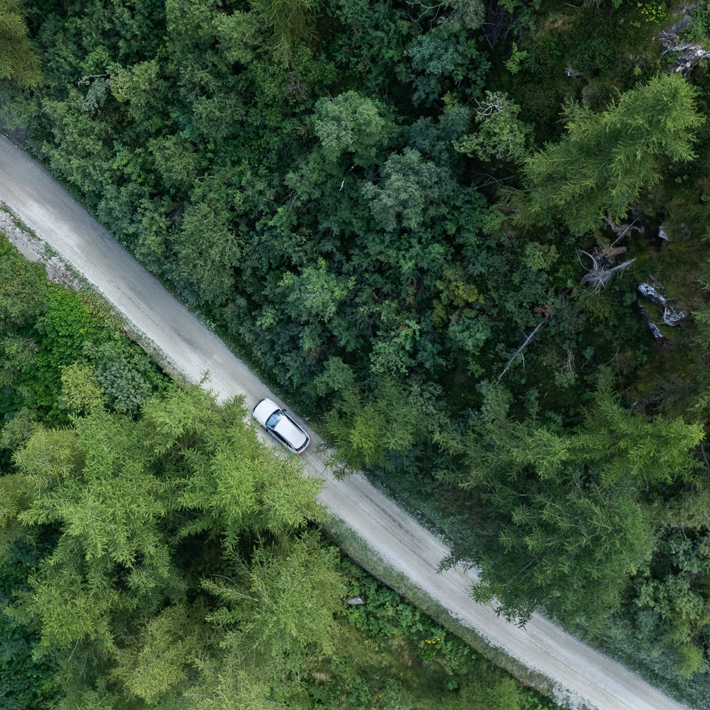
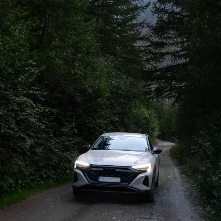
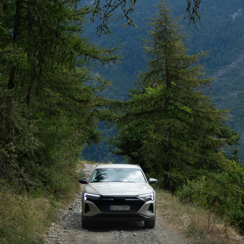
The beginning of the Assietta leads through a beautiful forest.


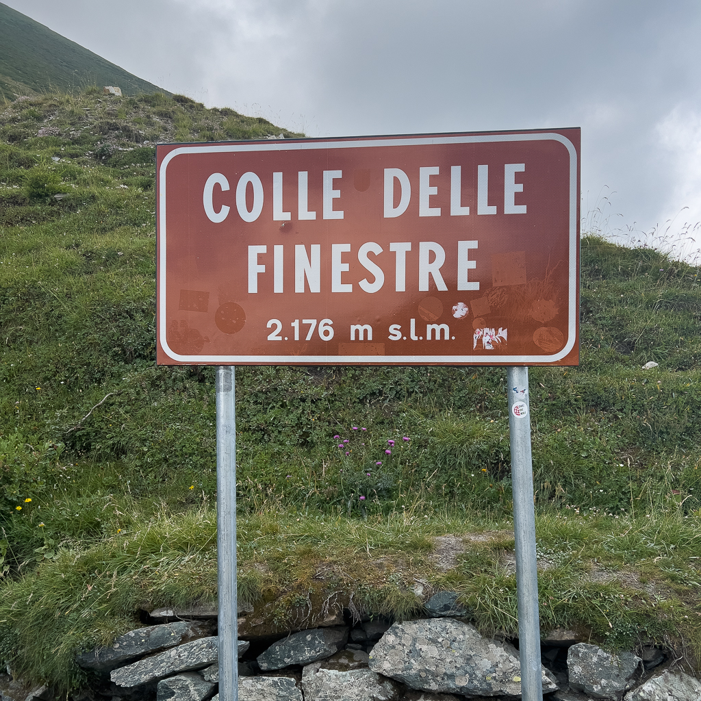
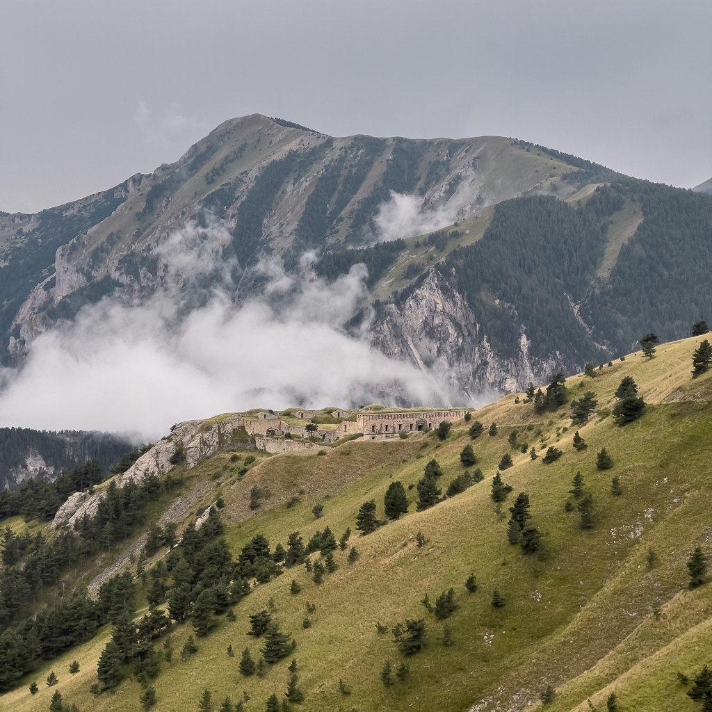
A bit later we reached the hairpin curves leading up to the first pass on the Assietta, the Colle delle Finestre.


The Colle delle Finestre pass has an altitude of 2176m.
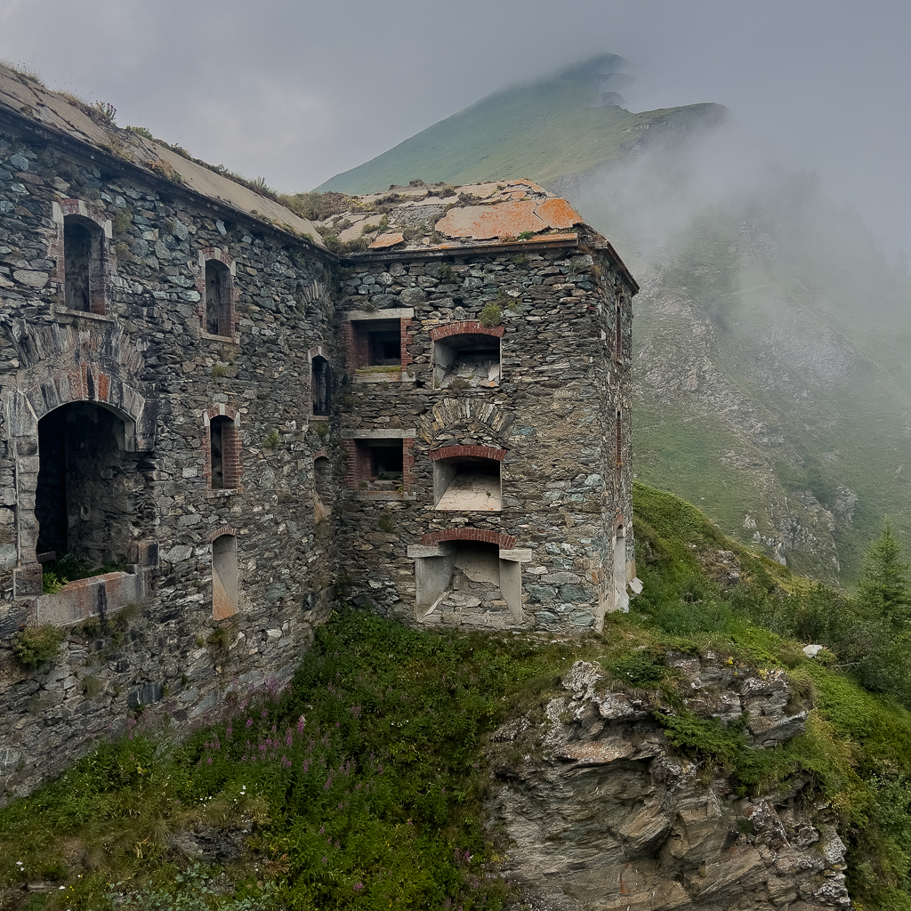
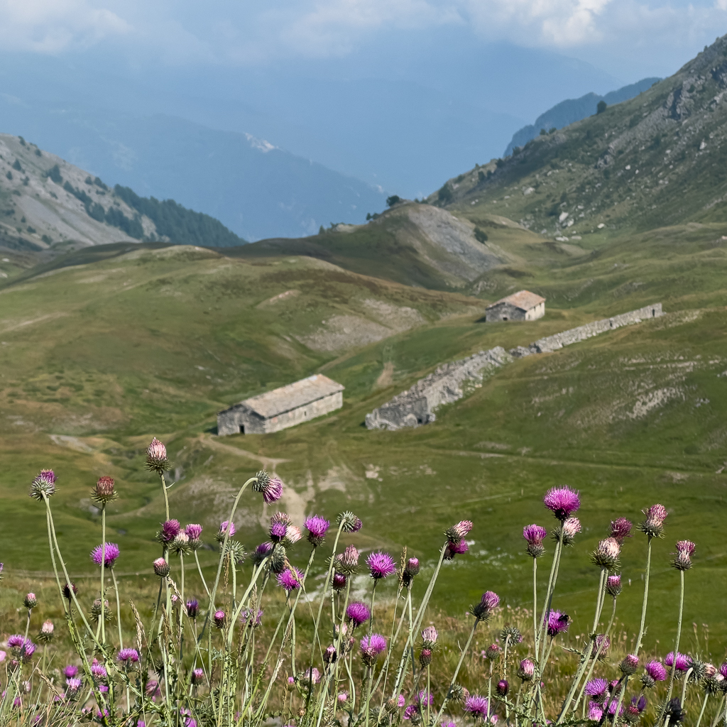
Close to the pass, you can find the Forte delle Fineste. It was built in 1861 and used in WWI to secure the pass and its surroundings. Sadly, all entrances into the fort are now blocked. It’s still worth visiting the accessible areas.

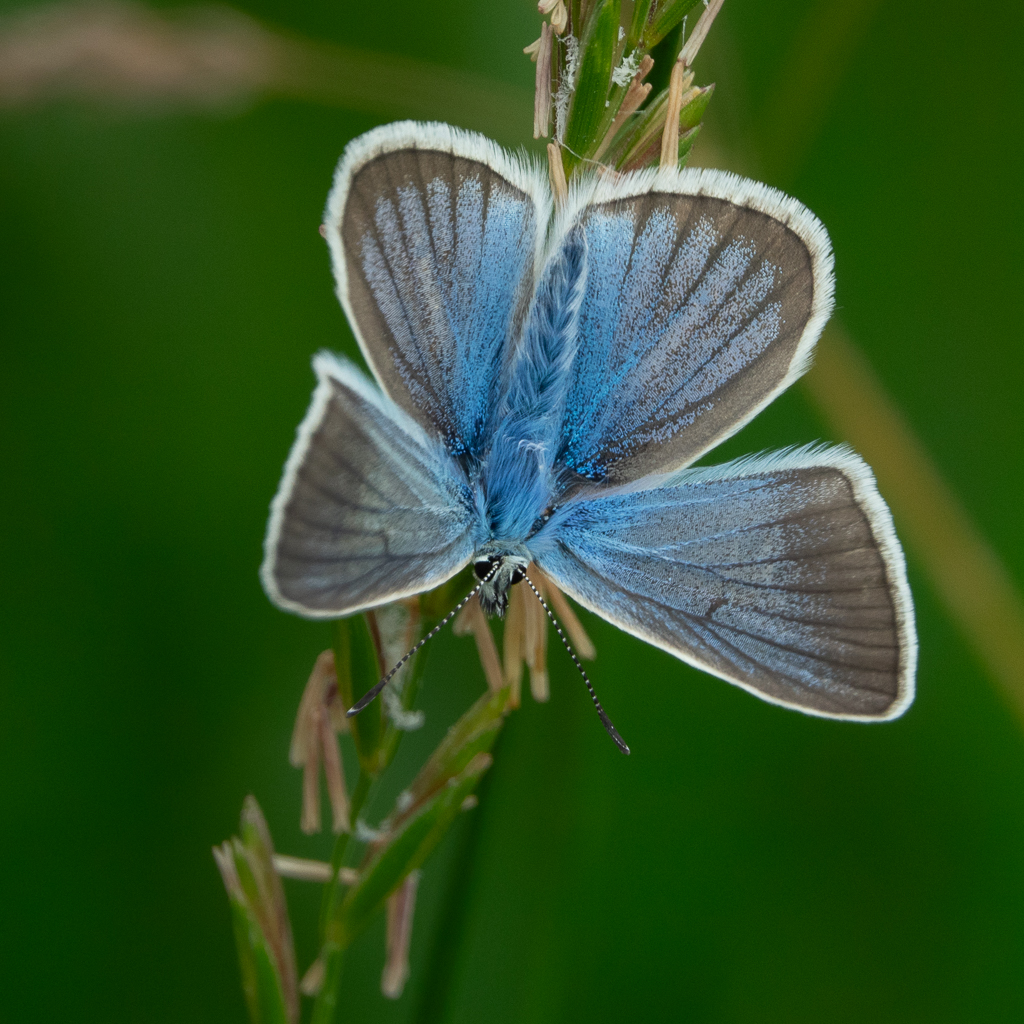
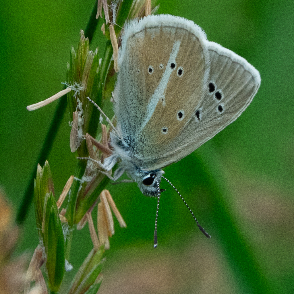
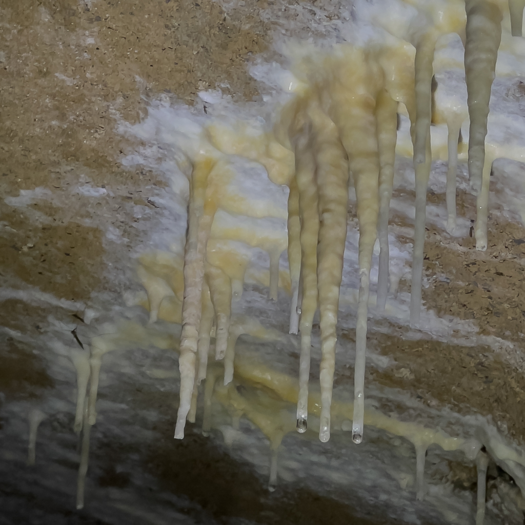
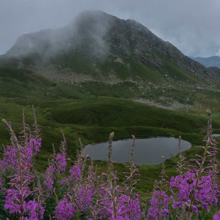
Besides some interesting historic buildings, you can also find beautiful Alpine vegetation along the Assietta. It is therefore highly recommended to stop often and explore the surroundings on short walks, including all the little details on the ground.


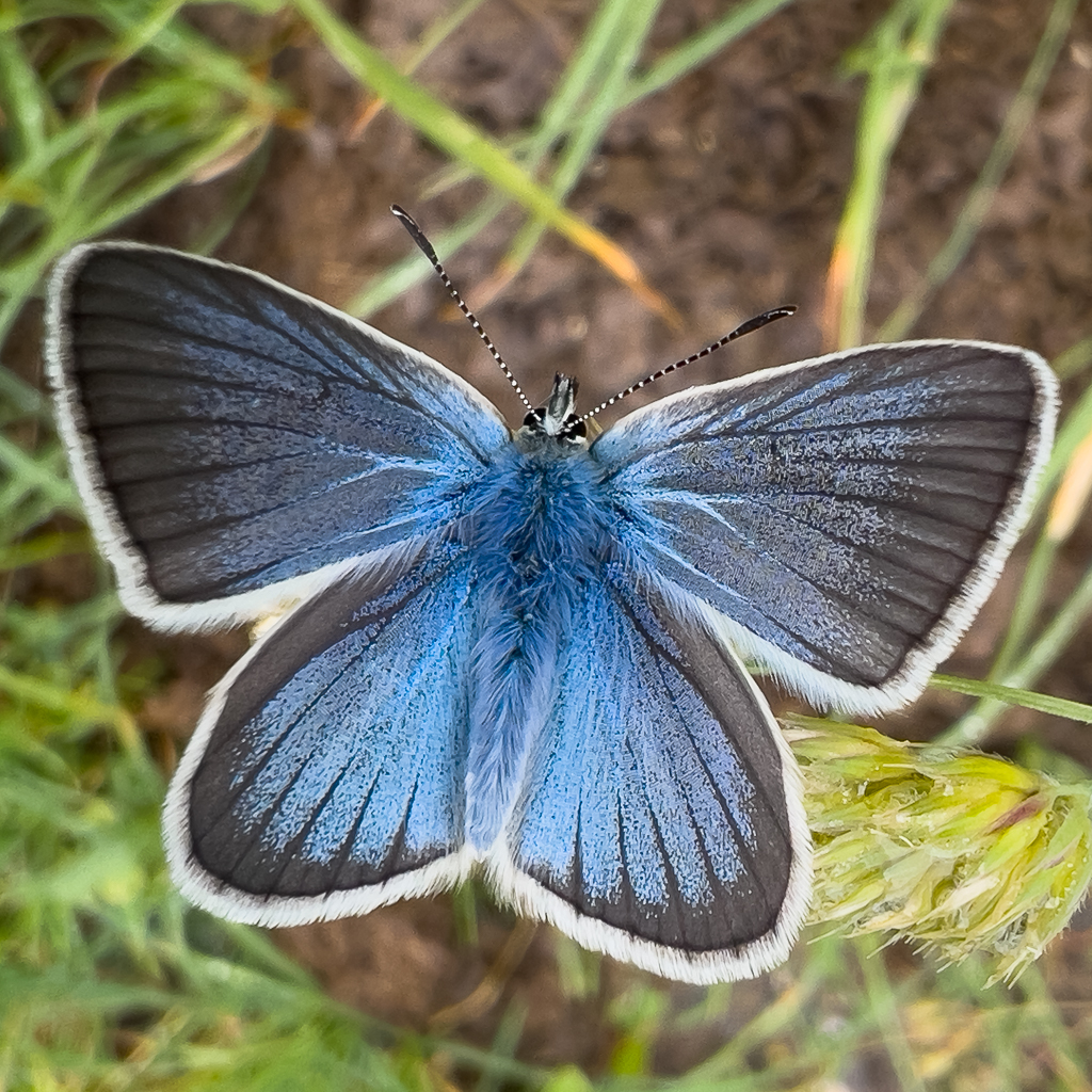
On the flowers, you can often find stunning butterflies.

After a short break at the pass, we continued along the Assietta road.


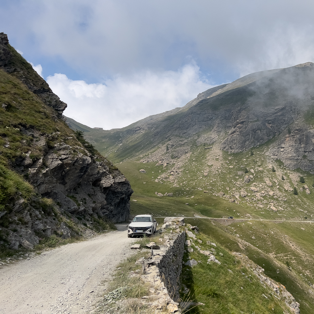
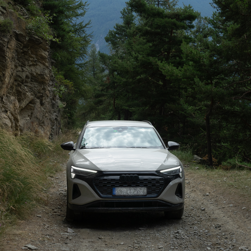
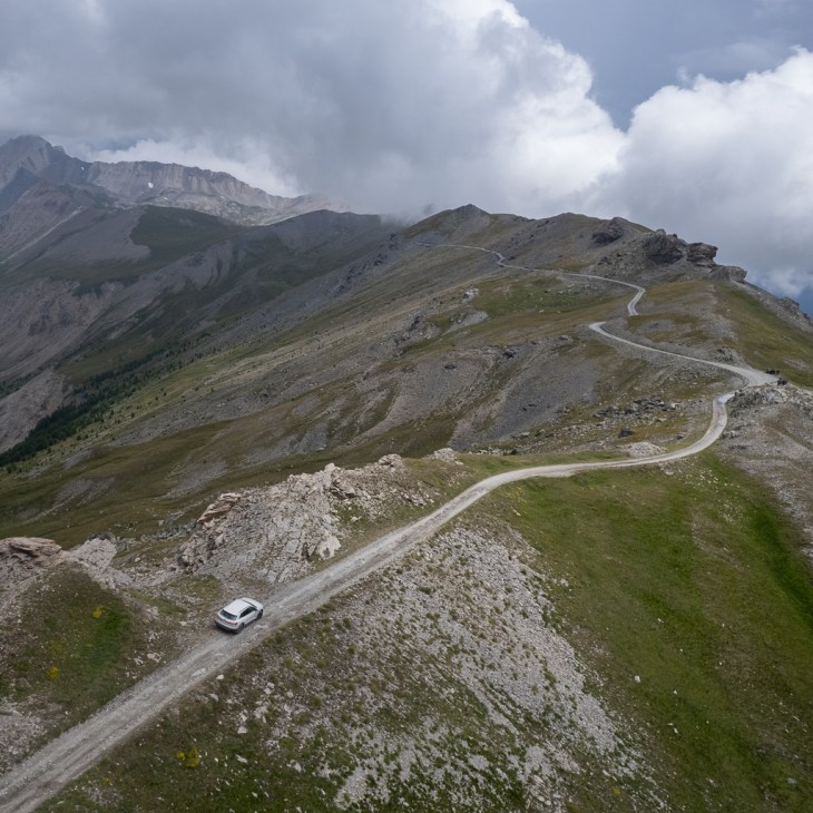
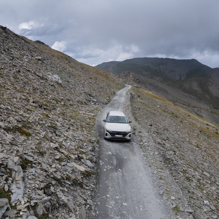
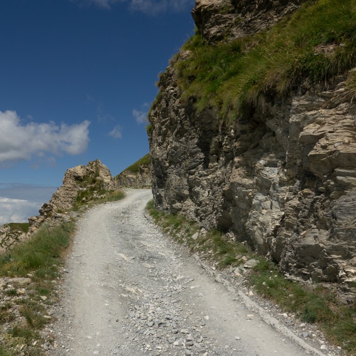
This section is now all gravel and some parts are quite narrow and would require backup driving in case of oncoming cars. Luckily there are more motorcycles than cars on the Assietta which can often pass even on the narrow sections.
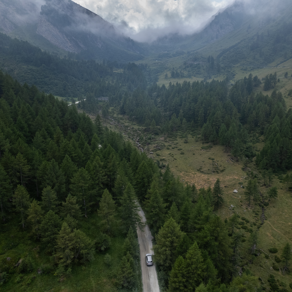
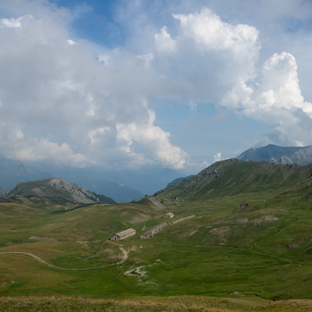
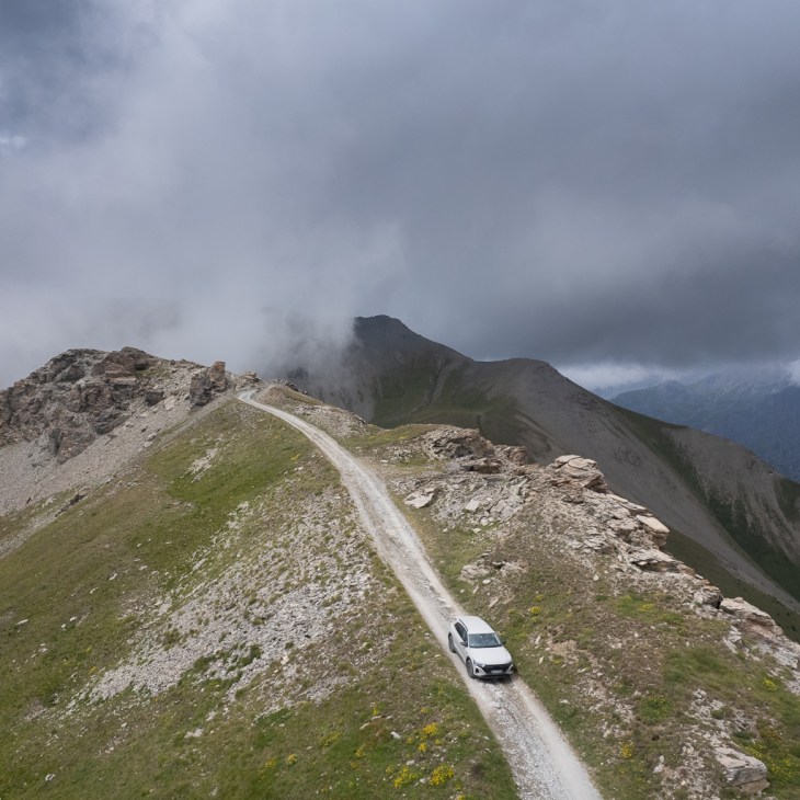
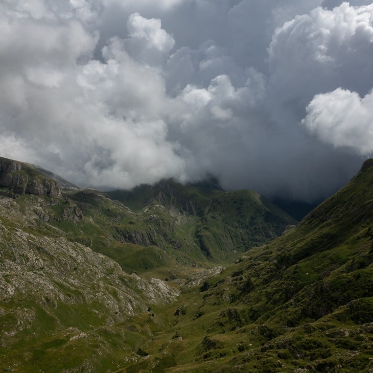
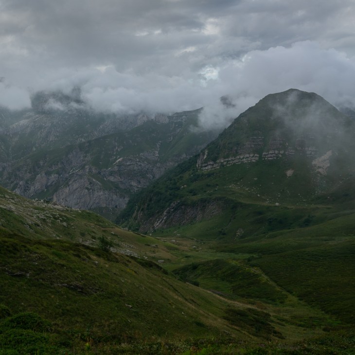
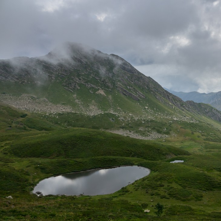
During the whole time, the Alpine landscape was really stunning.

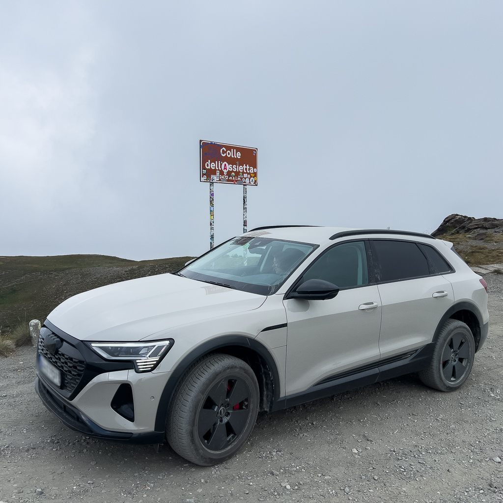
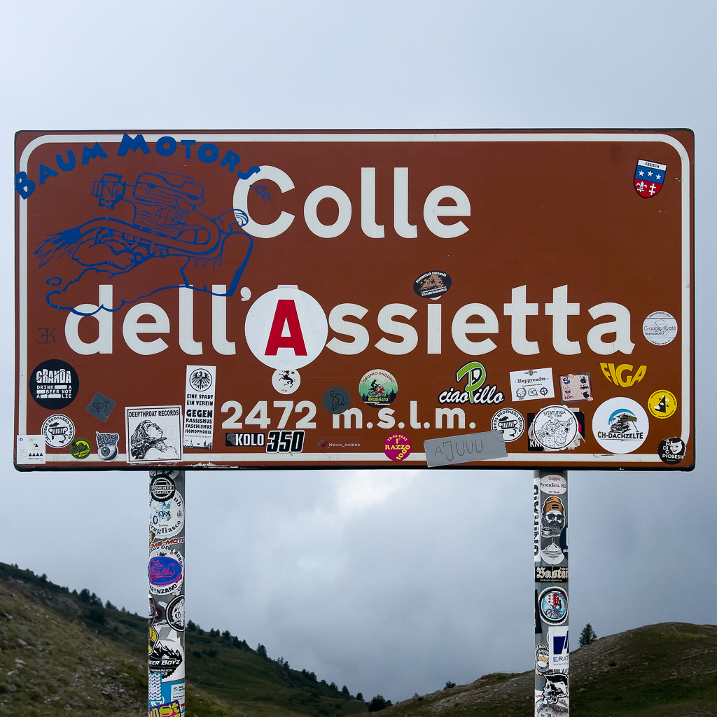
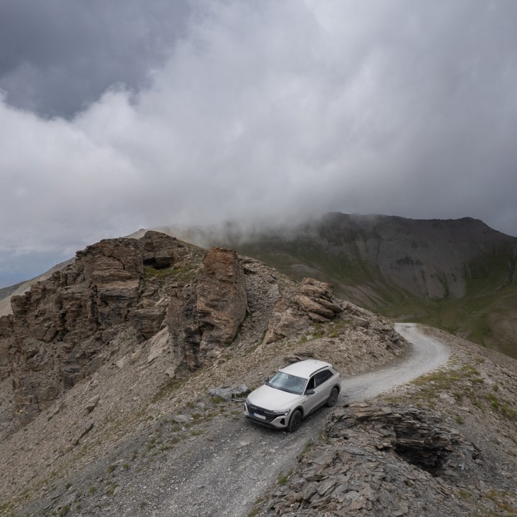
Soon, we reached the next pass, the Colle dell’Assietta at an altitude of 2472m.
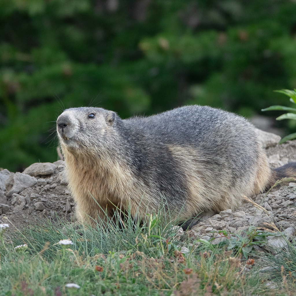
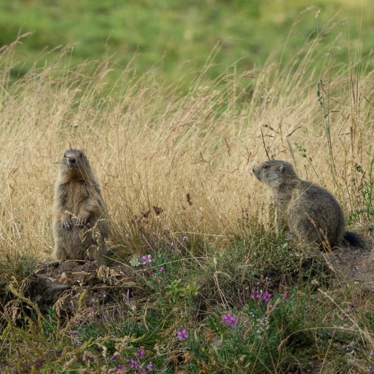
In addition to the beautiful vegetation, you can often spot marmots along the Assietta.


About half a day later we were finally back in Susa. Driving the Assietta is easy and the landscape is stunning. Therefore it should not be missed if you are in the Western Alps.
Col de Sommeiller
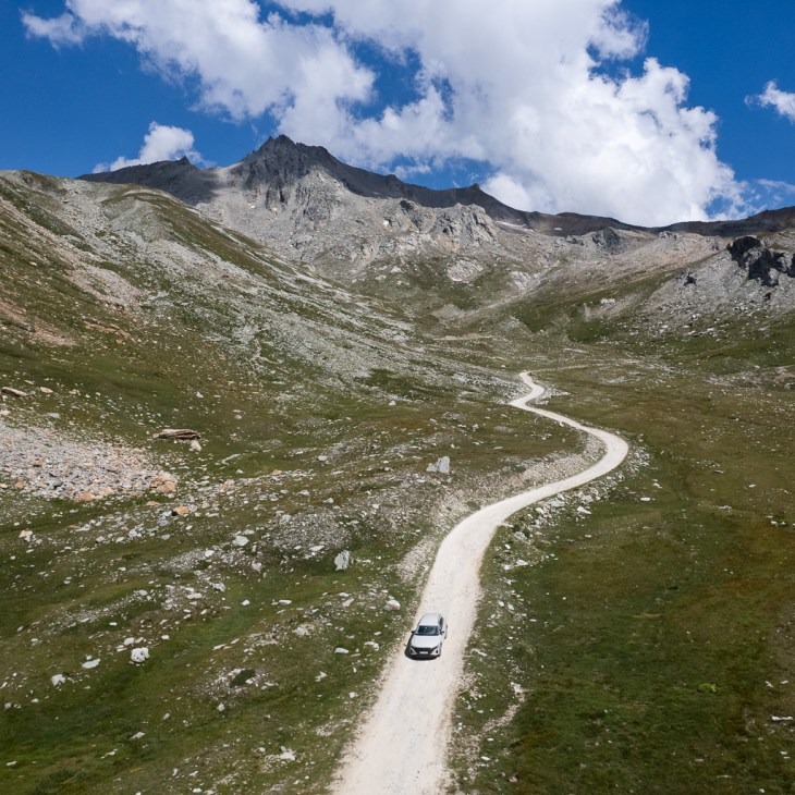
Our next destination was the road to the Col de Sommeiller. The main track to the top has a length of 40km (all gravel) and the whole loop Susa – Col de Sommeiller – Susa is 109km long.
The track is closed on Thursday for motorized vehicles.
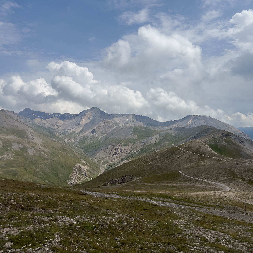
The Col de Sommeiller is located directly at the border between Italy and France. It is one of the highest mountain roads in Europe. The roads end at an altitude of 2,993m. The peak of the Sommeiller mountain has an altitude of 3333m but can only be reached by foot.
The road to Sommeiller is no former military road. It was built to access a ski area (which doesn’t exist anymore).
To enter the road you have to pay a fee of 10€ per vehicle.

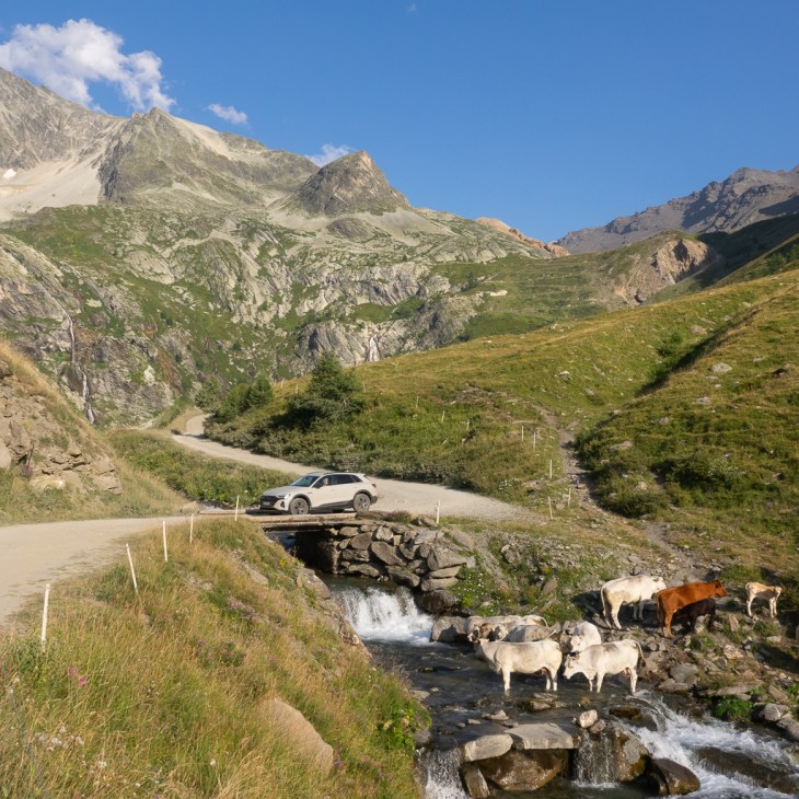
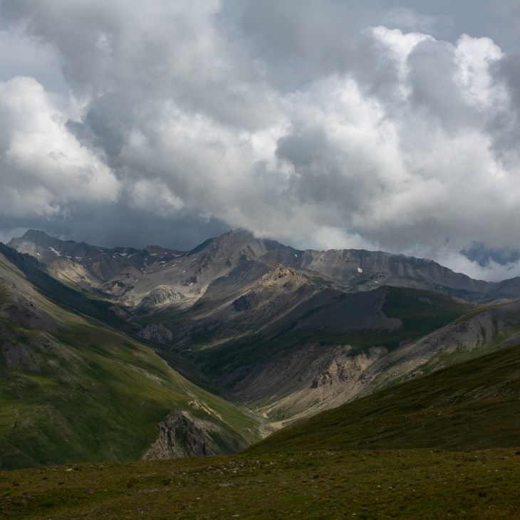
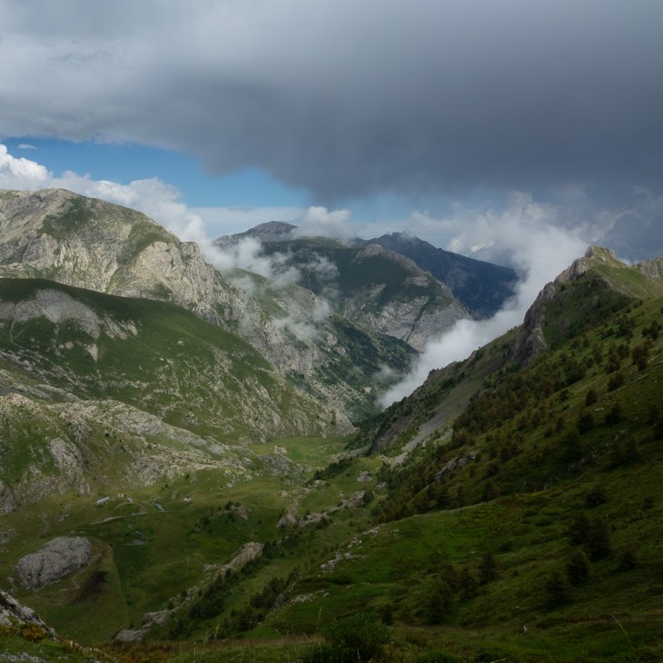
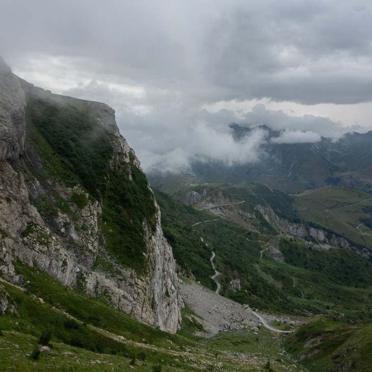
This road leads again through a spectacular alpine landscape. Even some beautiful high waterfalls can be seen next to the road.
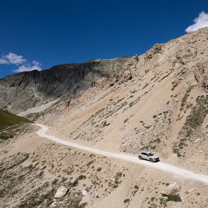
Although the track is a bit rougher than the Assietta, the first part can be driven with any SUV or vehicle with enough ground clearance.


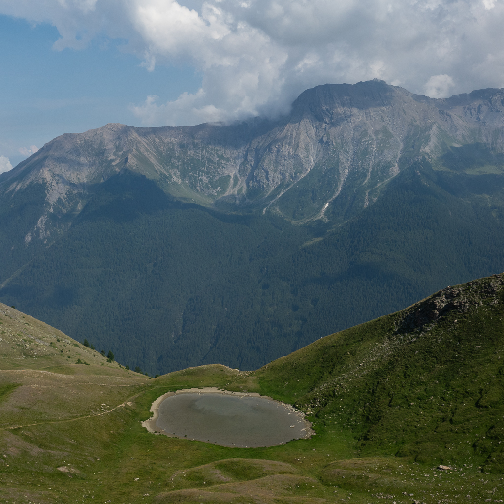
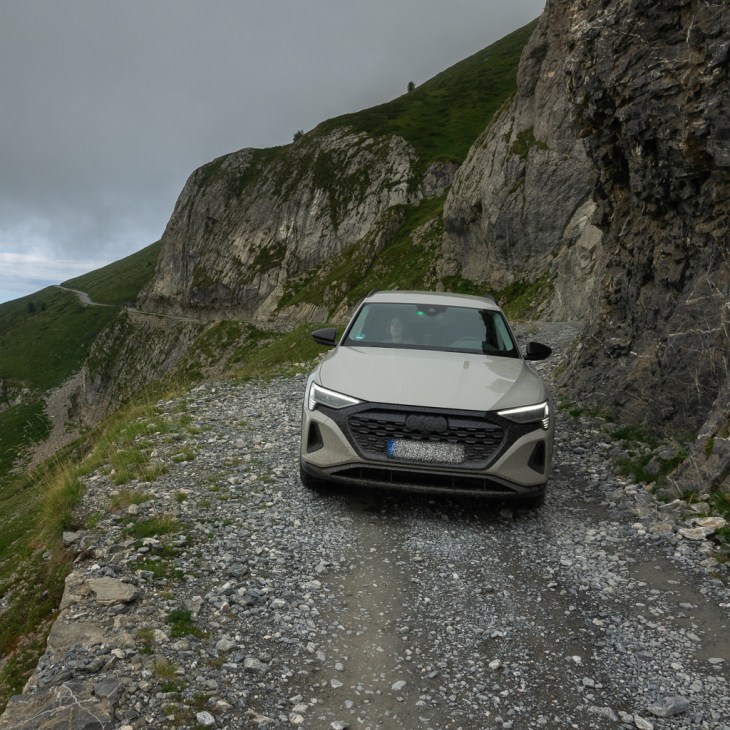
The last few hundred meters before the end of the road are extremely rough and should only be driven with serious offroad vehicles like a Rivian or Mercedes G. Since we didn’t want to damage our car we decided to turn around and not try the last section.


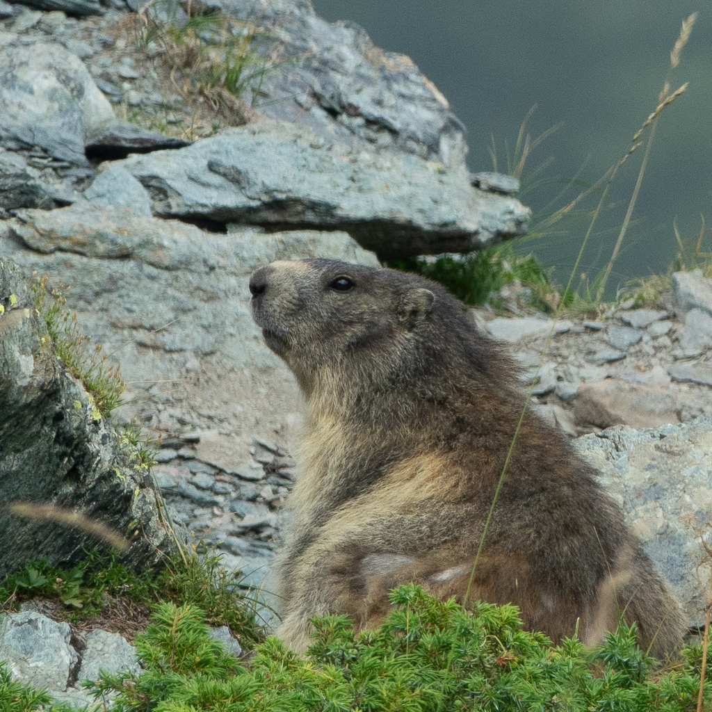
The Rifugio Scarfiotti (about 11 km from the end of the road) is a great place for a break. There you can find a small lake, little streams, and lots of cute marmots.


After a long break at the Refugio, the sunset was approaching quickly and we decided to drive back to Susa.

Monte Jafferau
The next day, we wanted to explore the Monte Jafferau. The main track starts and ends in Bardonecchia and has a length of 43km (36 km of it is gravel). The whole distance Susa – Forte Jafferau – Susa is about 75km.
This high altitude road was built in the late 19th century and connects three important forts in this area: Foens, Jafferau, and Pramand.
With motorized vehicles, you can enter this road only on Wednesdays or Saturdays and only between the 1st of June and the end of September.


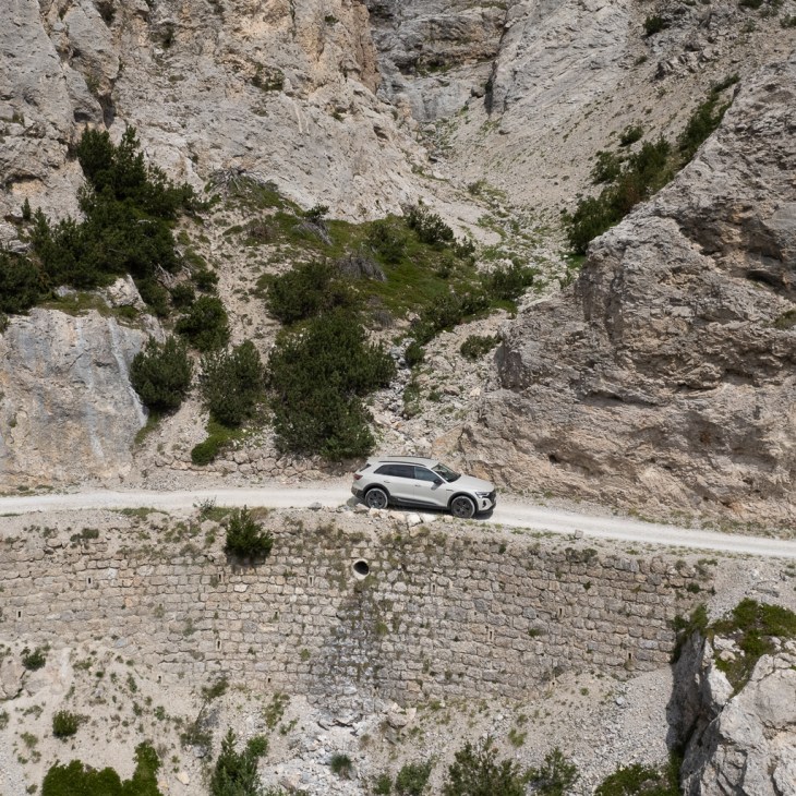
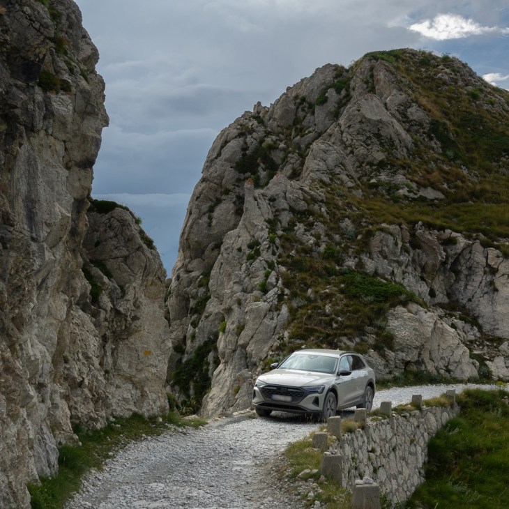
The most spectacular passage of the Jafferau track is the Saracen tunnel. It’s a 900m long, extremely narrow, and completely dark single-lane tunnel. On some sections of the tunnel, the ground is completely covered by water. In addition, the tunnel is curved. If you meet oncoming vehicles in the Tunnel you have to drive backwards for a couple of 100m under these challenging conditions. This makes it altogether a slightly nerve-wracking but fun experience.


Shortly after the exit of the tunnel, you can find the ruins of the Forte al Seguret on the left side. It’s often used by offroaders/overlanders as an overnight camp.


After a short break at the fort, we continued on the road to Monte Jafferau. This section leads through a beautiful wild high altitude Alpine landscape.

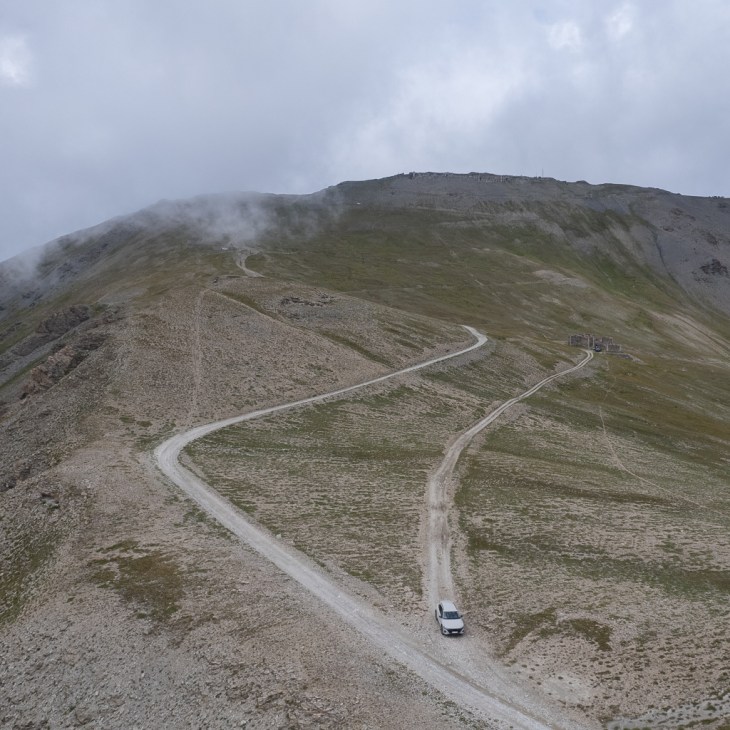
The last section of the road just before reaching the Jaffery Battery at the summit of the Jafferau crest is a bit rougher than the other parts of the track. You definitely need high ground clearance for this section. We would have probably managed to get through using the lift level of the air suspension of our car. But to be on the safe side we decided to turn around a few meters before the end of the road.

The Jafferau Battery is located at an altitude of 2800m. It’s the highest fortification in this region.

On the way back we did lots of drone shots to get a better impression of the vastness of this landscape.


Oncoming traffic is always a challenge on these narrow high altitude roads. In this case, I had to drive nearly 1km backward to reach a suitable place to let the other car pass.

On the way back to Susa we had to cross the Saracen tunnel again.

Luckily, without meeting any other cars in the tunnel.


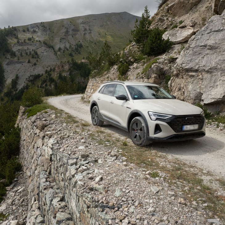

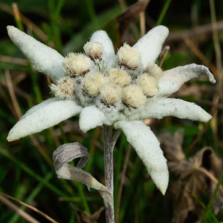
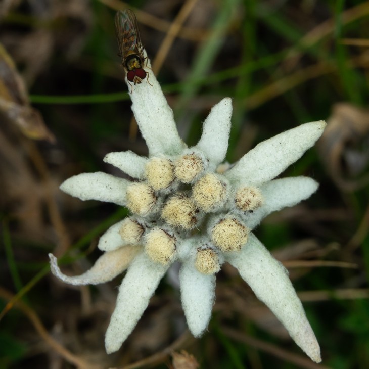
The landscape along this road is absolutely stunning. It’s also a great place to find the rare and protected Edelweiss.

Altogether this road should not be missed if you are in the Western Alps. But you need a car with slightly higher ground clearance. Personally, I wouldn’t drive it with a Tesla Model Y or VW ID.4 for example. It could work, but there would be a slight risk of damaging the car.
Col de Tende
Next, we wanted to visit the famous Col de Tende.
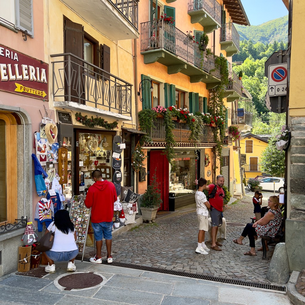
Since Susa is a bit far away we needed a new basecamp to explore the area around the Col de Tende. We chose Limone Piemonte, a cute little village with lots of nice restaurants and cafés.

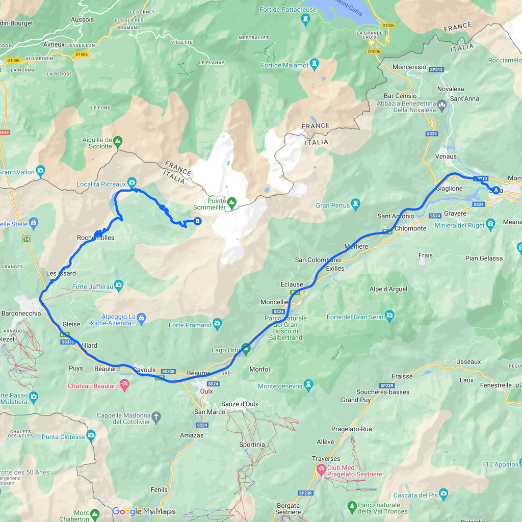
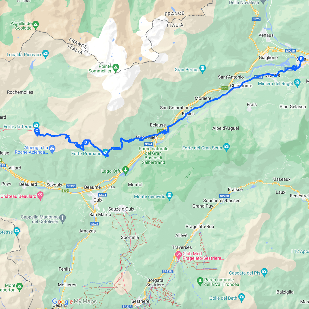
Our plan was to drive the following loop (as shown on the map below): Limone Piemonte – Col de Tende – Fort de Marguerie – Saint-Dalmas de Tende – Col de Tende – Limone Piemonte. The total length of this loop is 80km.

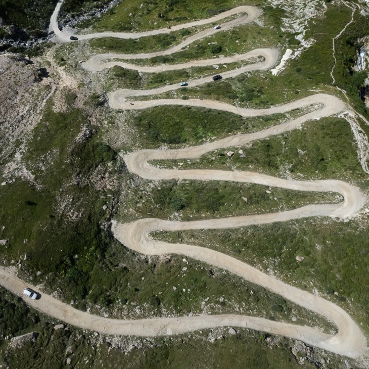
The northern ramp from Limone Piemonte to the Col de Tende has 12 bends and is now all paved.
Normally, the main connection between Limone Piemonte and Saint-Dalmas de Tende was a long tunnel (avoiding the serpentines to the Col de Tende). However, this tunnel is currently closed due to some serious flooding damage and landslides. Repair will take at least until 2025. Therefore, there is currently more traffic than usual at the Col de Tende.
Napoleon Bonaparte built the road to the Col de Tende in the 19th century to be used by coaches (before, it was just a footpath). The pass marks the border between Italy and France and is the southernmost of the large Alpine passes. It is located at an altitude of 1871m.
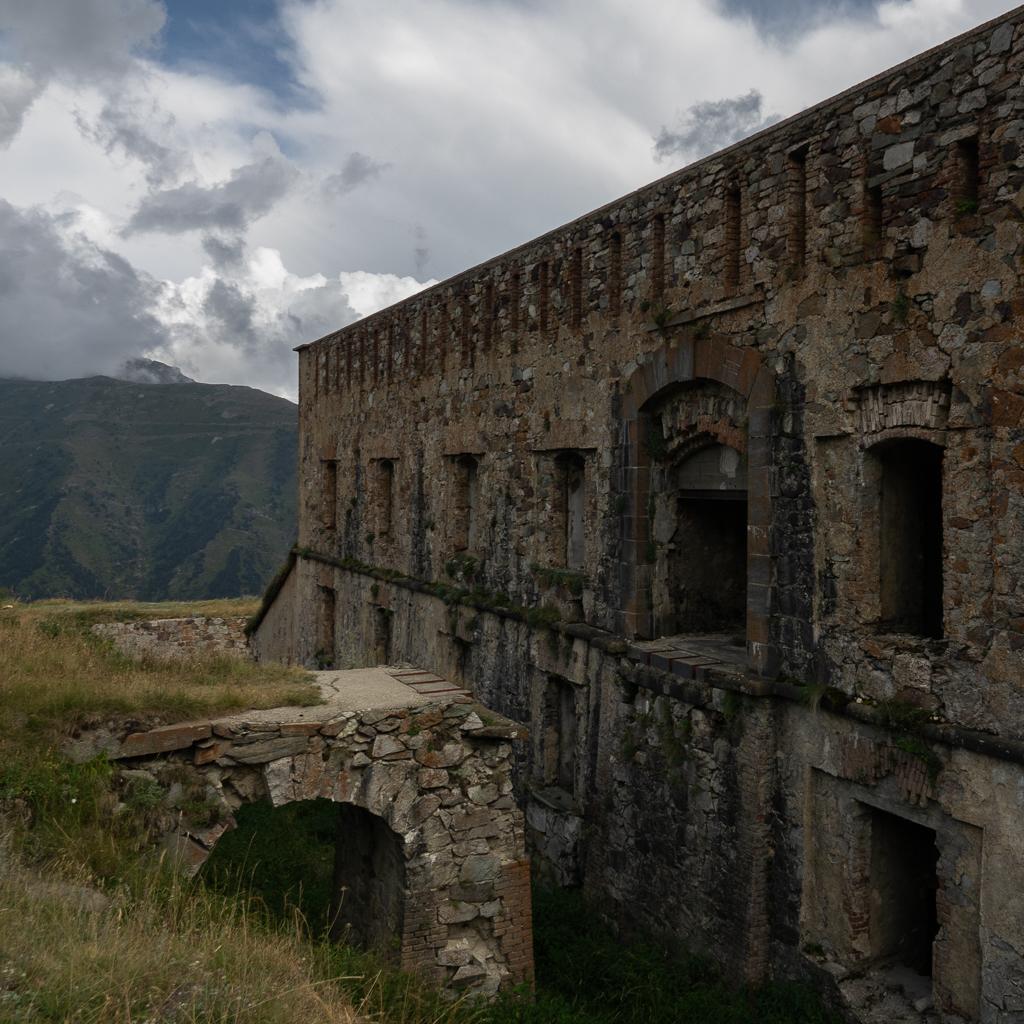
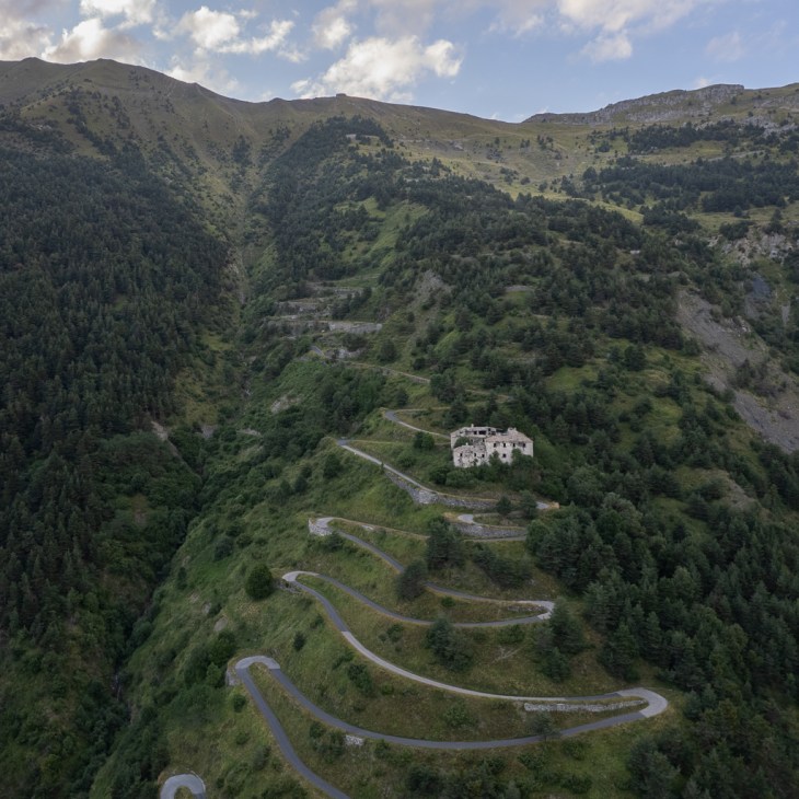
At the pass, you will find a couple of interesting historic forts: Fort Centrale, Fort de la Marguerie, Fort Tabourde, Fort Pernante, Fort de Giaure, and Fort Pepin.
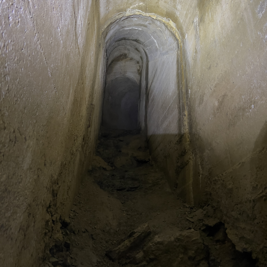
The Fort de la Margurie is located west of the pass at an altitude of 1842m. It is probably the most interesting of all the forts in this area. It’s a large building and has countless interesting underground passages. Definitely bring your flashlight if you want to explore this fort.


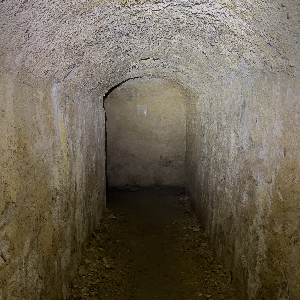

Halfway between the Col de Tende and the Fort de la Margurie you can find a small unimpressive bunker. Don’t miss it. An endless staircase leads far below the surface. From there you can take a long and very steep underground passage that leads to the other side of the mountain. A stunning experience if you love underground adventures.


After exploring the Fort de la Margurie we continued on the gravel track to the village Saint-Dalmas de Tende.


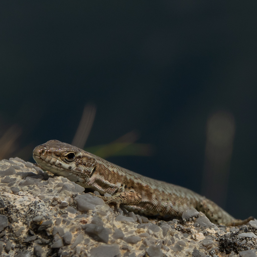
The landscape was again stunning and we saw some beautiful reptiles along the way.
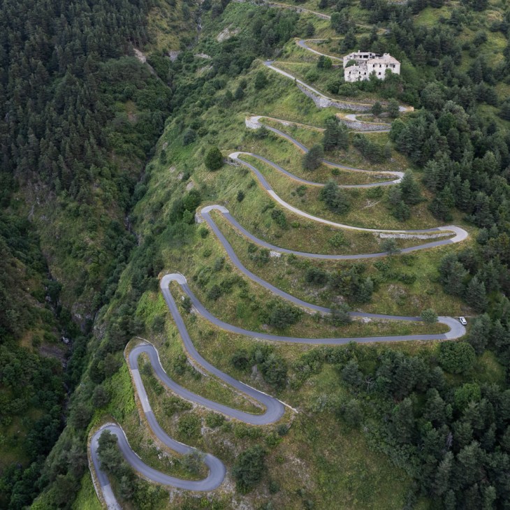
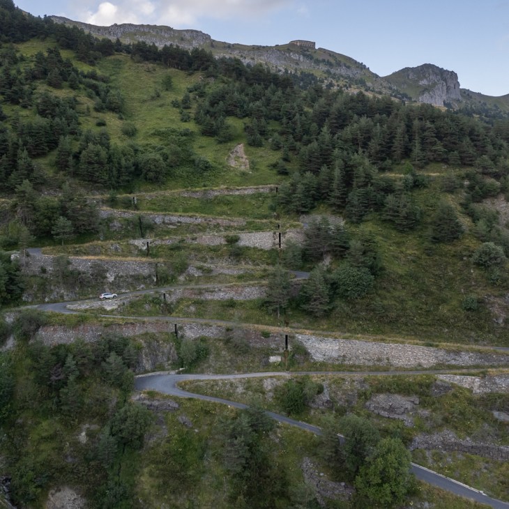
From Saint-Dalmas de Tende our plan was to take the southern ramp of the Col de Tende back to Limone Piemonte.
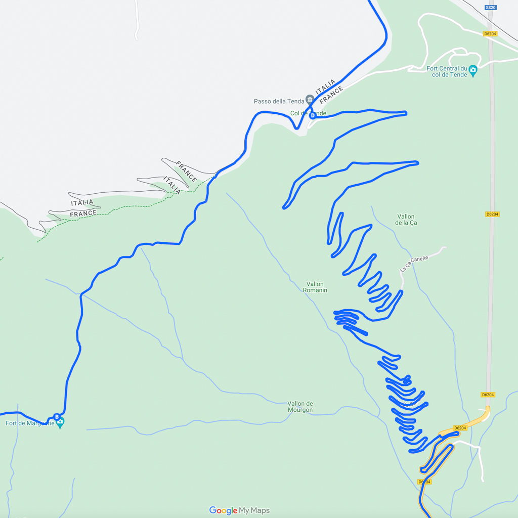
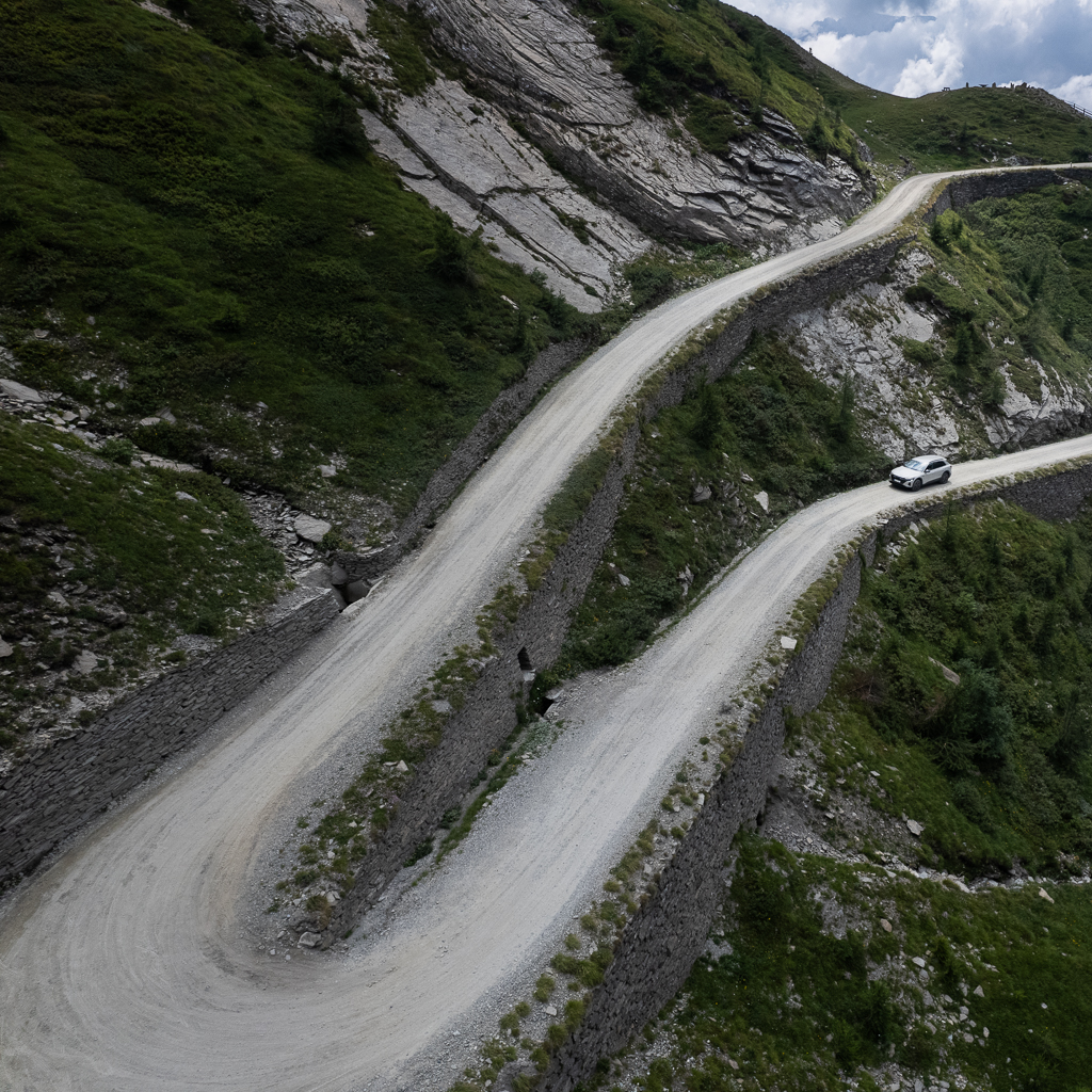
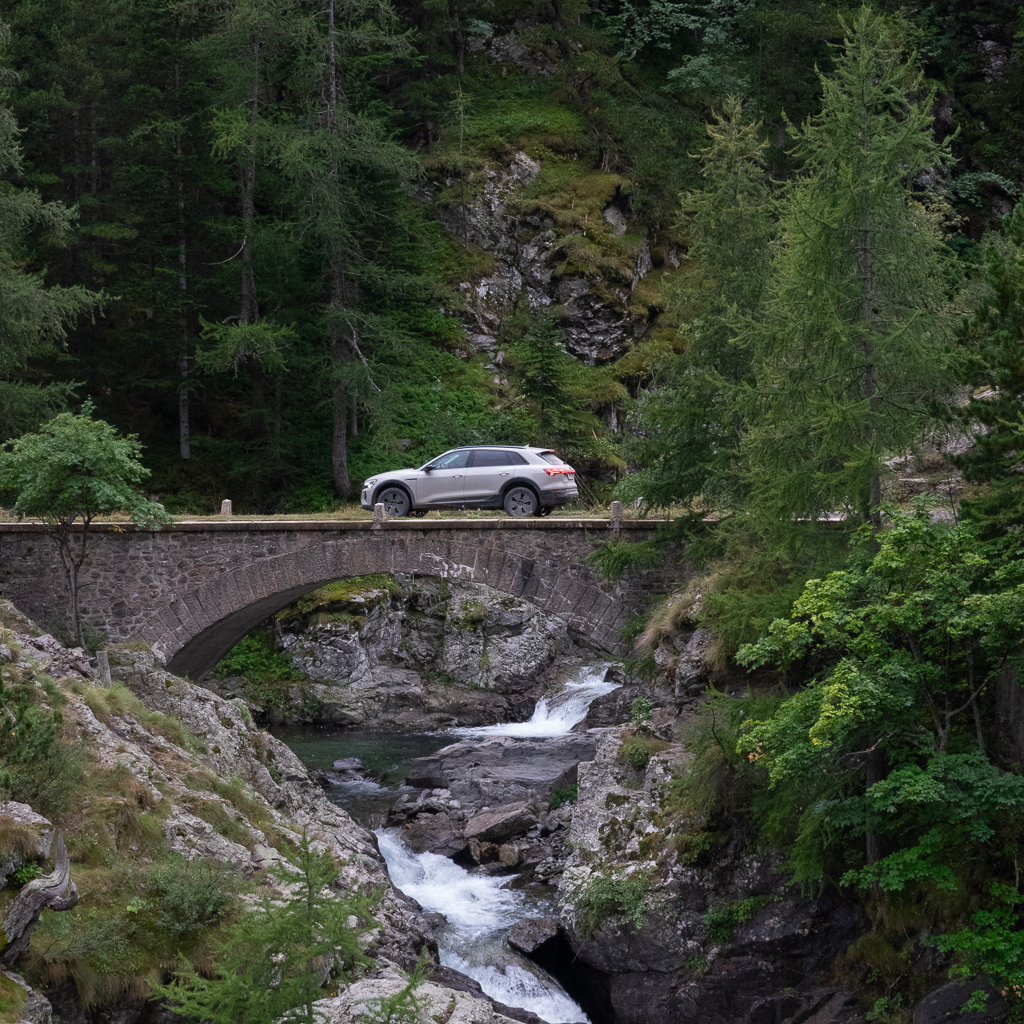
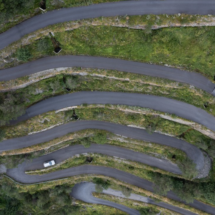
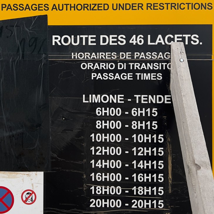
It has 46 spectacular serpentines. Some sections are still gravel but the majority of this road is now paved. It’s definitely one of the most stunning roads in the Alps.
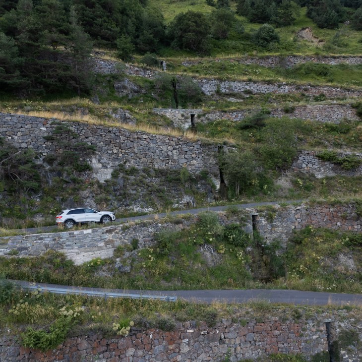


The problem with the southern ramp is that the passage is currently authorized under certain restrictions. According to the sign at the entrance and exit the restriction is mainly a time limit. You can enter this road only for 15 minutes every two hours in one direction. From Limone at even hours and from Tende at odd hours. But it seems that this is not the only restriction in effect. Because when we tried to pass the entrance for the second time we were stopped by the local police. They explained to us that this road can currently only be used by people living in this area and we should use the alternative way via Fort de Marguerie and Saint-Dalmas de Tende instead. My guess is that as soon as the tunnel is open again they will lift this restriction.
Alta Via del Sale
On our last day in the Western Alps, we had planned to drive the legendary Alta Via del Sale (Upper Salt Road). The Alta Via del Sale is also known as Route du Marguareis, Piste de l’Amitié, and Ligurische Grenzkammstraße.
It is located in the heart of the Ligurian Alps and has a length of 30km (one way). The whole length Limone Piemonte – Alta Via del Sale – Limone Piemonte is 98km.

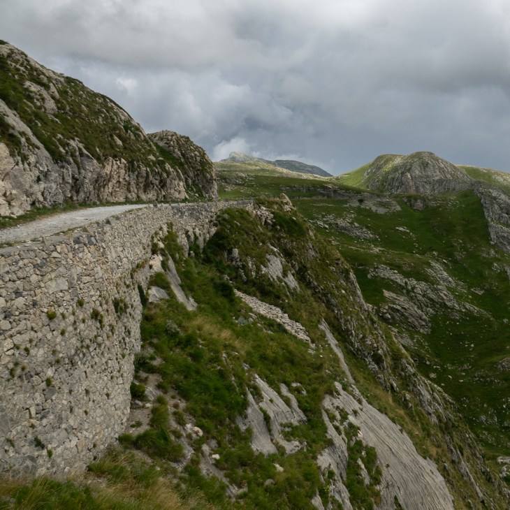
The Alta Via del Sale is a spectacular unsealed former military road. It winds along the main Alpine watershed near the border between Italy and France, at altitudes around 2000m.
It was originally built in the Middle Ages to transport salt from Ventimiglia via Limone Piemonte to Turin. This explains the name Via del Sale (salt road). Later the road was transformed into a military road to connect the numerous forts located along the border between Italy and France.
The road is limited to 47 cars and 84 motorcycles each day. Therefore it is highly recommended to book your entrance in advance on the following website:
https://www.altaviadelsale.com/eng/upper-salt-road
The entrance fee is 20€ per vehicle. The limitation of cars makes sense since this track is very popular and the road is narrow with often no chance to pass oncoming traffic. At one extremely narrow and difficult-to-see section, there is in addition now a traffic light regulation.
On Tuesdays and Thursdays, the road is closed for any motorized traffic.


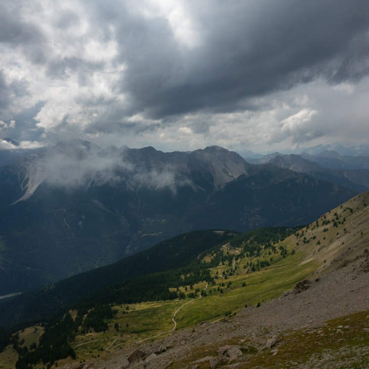
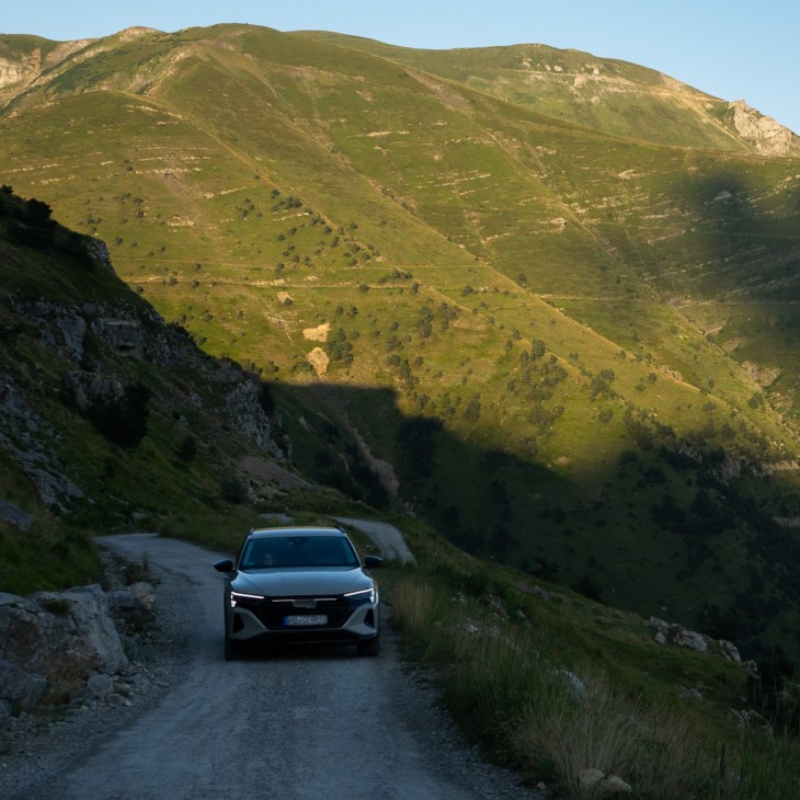
The landscape along this road is wild and the views are stunning.

You can also find lots of Edelweiss next to the road if you look carefully.


The official part of the Alta Via del Sale ends in a lovely forest. You could continue from there on some other unsealed tracks and drive a longer loop back to the Cole de Tende. But we decided to turn around and drive the same way back to Limone Piemonte.


Although this road is only 30km long it took us half a day to drive to the end and back. Don’t underestimate the time needed.
It is probably the most spectacular of all the high altitude roads in the Western Alps and should not be missed. A 4×4 is not really needed for it but a slightly higher ground clearance is definitely recommended.
Using an EV in the Western Alps
From my past trip to Iceland, I know that the Audi e-tron has no problems with light offroad tracks. This was also the case on the military roads in the Western Alps.
The remaining question is, is there any limitation by using an EV on these roads?
And the clear answer is: no!
Although my worst-case energy consumption on some steep gravel sections was around 85 kWh/100km, on average it was never above 50 kWh/100km.
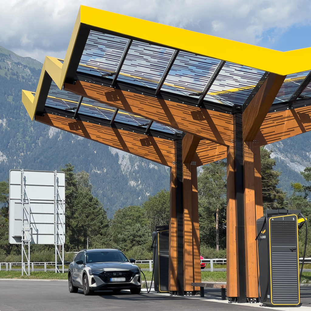
None of the driven high altitude roads were longer than 110km and chargers were always available at the start or end. In Susa, it was even a 300 kW HPC charger. In Limone Piemonte it was a 50 kW DC charger. Not ideal. But if you combine charging with a cappuccino and a visit to the bakery in the beautiful village of Limone it was no real limitation.
Interestingly, nearly all AC chargers in Italy and France were 22 kW chargers. In Germany, most AC chargers are 11 kW, while 22 kW are very rare. Since the Audi Q8 e-tron can charge AC at 22 kW (if you order this option) this helped a lot in cases where the only DC charger was blocked by another vehicle.
One problem in Italy and especially in France was, that chargers were often blocked by non-electric vehicles, despite large signs that parking is strictly forbidden for non-EVs. We have experienced this quite often and it was sometimes a serious nuisance.
In France, we once experienced a situation where some other EV driver disconnected our cable (on the charger side, Tye 2 AC) and plugged it into his car. We had charged only 3% and were still under 50% SOC. It was an unpleasant surprise when we returned to our car one hour later.
I really hope that the ethics and attitude regarding EV chargers will change in these regions in the next years.
But besides this minor problem, there was no real difference between driving these roads in an ICE SUV or in an EV.
